Term Path Alias
/sub-categories/maps
/sub-categories/maps
Assam represents a highly flood-prone region characterized by severe hazards of floods. Although occurrence of flood has been an age-old phenomenon in the riverine areas of this region, the extent of damage caused by floods has increased significantly in recent years.
The CGWB under the Ministry of Water Resources, Government of India, is the national apex agency entrusted with the responsibilities of providing scientific inputs for management, exploration, monitoring, assessment, augmentation and regulation of ground water resources of the country.
 This book by Space Applications Centre (SAC), Indian Space Research Organisation (ISRO) is an outcome of the project on National Wetland Inventory and Assessment (NWIA) . Increasing concern about how our wetlands are being influenced had led to formulation of the project entitled to create an updated database of the wetlands of India.
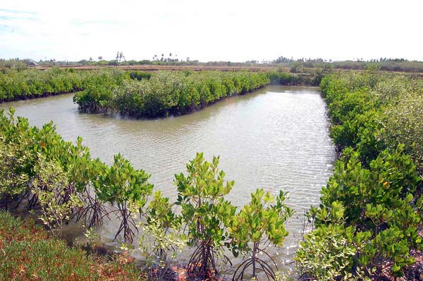
Wetlands defined as areas of land that are either temporarily or permanently covered by water exhibit enormous diversity according to their genesis, geographical location, water regime and chemistry. They are one of the most productive ecosystems and play crucial role in hydrological cycle. Utility-wise, wetlands directly and indirectly support millions of people in providing services such as storm and flood control, clean water supply, food, fiber and raw materials, scenic beauty, educational and recreational benefits. Thus, their identification and protection becomes very important.
 European Beech
Photo: Forestryimages.org/University of West Hungary/Norbert Frank
Although there are other local-and regional-scale forest canopy maps, the new map is the first that spans the entire globe based on one uniform method.
The work - based on data collected by NASA's ICESat, Terra, and Aqua satellites - should help scientists build an inventory of how much carbon the world’s forests store and how fast that carbon cycles through ecosystems and back into the atmosphere. Michael Lefsky of the Colorado State University described his results in the journal Geophysical Research Letters.
Marking the exact location on the map. It’s not really the lake itself, but the lake bed area on the right side of the bund/road adjoining the lake.
The agricultural land below the lake abutment forming the Bellandur Lake is being developed for residential / commercial use as the case may be. It is the present owners’ choice to convert agricultural land into residential / commercial purposes as it has now come within BBMP area. Some who may not like to convert have that choice too.

A welcome and important document, it brings up-to-date our understanding of the rapidly changing groundwater situation in Bangalore.
| Month | New borewells added each month | Borewells registered with BWSSB | Monthly % growth |
| Jan-09 | 91018 | ||
| Feb-09 | 924 | 91942 | 1.02 |
| Mar-09 | 705 | 92647 | 0.77 |
| Apr-09 | 965 | 93612 | 1.04 |
| May-09 | 1136 | 94748 | 1.21 |
| Jun-09 | 748 | 95496 | 0.79 |
| Jul-09 | 904 | 96400 | 0.95 |
| Aug-09 | 868 | 97268 | 0.90 |
| Sep-09 | 2062 | 99330 | 2.12 |
| Oct-09 | 838 | 100168 | 0.84 |
| Nov-09 | 875 | 101043 | 0.87 |
| Dec-09 | 2699 | 103742 | 2.67 |
| Jan-10 | 1759 | 105501 | 1.70 |
| Total as on Jan-2010 | 14483 | 105501 | 15.91 |
Growth of bore wells during February 2009 to January 2010 in Bangalore city
The national hydrographic dataset can be used to delineate watersheds and mark all streams and channels that contribute to the flow at the outlets of these watersheds. Even though I was able to find out pdfs created by the National Information Center, I felt we need something better than the pdfs.
 Flooding forced millions of Pakistanis to flee their homes in July and August 2010.
The summer of 2010 was different. In July and August, rain fell over most of Pakistan and persisted in some places for weeks.
A combination of factors, including La Niña and a strange jet stream pattern, caused devastating floods. The Indus River rapidly rose, and a dam failure in Sindh Province sent part of the river down an alternate channel. The resulting floodwater lake lingered for months, leaving crops, roads, airports, even entire communities underwater.