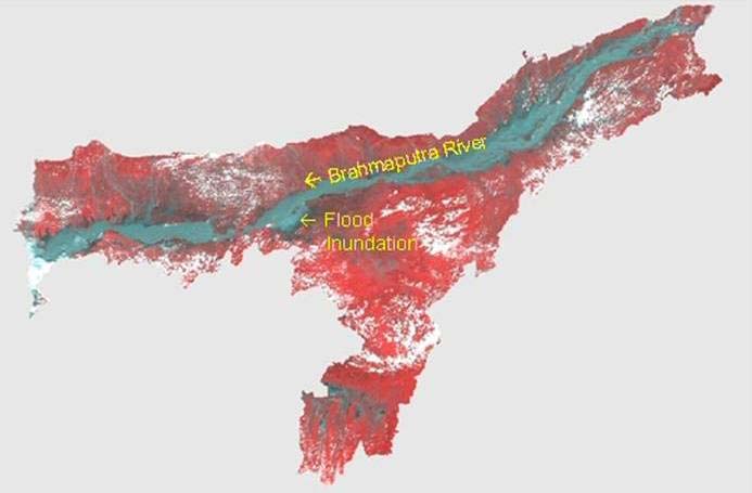
Assam represents a highly flood-prone region characterized by severe hazards of floods. Although occurrence of flood has been an age-old phenomenon in the riverine areas of this region, the extent of damage caused by floods has increased significantly in recent years.
Satellite remote sensing technology has made substantial contribution in every aspect of flood disaster management such as preparedness, relief and mitigation. Space systems from their vantage position have unambiguously demonstrated their capability in providing vital information and services for flood management.
Given this backdrop, the NRSC had in addition to the flood response services through Decision Support Centre, taken up the work of preparation of the flood hazard atlas. Assam is the first state in the country to have such an atlas with much detail; similar efforts are underway in Bihar and Orissa.

IRS satellite image showing the flood situation in Assam
The major steps involved in the preparation of the flood hazard zonation maps were -
- Satellite data acquisition: Satellite data (from 1998 onwards) was acquired from the Indian Remote Sensing (IRS) satellites for the period during which floods took place in the Brahmaputra. Similarly, microwave satellite data was acquired from Radarsat satellite. The water levels observed at different gauge stations were closely monitored during floods and attempts were made to programme the satellite data during near peak situations. Satellite data was also programmed and procured during progression and recession of the flood wave for studying the impact of the flood.
- Rectification: The acquired satellite datasets were rectified to a defined projection system for integration with database layers.
- Flood inundation layer: Using image processing classification algorithms water layer was extracted from the satellite data and integrated with the pre-flood river and water bodies layer to derive flood inundation layer.
- Annual flood layer: The flood inundation layers generated for different flood waves in a calendar year were integrated to generate the maximum flood inundation extent observed in that year.
- Hazard layer: The maximum flood inundation layers corresponding to various years (1998-2007) were integrated for assessing the frequency of inundation and subsequent generation of hazard layer.
- Database integration: The hazard layer was further integrated with the database consisting of administrative boundaries, landuse/ landcover, infrastructure, etc., for impact assessment and statistics generation.
- Map composition: Flood hazard maps were composed at State, District and detailed levels comprising of base details and hazard layer.

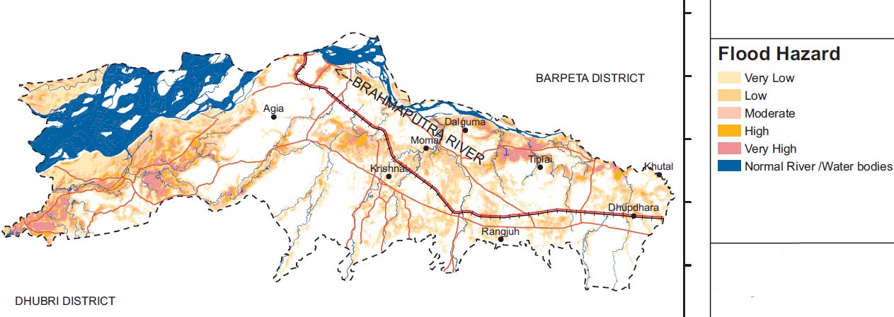
Flood Hazard Zonation for Goalpara district of Assam
Based on frequency of inundation, the flood hazard was categorised into five classes - very high, high, moderate, low and very low. The atlas indicates the following -
- About 28.31 per cent (22.21 lakh hectares) of the land in Assam was subject to flood inundation (at least once) during 1998-2007. Out of the total flood affected area (22.21 lakh hectares), about 3.53 lakh hectares of land i.e. 15.89 per cent falls under high to very high flood hazard categories (i.e., subject to flood inundation at least seven times during 1998-2007).
- Based on the flood hazard index derived for various districts, it was observed that Nalbari, Marigaon, Darrang, Lakhimpur and Dhemaji districts are the most flood affected districts.
- The districts of Cachar, Nowgong, Marigaon, Kamrup Rural, and Karimganj have maximum cropped area falling under very high to high flood hazard categories.
The flood hazard atlas can be viewed online here -
The district-wise flood hazard atlas can be downloaded below -
/articles/flood-hazard-zonation-assam-atlas-national-remote-sensing-centre