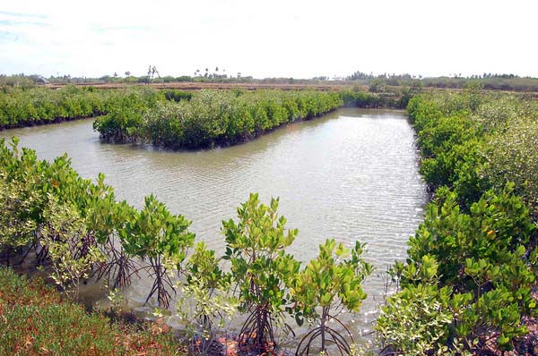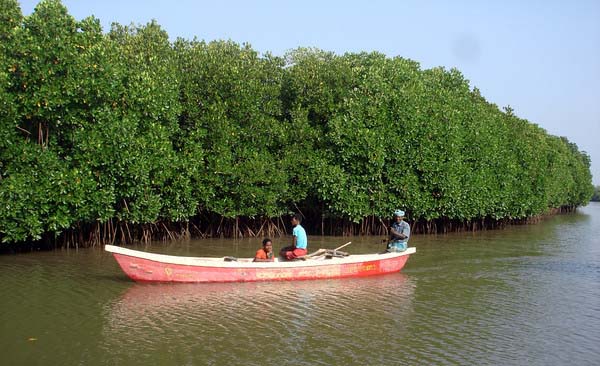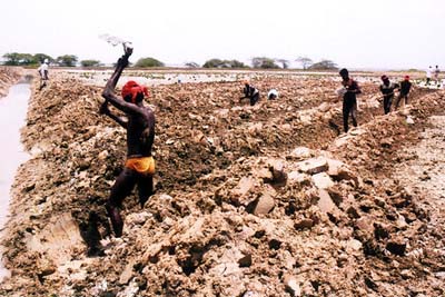
The MSSRF project on fostering the sustainable management of mangrove wetlands in the states of Tamil Nadu, Andhra Pradesh and Orissa had yielded valuable results on the quantitative and qualitative aspects of mangrove wetlands with particular reference to the impact of anthropogenic pressures on the ecosystem on the one hand, and the benefits arising from eco-restoration and mangrove rehabilitation programmes on the other. The data have been compiled in the form of GIS maps which have formed the basis for a series of Atlases.
The multi-functionality of mangrove ecosystems is now widely recognized. They serve as barriers to coastal storms, conservers of soil, supporters of sustainable fisheries, providers of medical products and fuel wood and fodder, habitats of wide range of flora and fauna, sources of genes for sea water tolerance and above all as the flagship of nature's ecological security system in coastal estuaries.
The mangrove wetland forms a dynamic ecotone between land and sea. It is one of the dominant features of the tropical coastline where salinity undergoes constant variation due to freshwater flow and where the substratum is composed of accumulated deposits of sediment. The mangrove wetland is a multiple use ecosystem that provides protective, productive and economic benefits to coastal communities.
 Estimates of the area of India’s mangrove wetlands range from 5,00,000 ha (Forest Survey of India, 1998) to 6,81,000 ha (Sidhu, 1963). The major mangrove wetlands are located along the east coast. On the west coast, they are predominant in Gujarat.
Along the east coast, the tidal amplitude as well as the volume and periodicity of fresh water inflow decrease from Sunderbans in the north to Muthupet in the south. Correspondingly, the species diversity and area of mangrove wetlands also decrease from north to south, indicating the influence of fresh water inflow and tidal amplitude on the health and wealth of mangrove wetlands.
Mangrove wetlands of India can be classified into (a) tide-dominated (Sunderbans and Mahanadi mangroves), (b) river dominated (Godavari, Krishna, Muthupet, Pichavaram mangroves) and (c) drowned river valley (Gujarat mangroves).
The atlases prepared by MSSRF include -
- Atlas of mangrove wetlands of Tamil Nadu (2002): The State has a coastline of about 950 km and its coastal zone is very narrow except in the Vedaranyam-Muthupet stretch of Thiruvarur-Thanjavur district where extensive mud flats are present. The Cauvery and its distributaries, the Palar and Tamarabarani are considered the major rivers of Tamil Nadu. The atlas shows the location of the major and minor mangrove wetlands of Tamil Nadu, major wetlands being located in the deltaic regions of the river Cauvery. A large patch of healthy mangroves is present in the Devipattinam area, bordered by Palk Strait in the east, in Ramanathapuram District. In the islands of the Gulf of Mannar Biosphere Reserve, mangroves are present in a few hundred hectares. These mangrove patches consist of a true mangrove species namely, Phemphis acidula, which is not present in any other Indian mangrove wetland.
- Atlas of mangrove wetlands of Andhra Pradesh (2004): Andhra Pradesh has about 582 sq km of mangrove forests. An advantage Andhra Pradesh enjoys is that most of the east flowing rivers in the heart of the state bring in copious supplies to the coast from the Western and Eastern Ghats and the Deccan Plateau. Some 40 major, medium and minor rivers flow through the State. Mangroves are found in the estuaries of these rivers but extensive mangrove wetlands are present only in the Godavari and Krishna deltaic regions. The Godavari mangroves are located in the Godavari estuary of East Godavari district and the Krishna mangroves on the Krishna estuary of Krishna and Guntur districts. Apart from these estuaries, mangroves are also found in small patches along the coasts of Vishakapatnam, West Godavari, Guntur and Prakasham districts. The present atlas gives detailed information on the mangrove wetlands of both Godavari and Krishna river basins of Andhra Pradesh.
- Atlas of mangrove wetlands of Orissa (2004): Of the 52,472 sq km of forested area in Orissa, mangrove forests constitute 243 sq km, which is only about 0.46 per cent of the total forest area of the state. The extent and location of mangrove forests in the estuaries of Orissa are shown in the atlas. The estuarine areas of the Mahanadi, Brahmani and Baitarani rivers harbour spectacular mangrove forests, which are rich in species diversity and biomass. In Orissa, rice cultivators grow varieties of salt tolerant paddy and also practise aquaculture in the mangrove areas. Large mangrove forest areas have been converted for these purposes. In Paradwip area, large tracts of pristine mangroves were cleared for the development of the port. The present atlas covers the mangrove wetlands of Mahanadi, Devi mouth and Bhitarkanika of the Orissa coast.
The atlases have been designed as tools for public policy and public action. These will be used to not only conserve the unique mangrove wetlands of the States but also to enhance their coverage and beneficial social, spiritual, environmental and economic impact.
Download the atlases below -
/articles/mangrove-wetlands-tamil-nadu-andhra-pradesh-and-orissa-atlas-mssrf