/topics/surface-water
Surface Water
Exhibition of "Dakshina Pinakini River Mapping and Landscape Survey"- An artistic intervention, 23rd - 26th May, 2011, Bengaluru
Posted on 26 May, 2011 01:23 PMVenue: Venkatappa Art Gallery, Kasthurba road, Bengaluru
Collaborated by: Subramani J, Ravikumar S M Halli & Shivaprasad S
Description:
The study focuses on Bangalore, highlighting its important rivers, lakes and its very lavish natural resources and how it is getting damaged due to its excessive urban growth and ignorance of the people. We started our documentation from Nandi hills to Hosur was our destination. Here we filmed and photographed various aspects of this river, the agricultural landscape and the urban scape. These documentations are archival materials, which have been focused during the process of research. Like how the death of a river takes place, where it used to begin and rebirth of the river due to the excess development of Broad Bangalore’s urban area.
Interlinking of water harvesting structures through link water channels - A viable alternative at micro-level by Ambuja Cement Foundation
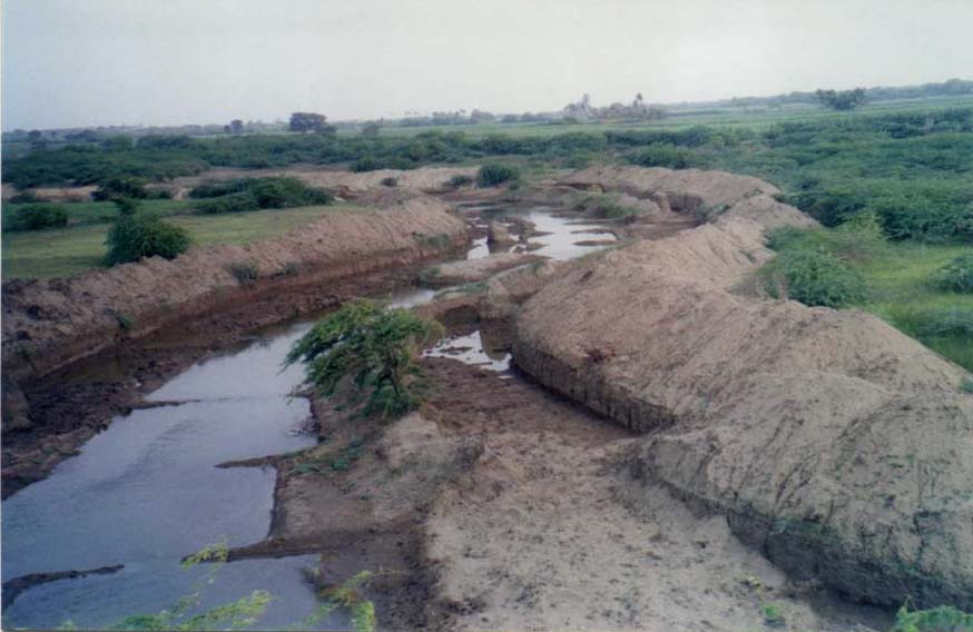
Posted on 25 May, 2011 07:39 PM The coastal areas of Gujarat especially the villages lying within 20-25 km from the seashore are suffering from the problem of salinity ingress. Most of the rivulets that drain this region like Goma and Somat are seasonal at best and their water does not last beyond monsoons. The other aquifers like ponds, which get water from these rivers, also dry up as early as October.
In the name of clean energy – A report on Asian Development Bank financed hydropower projects in Himachal Pradesh
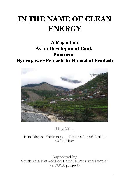
Posted on 25 May, 2011 07:06 PM This report by Him Dhara, an environmental research and action collective, deals with the Asian Development Bank financed hydropower projects in Himachal Pradesh, which are leading to obstruction of the rivers and their consequent disappearance for harnessing energy and making ‘judicious’ use of the water. Within the hydro sector the attention has turned to the Indian Himalayan region which is estimated to have seventy nine per cent of the total hydropower potential of the country.
The technology of ‘run of the river’ (ROR) used to tap “the flow of rivers” in high gradient zones to generate power has given impetus to setting up of hydro-projects in the Himalayan states. In India, the mountainous region of the Himalayas offered the “perfect setting” for such projects, with the availability of several flowing water sources that could be tapped before they reached the plains. Of the Himalayan states, after Arunachal Pradesh, Himachal Pradesh is second in line with a hydropower potential of about 21000 MW. The installed capacity has increased twenty fold (from 326 MW to 6370 MW) in the last ten years indicating the frenzied pace of hydropower development in the state.
Bellandur lake, Bangalore - Landfill activity and hinterland development - Updates from Praja
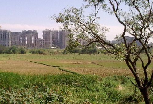
Posted on 19 May, 2011 07:09 PMMarking the exact location on the map. It’s not really the lake itself, but the lake bed area on the right side of the bund/road adjoining the lake.
The agricultural land below the lake abutment forming the Bellandur Lake is being developed for residential / commercial use as the case may be. It is the present owners’ choice to convert agricultural land into residential / commercial purposes as it has now come within BBMP area. Some who may not like to convert have that choice too.

Kelo dam, Raipur, Chattisgarh oustees agitation - Hunger strike called off after meeting with Chief Minister - Audio updates from CGNet Swara
Posted on 19 May, 2011 11:03 AMArticle courtesy: CGNet Swara
Kelo dam hunger strike: 7 more farmers shifted to hospital
Rajesh Tripathi is reporting from continuing hunger strike of farmers from Kelo dam site in Raigarh district of Chhattisgarh. He says 7 more farmers have now been shifted to hospital. 4 were shifted before in last 2 days.
Recession and reconstruction of Milam Glacier in Kumaon Himalaya – A paper in Current Science
Posted on 18 May, 2011 07:29 PMHimalaya is one of the youngest mountain systems on Earth, and has a direct influence on the climate, hydrology and environment of the Indian subcontinent. It is the abode of one of the world’s largest and mostly inaccessible area of glaciers outside the polar region and provides glacier-stored water to the major Indian river basins. Many of the Himalayan rivers are fed by snow and ice melt run-off from snow fields and glaciers.
Vembanad Fish Count 2011, Ashoka Trust for Research in Ecology and the Environment, 26th May 2011, Muhamma, Kerala
Posted on 18 May, 2011 12:44 PMOrganizer: Ashoka Trust for Research in Ecology and the Environment (ATREE) - Community Environmental Resource Centre (CERC)
Venue: St.George Parish Hall, Muhamma, Kerala
Hathinikund barrage at Tajewala, Haryana,a complete failure: Press release by Maan Mandir Seva Sansthan
Posted on 11 May, 2011 01:16 PMAs you are aware of the fact that the Government has constituted an inspecting body comprising of high authority personnel’s of Central Water Commission, Planning Commission, Haryana Irrigation Department, Delhi Jal Board, Ministry of Environment and Forests and 6 members of Yamuna Bachao Aandolan. The team will then submit its report to the Central Government within one week and forthcoming plans will be discussed then.
The team had visited the Hathinikund barrage and told that it was a complete failure as the water is not at all being released from Hathinikund barrage. They came to know about the matter after enquiring with local public. The imposter authorities had released the said amount (160 cusecs) of water. The local public there told that they are habitual of crossing the Yamuna by riding on their bikes as it remains completely dry, but the water has been released.


