Term Path Alias
/topics/surface-water
/topics/surface-water


It explores the understanding of the local controls on the retreat of glaciers of the Baspa valley in Himachal Pradesh. The geomorphic records mapped are accumulation zone, exposed ablation zone, moraine-covered ablation zone, snout, deglaciated valley, lateral moraine, medial moraine, terminal moraine and hanging glacier.
down the drain from tarun jayaram on Vimeo.
These are some of the questions which led Tarun Jayaram, the film-maker to explore traditional water systems in the country. From the documentary’s opening moments, the director engages us with a beautifully shot array of footages ranging from pilgrims taking a holy dip of Ganges to beautiful baolis and tankas of Rajasthan to the ancient town of Hampi in Karnataka, while establishing how rivers have been an integral part of Indian culture and how its rich tradition of harvesting rainwater needs to be re-established to deal with the present day water crisis. Over the refreshing images and soothing audio, it advocates the need for community participation in rejuvenating the traditional methods of rainwater harvesting.
 Fisherman on Hessarghatta Lake on the Arkavathy River
It is here in a small pond that the Arkavathy river is famously said to originate. It moves down the hill in the form of a spring and enters the first of the man-made reservoirs, called ‘tanks’, the Chikkarayyappanhalli Kere. From thence begins the journey of this tributary to the Cauvery. Passing through a series of tanks built to hold its water for irrigation it comes to the large ‘Nagarakere’ at Dodballapur. The entire drinking water for the town of population 100,000 used to come from this large tank. Moving further on the river comes to the almost 7 sq.km. Large Hessarghatta tank. In 1894 this tank was enlarged and became the first external source of water supply to the city of Bangalore.
This approval is for the reconstitution of the Damodar Valley Corporation with four full time members, namely, Chairman, Member (Technical), Member (Finance) and Member Secretary; and six part time members, namely – one representative from the Central Government; two representatives – one each from the Government of Jharkhand and the Government of West Bengal; three independent experts- one each from the field of irrigation, water supply and generation or transmission of electricity. The Chairman will be the Chief Executive Officer of the Corporation. The posts of Financial Adviser and Secretary will be abolished.
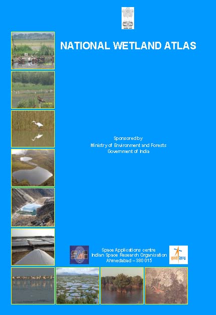 This book by Space Applications Centre (SAC), Indian Space Research Organisation (ISRO) is an outcome of the project on National Wetland Inventory and Assessment (NWIA) . Increasing concern about how our wetlands are being influenced had led to formulation of the project entitled to create an updated database of the wetlands of India.
Wetlands defined as areas of land that are either temporarily or permanently covered by water exhibit enormous diversity according to their genesis, geographical location, water regime and chemistry. They are one of the most productive ecosystems and play crucial role in hydrological cycle. Utility-wise, wetlands directly and indirectly support millions of people in providing services such as storm and flood control, clean water supply, food, fiber and raw materials, scenic beauty, educational and recreational benefits. Thus, their identification and protection becomes very important.
The Government of India’s 15-year old AIBP has come under much-deserved criticism for all-round non-performance. It was introduced to support states in "last mile" public irrigation projects, that is, projects which are nearly completed but whose full benefits can start flowing only after small, incremental investments are made. Yet, the AIBP has been used mostly for funding new projects.
The River cleaning project is to the tune of US $ 1 billion (approximately Rs 4,600 crore) loan and credit that will form part of the Bank’s long-term support for cleaning the Ganga River. Two Biodiversity Conservation agreements are for a credit of US$15.6 million and US$8.14 million grant.
On this occasion, Sh Jairam Ramesh , Minister of State for Environment and Forest Minister said, “Two protected areas, one each in Uttarakhand and Gujarat, will put in place a complete new model of managing the protected areas while safeguarding the livelihoods of local communities. So far local community was looked as enemies of protected areas, but this has to be changed. We have to make local communities full partners in the protection and regeneration of these protected areas. These new models will be applied in other areas of the country.” Giving details of cleaning operations of last few years, the Minister said, “The objective of Ganga project is ‘by 2020 no municipal sewage and industrial effluent will be let into the river Ganga without treatment’. With the help from the World bank, we are taking a big step forward in achieving the Mission Clean Ganga”.
Gujarati newsletter brought out by ACT Kutch, for admirers of the Hamirsar lake and its environs
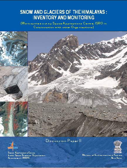 The study on “Snow and Glacier Studies” was taken up by the Space Applications Centre, Indian Space Research Organisation (ISRO) and executed in collaboration with fourteen research organizations and academic institutions of the country, at the behest of the Ministry of Environment and Forests.
Himalayan mountains contain important natural resources of frozen fresh water in the form of snow and glaciers. These glaciers are unique as they are located in tropics, high altitude regions, predominantly valley type and many are covered with debris.
The great northern plains of India sustain on the perennial melt of snow and glaciers meeting the water requirements of agriculture, industries, domestic sector even in the months of summer when large tracts of the country go dry. Therefore, it is important to monitor and assess the state of snow and glaciers and to know the sustainability of glaciers in view of changing global scenarios of climate and water security of the nation. Any information pertaining to Himalayan glaciers is normally difficult to be obtained by conventional means due to its harsh weather and rugged terrains.
 Jog falls in Western Ghats
These dams have had a profound negative impact on communities and ecology upstream and downstream. While promised benefits of these dams (irrigation, hydro-power or flood control) have been overstated, numerous interrelated and complex negative impacts have simply not been studied or documented. Nonetheless, communities and ecosystems continue paying huge prices of these impacts.
