/topics/surface-water
Surface Water
NASA Earth Observatory: Cyclone Bijli
Posted on 07 May, 2009 12:03 PMImage & Content Courtesy: NASA Earth Observatory
 A ragged-looking Tropical Storm Bijli draped the east coast of India in this image from the Moderate Resolution Imaging Spectroradiometer (MODIS) on NASA's Terra satellite on April 16, 2009. Bijli became a tropical storm in the northwest Bay of Bengal on April 15, and initially headed north, toward the west coast of India. By April 16, it had begun a northeastward turn, however, and the storm was being projected to make landfall in eastern Bangladesh on April 17, according to Unisys. Access higher resolution image here:Cyclone Bijli
The Sambalpur declaration on Odisha rivers : Let the river flow
Posted on 23 Apr, 2009 12:04 PMWater Initiatives Orissa(WIO) and the Indian River Network (IRN) organsied the Odisha River Conference during 18 - 20 April 2009 at Sambalpur, Odisha. Attended by about 75 participants which included activists, environmentalists, journalists, academicians, researchers and civil society representatives from across the country, the Conference has just concluded with a "Sambalpur Declaration" that calls for saving the rivers from the current fate of high rate of degradation and giving communities their traditional rights over the rivers, among other strong resolutions.
Basin maps of Mahanadi river showing basin indicators, landcover classes and biodiversity information and indicators
Posted on 17 Apr, 2009 02:07 PM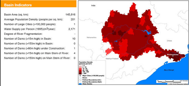
Basin indicators map of Mahanadi river basin
Basin maps of Krishna river showing basin indicators, landcover classes and biodiversity information and indicators
Posted on 17 Apr, 2009 01:25 PM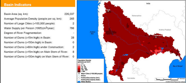
Basin indicators map of Krishna river basin
Basin maps of Indus river showing basin indicators, landcover classes and biodiversity information and indicators
Posted on 17 Apr, 2009 01:05 PM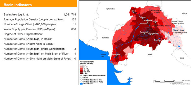
Basin maps of Narmada river showing basin indicators, landcover classes and biodiversity information and indicators
Posted on 17 Apr, 2009 12:55 PM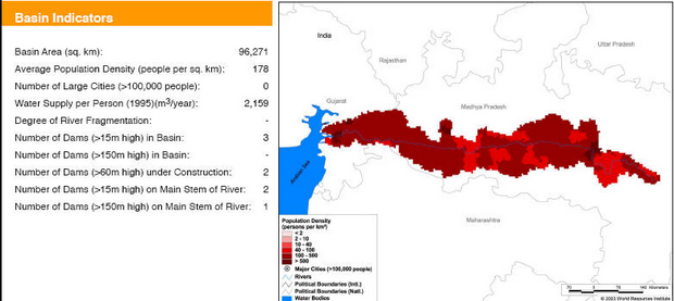
Basin indicators map of Narmada river basin
Basin maps of Godavari river showing basin indicators, landcover classes and biodiversity information and indicators
Posted on 17 Apr, 2009 12:42 PM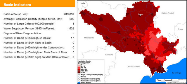
Basin indicators map of Godavari river basin
Basin maps of Ganga river showing basin indicators, landcover classes and biodiversity information and indicators
Posted on 17 Apr, 2009 11:08 AMGanga river basin
Basin maps of Tapti river showing basin indicators, landcover classes and biodiversity information and indicators
Posted on 17 Apr, 2009 10:37 AM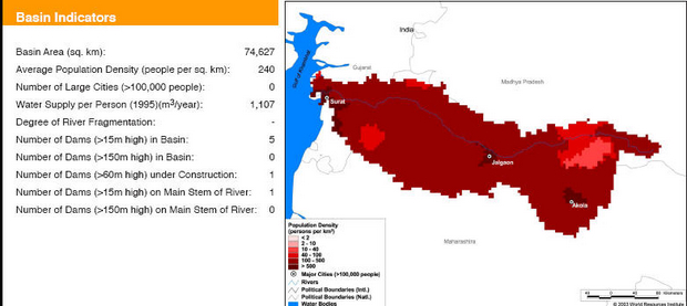
Basin indicators map of Tapti river basin
Compilation of data for Cauvery basin for river basin planning along with maps of major river basins of India
Posted on 17 Apr, 2009 09:49 AMWater flows without regard to political and administrative boundaries. Water planning with respect to rivers should therefore be done for the river basin (or sub-basin) as a whole. River basin planning also has to look in an integrated way at all the relevant parameters like urban and rural populations, water usage patterns, water pollution, wastewater flows.


