Term Path Alias
/topics/rivers
/topics/rivers

The study deals with estimation of surface soil properties in Malaprabha command area. It can be broadly concluded that generalization of soil properties for an area is difficult since the soil and land use type varies drastically from one point to another in a short distance. It is only possible to have an average value for a particular type of soil. Also, it can be seen from the results that the percentage of silt-clay plays an important role in shaping the hydraulic properties of a soil.
The report deals with the modeling of the Cochin estuary along Kerala coast using two- dimensional finite element model. The basic equations for modeling of any surface water problems are the three dimensional hydrodynamic equations arising from consideration of mass and momentum conservation. In vertically well mixed shallow water bodies, the horizontal components of flow quantities are normally much more significant than vertical components.
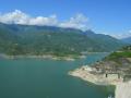
In this study, a two layered finite difference method has been generated for groundwater flow analysis of Ghataprabha sub-basin of Krishna river basin. The conceptual model has been calibrated for steady state conditions and validated for both steady state and transient conditions through USGS, 3D Finite Difference Code and MODFLOW. Various applications were tried out on the calibrated model, like River-Drain influencing the aquifer, reasons for waterlogging and drying out of wells and well design strategies.
Dr. G. D. Agrawal Scientist and Rishi
Meeting Dr. G. D. Agrawal in his spartan, two room cottage in Chitrakoot, Madhya Pradesh, you would never guess what an accomplished and distinguished scientist he is – first Member-Secretary of the Government of India’s Central Pollution Control Board, former Head of the Department of Civil and Environmental Engineering at IIT Kanpur and a PhD from the University of California, Berkeley. The list goes on and on.
Yet this eminent professional sweeps his own floors, washes his own clothes and cooks his own meals. He retains only a few possessions and dresses in homespun khadi. At the age of 76, his main mode of transport within Chitrakoot is a bicycle and when he travels further afield, he goes by ordinary bus and second-class train. These are the deliberate choices of a devout Hindu whose deepest values are for simplicity and reverence for nature. Dr G.D. Agrawal is the doyen of environmental engineering professionals in India. Well past retirement, he continues to teach and inspire students as an Honorary Professor of Environmental Sciences at the Mahatma Gandhi Chitrakoot Gramodaya Vishwavidyalaya, in Chitrakoot (M.P.).

Organizers:
Workshop Themes:
This International workshop will provide a platform to the exprerienced and related expert professionals for intensive and threadbare deliberations to explore possible solutions to the vexed problem of stream flow management, channel improvement, sustainability of river eco-systems & IWRM and inland water ways. The focuses of the workshop are as follows:
Forwarded to the Portal by Dr.Vijay Verma
You are well aware that Dr. G D Agarwal aged 79 years Scientist, Environmentalist, Bureaucrat and Saint is on fast unto death from 20th July 2010 at Matri Sadan, Haridwar. His fragile age will not permit to endure long days of fast. It seems we are waiting for his demise.
National River Ganga Basin Authority (NRGBA) is formed to fool people of India as this is happening since Independence.
dear all, I have sent several mail to concern department including minster jairam romesh regarding the Protecting PILI river , due to filling pond , taal , river land , dam to a river land encroachment in my village KOPA , Unfortunately, I still haven't received my reply .
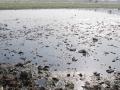
In the present study, an attempt has been made to estimate the soil erosion rate in Malaprabha representative basin by using WEPP model and Universal Soil Loss Equation. Soil erosion and sedimentation are the two important natural processes, which need immediate attention from the scientific community. Two major types of erosion are geological erosion and erosion from human or animal activities.
In this study, an attempt has been made to study the characteristics of short interval rainfall data of the Punpun river basin lying in Bihar-Jharkhand, which has been identified as the representative basin for the NIH- Centre for Flood Management Studies, Patna. The estimation of flood peaks for small catchments is required for water resources planning, flood forecasting, design of various drainage systems, flood control and design of hydraulic structures.
The report presents the analysis of surface runoff and baseflow carried out for the Ariyanayakipuram anicut, Tambarapani basin, Tamil Nadu for a period of 13 years (1983-95). The hydrological behavior of catchments is a very complex phenomenon and is controlled by a large number of climatic and physiographic factors that vary in time and space. The analysis shows that the contribution of baseflow at Ariyanayakipuram anicut was observed to be more.