Term Path Alias
/topics/rivers
/topics/rivers

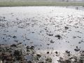
The report attempts to analyze the shallow groundwater table and water quality data for about 20 years pertaining to the Krishna delta. The trend analysis of groundwater level data of shallow wells indicates that in the upper part of the delta, the groundwater table moved up during the period 1979 to 1999. This may be due to the dense canal network in the delta and increase in irrigated area over a period of time.
Forwarded to the Portal by: Ayan Biswas
Image and News Courtesy:
Shankracharya designate Swami Avimukteshwaranand ji presided over an emergency meeting organized by Manushi Sangathan, Ganga Ahvaan and Ganga Yamuna Jal Biradri to express our strong protest against the patently illegal decision of the Group of Ministers giving clearance to the Loharinag-Pala dam on the Ganga River. The following expert members of the NGRBA also participated in the meeting to express their strong protest having been kept in the dark about the appointment of the GoM which has passed a virtual death sentence on the most sacred river of India: Rashid Hyatt Siddiqui, Rajendra Singh, Rama Raota and Ravi Chopra.
The report deals with the artificial recharging of an unconfined aquifer with injection well in the Hukkeri taluka in Ghataprabha sub-basin of Krishna river. The Ghataprabha sub-basin of Krishna like most river basins of peninsular India has been facing groundwater development problems varying in nature and severity. It has got a wide spectrum of issues such as cases of failure of wells at several places on the one hand, while some areas becoming unfertile due to waterlogging.
In the present study, watershed prioritization of the catchment immediately upstream of the Ukai reservoir has been carried out using remote sensing technique. The Watershed Response Model (WRM) has been used for this purpose. This model utilizes the Normalized Difference Vegetation Index (NDVI) and the Soil Brightness Index (SBI), the two important parameters responsible for soil erosion.
Ghodadoha is a rock-filled earthen dam located in one of the tributaries of the Rushikuliya river of Orissa.
The research study attempts to develop a rainfall-runoff model using the Artificial Neural Network (ANN) technique for the Baitarni river in Orissa. A detailed review of the research work in the area of interest revealed that the approach of neural computations was very effective in developing the required model, due to its various advantages. Accordingly, three candidate models based on ANN architecture were developed for the study area, to represent rainfall-runoff transformation.
In the study, raingauge network design has been developed for the Pagladiya basin of Brahmaputra river in Nalbari, Assam and Bhutan. Precipitation is the most basic data required for any water resources study and the estimation of the number & location of raingauge stations that provide adequate information regarding rainfall falling over the catchment is referred to as network design. A raingauge network is intended to serve general as well as specific purposes such as water supply, hydropower generation, flood forecasting, irrigation and flood control.
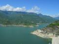
The study attempts to determine the useful life of the Bargi reservoir and assesses the sedimentation rate in it using satellite data. Periodical surveys are essential to provide a correct understanding of the sedimentation process going on in a reservoir, so that remedial measures can be undertaken well in advance and reservoir operation schedule planned for optimum utilization of water.
In this study, a model has been developed considering surface flow component and subsurface flow component along with the evapotranspiration from the crop as the sink term for the Lokapavani area of KR Sagar command of Karnataka. The surface flow component is represented using one-dimensional St-Venant equations and the subsurface flow component is represented using one-dimensional Richards equation with the sink term for the evapotranspiration from crop.