Surface Water

Term Path Alias

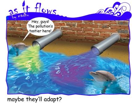
/topics/surface-water

Featured Articles
January 2, 2023 अनुपम मिश्र या हम सबके प्रिय पमपम पर पाँच साल पहले लिखा गया श्रवण गर्ग का यहआलेख है। अनुपम भी उनके द्वारा तलाशे गए तालाबों की तरह से ही खरे थे। अनुपम ने तो तालाबों को उनके दूर होते हुए भी खोज लिया । हम उन्हें अपने इतने नज़दीक होते हुए भी खोज नहीं पाए। 19 दिसम्बर को अनुपम की पुण्यतिथि थी।
अनुपम मिश्र, गांधी शांति प्रतिष्ठान में। फोटो - सिविल सोसाइटी, लक्ष्मण आनंद
January 1, 2023 Results show the impacts of agricultural productivity boosts in India can be highly heterogeneous
Buckingham canal near Kasturba Nagar, Adyar (Image: India Water Portal)
December 25, 2022 A study develops a prototype method by employing the remote sensing-based ecological index
rigorous post-implementation monitoring and impact assessment of assets is needed (Image: UN Women)
October 6, 2022 In an effort to inform the general public, especially citizen activists, policymakers, researchers, and students, about the current status of the Vrishabhavathi river, Paani.Earth has created the necessary maps, data, analysis, and information to drive conservation awareness and action around the river.
Vrishabhavathi river (Image Source: Paani.Earth)
August 9, 2022 Ensuring irrigation through farm ponds in tribal Chhattisgarh
Many tribal farmers opted for individual farm ponds under MGNREGA ensuring protective irrigation. (Image: Meenakshi Singh)
November 8, 2020 The National Hydrology Project has created a national platform for water data and is working to enhance the technical capacities of agencies dealing with water resources management.
Breakthrough cloud computing facilities and remote sensing applications have helped showthe filling pattern of a water body (tank or reservoir) through freely available satellite imagery at an interval of five days.  (Image: Maithan dam, Wikimedia Commons)
Surface and groundwater quality evaluation in parts of Udhampur district – A research report by National Institute of Hydrology
This study focuses on the surface and groundwater quality monitoring in parts of Udhampur district in Jammu and Kashmir in order to evaluate its quality for domestic and agricultural purposes. Posted on 23 Jul, 2010 08:29 PM

In the present study, surface and groundwater quality monitoring has been undertaken in parts of Udhampur district in Jammu and Kashmir in order to evaluate its quality for domestic and agricultural purposes. Water sources are polluted by four kinds of substances: traditional organic waste, waste generated from industrial processes, chemical agents of fertilizers & pesticides used for crop production and silt from degraded catchment.

Proposing a National River Authority of India (NRAI)
In hope of a better river management Posted on 23 Jul, 2010 04:29 PM

Intervening at the urgency of the water situation of the country and need in larger interest of the people and nation from political, legal, social, administrative, commerce,trade,cultural, world tourism angles, apart from agricultural and drinking water angle; annual devastation by floods,and loss by drought. One single Authority, with P.M. as Chairman may hopefully bring expected and good results in river management; riverine rejuvenation - National River Authority of India

Here is a draft proposal for such an authority to be created.

We are looking for collaborations on making this a reality.

Please post your comments.

Evaluation of groundwater table and quality in Krishna delta of Andhra Pradesh – A research report by National Institute of Hydrology
The report attempts to analyze the shallow groundwater table and water quality data for about 20 years pertaining to the Krishna delta. Posted on 22 Jul, 2010 07:45 AM

The report attempts to analyze the shallow groundwater table and water quality data for about 20 years pertaining to the Krishna delta. The trend analysis of groundwater level data of shallow wells indicates that in the upper part of the delta, the groundwater table moved up during the period 1979 to 1999. This may be due to the dense canal network in the delta and increase in irrigated area over a period of time.

Prof G.D. Agrawal resumes fast unto death to save the Ganga, Swami Avimukteshwaranand and others to join in support
Resolves of the Emergency Meeting to decide Plan of Action against the illegal decision of the GoM to allow resumption of Loharinag - Pala Power Project Posted on 21 Jul, 2010 11:10 AM

Forwarded to the Portal by: Ayan Biswas
Image and News Courtesy: 

Shankracharya designate Swami Avimukteshwaranand ji presided over an emergency meeting organized by Manushi Sangathan, Ganga Ahvaan and Ganga Yamuna Jal Biradri to express our strong protest against the patently illegal decision of the Group of Ministers giving clearance to the Loharinag-Pala dam on the Ganga River. The following expert members of the NGRBA also participated in the meeting to express their strong protest having been kept in the dark about the appointment of the GoM which has passed a virtual death sentence on the most sacred river of India: Rashid Hyatt Siddiqui, Rajendra Singh, Rama Raota and Ravi Chopra.

Sedimentation study of Mansar lake in Udhampur – A research report by National Institute of Hydrology
The report presents a sedimentation study of the Mansar lake in Udhampur district situated about 55 kms east of Jammu at an elevation of 666 m above mean sea level in the Siwalik terrain. Posted on 21 Jul, 2010 10:18 AM

The report presents a sedimentation study of the Mansar lake in Udhampur district situated about 55 kms east of Jammu at an elevation of 666 m above mean sea level in the Siwalik terrain. The lake surface area is 0.59 sqkm whereas the lake basin area is 1.67 sqkm. The maximum depth of lake is 38.25 m. The lake has been developed as a tourist spot of the region owing to its natural beauty. The water is also being used for drinking and irrigation purposes.

Artificial recharging of an unconfined aquifer with an injection well in Ghataprabha sub-basin– A research report by National Institute of Hydrology
The report deals with the artificial recharging of an unconfined aquifer with injection well in the Hukkeri taluka in Ghataprabha sub-basin of Krishna river in AP. Posted on 21 Jul, 2010 08:47 AM

The report deals with the artificial recharging of an unconfined aquifer with injection well in the Hukkeri taluka in Ghataprabha sub-basin of Krishna river. The Ghataprabha sub-basin of Krishna like most river basins of peninsular India has been facing groundwater development problems varying in nature and severity. It has got a wide spectrum of issues such as cases of failure of wells at several places on the one hand, while some areas becoming unfertile due to waterlogging.

Environment flows - Continuing the discussion
Environment Flows are simple, yet devilishly difficult to achieve. Continuing the discussion on environment flows Posted on 21 Jul, 2010 12:41 AM
As It Flows Cartoon
 
The Portal has earlier seen a debate on Environment Flows (the principle that we must leave some water in the rivers for the environment and ecosystem).
Watershed prioritization of Ukai dam catchment in Gujarat using remote sensing and GIS – A research report by National Institute of Hydrology
In the present study, watershed prioritization of the catchment immediately upstream of the Ukai reservoir has been carried out using the Watershed Response Model. Posted on 20 Jul, 2010 08:29 PM

In the present study, watershed prioritization of the catchment immediately upstream of the Ukai reservoir has been carried out using remote sensing technique. The Watershed Response Model (WRM) has been used for this purpose. This model utilizes the Normalized Difference Vegetation Index (NDVI) and the Soil Brightness Index (SBI), the two important parameters responsible for soil erosion.

Dam break analysis of Ghodadoha project in Orissa – A research report by National Institute of Hydrology
The study helps assess the flood magnitude and its behaviour so as to make a preparatory plan to safeguard the lives and properties on the flood plains of Rushikuliya river in Orissa. Posted on 20 Jul, 2010 07:54 PM


 Ghodadoha is a rock-filled earthen dam located in one of the tributaries of the Rushikuliya river of Orissa.

Rainfall-runoff modeling using Artificial Neural Network technique for Baitarni river in Orissa – A Research Report by National Institute of Hydrology
The research study attempts to develop a rainfall-runoff model using the Artificial Neural Network (ANN) technique for the Baitarni river in Orissa. Posted on 20 Jul, 2010 07:21 PM

The research study attempts to develop a rainfall-runoff model using the Artificial Neural Network (ANN) technique for the Baitarni river in Orissa. A detailed review of the research work in the area of interest revealed that the approach of neural computations was very effective in developing the required model, due to its various advantages. Accordingly, three candidate models based on ANN architecture were developed for the study area, to represent rainfall-runoff transformation.

×