Term Path Alias
/topics/lakes-ponds-and-wetlands
/topics/lakes-ponds-and-wetlands

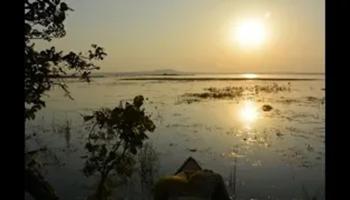
dear all, I have sent several mail to concern department including minster jairam romesh regarding the Protecting PILI river , due to filling pond , taal , river land , dam to a river land encroachment in my village KOPA , Unfortunately, I still haven't received my reply .
The report presents a sedimentation study of the Mansar lake in Udhampur district situated about 55 kms east of Jammu at an elevation of 666 m above mean sea level in the Siwalik terrain. The lake surface area is 0.59 sqkm whereas the lake basin area is 1.67 sqkm. The maximum depth of lake is 38.25 m. The lake has been developed as a tourist spot of the region owing to its natural beauty. The water is also being used for drinking and irrigation purposes.
In this study, a model has been developed considering surface flow component and subsurface flow component along with the evapotranspiration from the crop as the sink term for the Lokapavani area of KR Sagar command of Karnataka. The surface flow component is represented using one-dimensional St-Venant equations and the subsurface flow component is represented using one-dimensional Richards equation with the sink term for the evapotranspiration from crop.
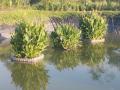
The report presents a study on the Sagar lake wherein the various water balance components like inputs and outputs have been quantified to visualize the influence of these parameters on the storage changes. Lakes play an important role in shaping the hydrological, ecological and environmental balance of the region by developing the flora, fauna and habitation of the aquatic biota. Like other lakes, Sagar lake too faces manifold problems of siltation and deterioration of water quality, thus threatening its survival.
The report presents an inventory of water bodies in the State of Jammu & Kashmir in the Western Himalayan region prepared using satellite data of IRS-1A (standard FCC, scale 1:250000) for 1988/ 99 and digital data of IRS-1C for 1998. Also, presented is a database developed with the help of Survey of India (SoI) topographic maps, which includes name and type of the water body, nearest place, district, river basin, geographical coordinates and elevation.
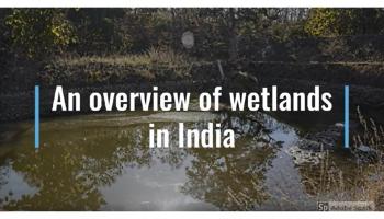
The Ministry of Environment and Forests released a draft of the regulatory framework for wetland conservation - Wetlands Conservation and Management Rules (2009) for feedback from all stakeholders. The draft framework was prepared by a multi-disciplinary expert group, and final round of comments were invited till June 21st 2010.
The Wetland Conservation Team of Ashoka Trust for Research in Ecology and the Environment (ATREE) did a detailed analysis of the draft regulation and submitted several pertinent concerns to the Ministry. The most significant observation is that the new framework (as do much of India's policies and laws) continues to propose unjustifiable State control and interventions over the country's wetlands and livelihoods of people dependent on them. The regulation does not make any constructive suggestions or recommendations for the conservation that the country's wetlands demand, and instead brings all wetlands into complete official control by installing Central, State and District-level wetland regulatory authorities, wherein the majority of the members will be senior government officials.
Desilting is becoming a major component of any Lake Conservation Project now a days. The basic reasons given for necessity of desilting are - increasing the storage capacity and checking eutrophic conditions.
As it is not practicable to reverse the slow process of silting in the bed of lakes through which only silt can be removed, there is no word like 'desilting' in any standard English dictionary. What we are doing in the name of 'desilting' is practically 'digging' or 'excavation' of lake bed. By so called desilting, the original lake bed is disturbed which has far reaching adverse effects on the performance of the lake. Most visible effect is the increase in percolation rate resulting in heavy seepage losses through the lake bed as observed after massive desilting at Pushkar lake in 2009.
The report presents a systematic procedure for the computation of evaporation from lakes. Water balance of a lake depends upon the relative importance of various inputs and outputs to and from the lake. In Indian conditions, evaporation loss constitutes one of the major outputs from a lake and as such, the water regime of a lake and yield are influenced by it. In order to conserve and use the water, there is an urgent need for a first hand reasonable accurate estimate of its water balance.
The report provides an account of the findings of water quality studies of Lake Nainital and surroundings. Even though quite a few water quality investigations have been conducted by other researchers, they were more focused on biological aspects and overlooked the hydrological aspects. Further, not all of the earlier studies on Nainital incorporated the groundwater quality aspects, which are essential to establish the background values that can be ascribed to the geology of the region. Only after establishing these, the pollution levels can be assessed.
The report attempts to compile all the published works on the Sagar lake in one place. This includes brief description of the historical and the geographical background of the lake, details of water quality analysis carried out in various years, present position of the lake and various schemes proposed and implemented for the improvement of the condition of the lake.