/topics/lakes-ponds-and-wetlands
Lakes, Ponds and Wetlands
Channel network delineation and catchment area demarcation of ponds: A GIS-based application
Posted on 25 May, 2010 03:06 PMContent Courtesy: GIS Development
Forwarded to the portal by: Sangeeta Deogawanka
Ponds are important sources of fresh water in the world as they store surface runoff produced by the storms. In this research paper, demarcation of the portion of land contributing runoff to ponds in village Nandgaon (Uttar Pradesh) has been done using topographical information of the surrounding area of the ponds, in a GIS interface.
Awards ceremony of the "Lost lakes of Bangalore" video contest
Posted on 25 May, 2010 01:30 PMAwards distributed to the winners of Lost lakes of Bangalore – A video contest
The awards ceremony of the Lost lakes of Bangalore video contest was held on July 3, 2010 at the TERI auditorium, Domlur.
The contest had two categories of entries – general (aimed at citizens) and the student category.
The Lost lakes of Bangalore contest elicited 23 student category and 15 general category videos, covering 32 lakes of the city.
The awards ceremony was well attended by students, participants and several citizens of Bangalore. Ms. Rohini Nilekani, Chairperson, Arghyamreinvigorated the youth to participate in redefining our lifestyles in order to reach sustainable consumption patterns.
Ramsar Small Grants Fund
Posted on 10 May, 2010 10:41 AM Article Courtesy: Funds for NGOs.org
“The Ramsar Small Grants Fund (SGF) was established in 1990 as a mechanism to assist developing countries and those with economies in transition in implementing the Convention and to support the conservation and wise use of wetland resources, with a strong human and social dimension. From 1991 to 2008 the Fund has provided a total of 7.5 million Swiss Francs to 227 projects from 108 countries, providing up to 40,000 Swiss francs (about US$32,000) per project.”
A study on Bellandur tank and changes due to urbanisation - A report by CASUMM
Posted on 21 Apr, 2010 05:08 PM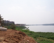 This article by Collaborative for the Advancement of the Study of Urbanism through Mixed Media (CASUMM) presents the case of Bellandur Tank in Bangalore city and highlights how rapid unplanned urbanisation has led to the destruction of one of the biggest water bodies in Bangalore Urban district.
The tank provided sustenance for people who lived in the areas surrounding it and provided water for irrigation, household purposes such as drinking, washing and cleaning, besides providing ample supply of fish. The tank was thus an integral part of the society and had a relationship with the communities residing around the tank.
Water owned by all and used by all
Posted on 30 Mar, 2010 02:17 PMThis is cross posted from my blog (link). I wanted to introduce the idea of common pool resources, on which there is a whole new body of work coming up lately. This had won Elinor Ostrom the 2009 Nobel Prize. For water sector, I believe this theory can definitely yield some new insights. And it all starts with a question "Who owns the water?'
World Wetland Day 2010 Celebrations - Updates from ATREE
Posted on 24 Mar, 2010 05:21 AM
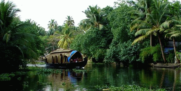 The World Wetland day 2010 was celebrated by CERC-ATREE with a number of programmes. As an Annual event ‘WETLAND FESTIVAL 2010’ involving the students and teachers from the wetland clubs of Jalapadom schools around the Lake, was held at Kalyani auditorium, Aleppey.
Workshop on Protecting water bodies of Chennai, ASCE-EWRI, Chennai
Posted on 20 Mar, 2010 10:05 AMThe first international chapter of Environmental and Water Resources Institute of the American Society of Civil Engineers, ASCE - EWRI South India Chapter was inaugurated at IIT Madras on January 6th 2010.
Jaltarang, a celebration of World Wetlands Day - An update from TERI's wetland management program in Navi Mumbai
Posted on 11 Mar, 2010 10:45 PM The satellite township of Navi Mumbai, with a total area of 344 km2, was developed in 1972 by CIDCO (City and Industrial Development Corporation) to de-congest the city of Mumbai. Initially a marshy land interspersed with villages, Navi Mumbai has been developed into a planned township, with much of its marshes and freshwater wetlands being converted into urban infrastructure.
Navi Mumbai is a rapidly developing twin city. In the course of development, it was realized that more emphasis needs to be given towards the preservation and sustainable management of the freshwater wetlands it harbours. Given the vulnerability of these wetlands and their resource potential, there is an urgent need to develop a framework for sustainable use of freshwater wetlands. This requires efficient management systems and development of sustainable models, which would help maintain the natural characteristics of wetlands while also exploiting its potential to meet the socio-economic and recreational needs of communities. To tackle this important aspect, TERI conceptualized a pilot project with active support of CIDCO in October 2008. The Khandeshwar Lake was chosen as a model to demonstrate the feasibility as a ‘sustainable wetland’.
The attached presentation is an update on the work taken up and impact achieved since the start of the project, and includes details from the World Wetlands Day celebration organised on 2 February 2010. Details of TERI's wetland management program are here.
The Vand women of Kachchh - A case study on drinking water management from the work of Samerth Trust in Kutch, Gujarat
Posted on 07 Mar, 2010 02:23 AMThis case study is about Samerth's efforts to achieve drinking water security, in participation with local village communities in Rapar, Kachchh (Gujarat). Arghyam has been collaborating with Samerth on this effort since 2007.
The Vand Women of Kachchh: Guest post by Keya Acharya
She gazes unflinchingly with direct eyes into the camera with a feminine mystique and physique that could, be gracing the front cover of a beauty magazine. Her red, mirror-worked blouse, in the traditional Kachchhi style worn by tribal women, is strapped at the back in stringed bows, greatly practical in the dry, wilting heat of that arid expanse of land in hinterland Gujarat called Kachchh. Her skirt is a colourful hue of printed green, and her ‘dupatta’ is a blazing red piece of cloth swept forward from her waist, partially covering her back, brought over her head and tucked back demurely into her waist again. Her name is Ammi.
Wetland mapping and conservation: Use of GIS
Posted on 01 Mar, 2010 04:35 PMGuest post by Sangeeta Deogawanka
February 2nd, designated as World Wetlands Day, has quietly slipped by with isolated events that speak of the lackadaisical attitude towards this rich ecosystem.
With 67,429 wetlands covering an area of about 5.5 million hectares, [Ministry of Environment and Forests (MoEF), 1990], the wetland systems in India are diverse, found in high altitude cold zones, the hot and humid coastal areas or occurring as scattered inland wetland systems.


