Term Path Alias
/topics/groundwater
/topics/groundwater
This presentation by ACWADAM deals with the conceptual framework of groundwater management.
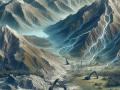
This presentation by ACWADAM deals with the issue of groundwater management under the climate change scenario in India. Climate change is a change in the statistical distribution of weather over periods of time that range from decades to millions of years. The causes are -variations in solar radiations, plate tectonics, volcanism and change in earths orbit & axis.
This presentation on aquifer properties by ACWADAM deals with the storage and transmission properties of aquifers. The two functions of an aquifer, accumulation of water (storage) and flow of water (transmission) are discussed. The permeability or hydraulic conductivity of the aquifer which allows water to flow towards the well is described.
The presentation by ACWADAM on earth system deals with the four elements that make up this system. Earth science generally recognizes four spheres, the lithosphere, the hydrosphere, the atmosphere, and the biosphere; these correspond to rocks, water, air, and life. These four interdependent parts or the earth's spheres are described as:
This presentation by ACWADAM deals with hydrologic properties of the rock framework in which groundwater occurs and through which it moves. In watershed programmes, it is necessary to develop a correct understanding of the storage and transmission of water within such channels because the shape of openings in a rock or sediment, their size, volume and interconnection play a vital part in the hydraulic characteristics of an aquifer.
This presentation by ACWADAM deals with introducing groundwater management protocols for wells in different phases of groundwater use. These protocols include geo-hydrology in watershed development, protection of recharge areas, efficient well use, pump capacity regulation, distance with respect to drinking water well regulation, depth regulation in drinking water well, regulation of agricultural water use and groundwater management through sharing.
This presentation by ACWADAM explains the occurrence of groundwater and deals with the vertical distribution of groundwater. To begin with, the openings in rocks in the zone of rock fracture such as intergranular openings, vesicles in volcanic rock, joints & fractures and solution cavities are described.
This presentation by ACWADAM deals with weather, the most fundamental process that shapes the earth. Meteorology, the science of studying weather, is described where some predictions can be made using atmospheric conditions or some data can be generated using simple equipments. These can in turn be used for measurement of weather for better implementation of a watershed project.
This presentation by ACWADAM deals with the three basic types of rocks that are found in nature – igneous, sedimentary and metamorphic. Rocks are classified on the basis of minerals & chemical composition, by texture and by the processes that formed them.
 This link on the CAG website provides the details of an international conference that was held on 15-16 March 2010, in the backdrop of the environmental audit proposed by the the Comptroller and Auditor General (CAG) of India, for management and conservation of the environment .
The purpose of this conference was to deliberate on the causes of pollution, action taken by governments and civil society to address this and environmental, management and legal interventions needed to put lakes, rivers and ground water on the path of sustainability.
More than 20 experts on water and water pollution issues were invited to share their views as panelists during the conference. Apart from these distinguished panelists, the heads of supreme audit institutions from countries like Austria, Maldives, Bangladesh and Bhutan were also present to share their experiences regarding audit of water pollution in their countries.