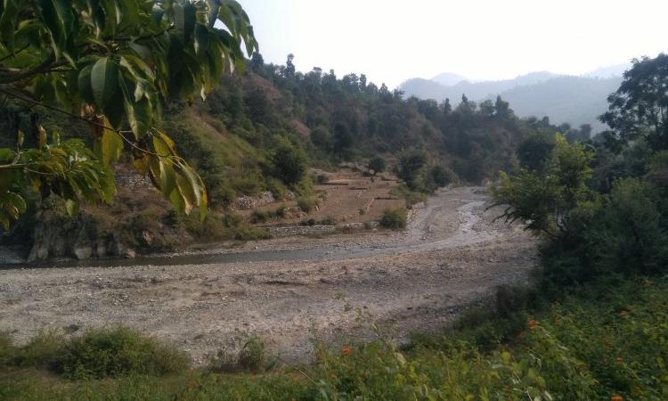
Mahakali, also known as Sharda in India, gushes through the hilly tracts of Nepal and Uttarakhand, collecting its water from the numerous streams it receives on the way. Like all rivers meandering through the lush terrains and forests of Uttarakhand, Mahakali too has become a cause of disagreement between the state and the people due to the widespread community opposition to the proposed dam on it at Pancheshwar.
Hydropower dams in the region
As per the Ravi Chopra Committee’s report on hydropower projects in Uttarakhand Himalayas, the government plans to harness around 27,000 MW of potential hydropower from its rivers by constructing over 450 hydropower projects. Currently 92 projects with a total installed capacity of approximately 3624 MW have been commissioned and around 38 projects are under construction. The area is poised to have one of the highest average dam densities in the world with one dam for every 32 km of the river.
These projects would largely populate the higher Himalayan region which is seismically active with maximum strain build-up and concentration of moderate earthquake epicentres. Recent studies indicate that the risk associated with disasters like earthquakes and floods is increased manifold by the construction of mega storage dams with the progression of damage.
A recent study has appraised the probable environmental consequences of the proposed 315 m high Pancheshwar dam in the light of current geologic and geomorphic understanding. The study suggests that if executed in its current format, the proposed dam in the Indian Central Himalayas raises a concern about safety and its sustainability due to seismicity, reservoir-induced seismicity, slope instability due to reservoir drawdown effect and an unpredictable large volume sediment mobilisation from paraglacial zones.
The study assesses the risks associated with the project in the light of environmental impact observed for the Tehri project in the region and the geological understanding developed over the years.
The project has a drainage area of around 12,000 sq. km, out of which 2700 sq. km lies in the glacial and paraglacial zones. There have been doubts regarding the impact of this project on the terrain and its ecosystem besides concerns on the disruption of the socio-economic conditions of the people living in Pithoragarh and Champawat districts of Uttarakhand.
Geology, structure and seismicity
The project area of the study lies in zone IV of seismic zone map of India where various faults around the proposed site are suggested to be currently active. The region is highly vulnerable to seismic hazards. The probability of a high magnitude earthquake in the Central Himalayan seismic gap areas is more, yet the precise timing of the earthquake cannot be predicted accurately. In the Nepal Himalayas, most of the hydropower projects are run-of-the-river type and lack any major reservoir and yet, a majority of them were damaged during the 2015 Gorkha earthquake.
According to Pancheshwar dam pre-feasibility report, a potentially active Rangunkhola fault capable of generating an earthquake of 7.4 magnitude traverses the dam site in Nepal Himalaya. There is a growing concern regarding the implications of impounding large water bodies in a tectonically active terrain like the Himalayas.
High sediment availability
The Himalayan rivers contribute about 10 percent of the total global sediment budget where 44 percent of total sediments are stored in the glacially scoured valleys. The upper catchment of the major river valleys in the Himalayas are not sediment-limited, instead, they are transport-limited.
Considering that the extreme hydrological events are likely to increase in future due to the increase in global temperature, it is important to study in detail the dynamics of the glacial fed Himalayan rivers for their carrying capacity both in terms of water discharge and sediment load. It is also important to study the changes in the stream profile gradient that may occur due to high sediment flux and may adversely impact the projected benefits from the proposed hydropower projects.
The Himalayan rivers constitute a combined flow of sediment, water and energy. Therefore, it is important to integrate the knowledge of sediment dynamics with the hydrological flow for the sustainability of engineering structures (dams).
The present study highlights the need to reassess geo-environmental implications of the project in the ecologically sensitive Kaliganga valley. With the changing inflow and outflow condition, the reservoir levels are going to fluctuate unpredictably. When the terrain stability around the Tehri dam could not be protected, how can we ensure that this would not happen in a much bigger reservoir of Pancheshwar dam?
In the pre-feasibility study, besides the geological aspects, there should have been detailed deliberations on the status of the valley slopes along all the four river valleys that are going to be inundated. This is critically important for the safety, security and ecological and economic sustainability of the people who are technically not displaced but bear the brunt of the project because they live at a higher elevation and are rarely compensated for the collateral damage as observed in many villages of the Tehri high dam.
The way forward
It is necessary to have a detailed geomorphic status of the valley slopes that are going to submerge. This should include extensive mapping of the slopes with emphasis on the lithology, thickness and the extent of debris/colluvium in the proposed reservoir rim area of the Pancheshwar dam. Such a study would help the dam authority to initiate slope treatment measures well in advance to avoid any collateral damage after the filling of the reservoir, and thus a situation like Tehri dam can be averted.
Finally, we are yet to develop a reasonable understanding of the behaviour of the Himalayan cryosphere in response to climate variability and changing precipitation trends. This calls for a complete re-evaluation of the methodology employed for assessing hydropower potentials of the glacial and snow-fed Himalayan rivers.
A recent study from Hindu Kush Himalayas indicates that a majority of the glaciers have retreated and lost ice mass since the mid-19th century. As a consequence, the meltwater contribution into rivers would be adversely impacted, which, if not accounted for, will lead to under-performance of the hydropower project. It is also feared that such projects are likely to impact the aquatic biodiversity in the downstream of barrages/dams due to reduced environmental flow.
The paper can be downloaded here
/articles/environmental-implications-pancheshwar-dam