The simplification of access to the Global Positioning System (GPS) via smartphones, along with mapping solutions built to leverage these in the form of easy-to-use apps, has contributed to the widespread adoption of geospatial technologies in the rural landscape. The use of GPS devices and mapping tools for planning and monitoring development interventions is now increasingly visible.
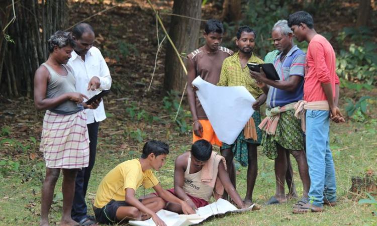
The potential for grassroots-level data generation using free and user-friendly tools such as Open Data Kit, Google Earth, Bhuvan, etc., is immense. It can play a key role in providing rural communities agency in determining their own development. However, stakeholders at the grassroots level, including community leaders, Panchayat Raj Institutions, NGOs, CBOs, and local government officials, often lack awareness and the capacity to effectively utilise geospatial data, tools, and technologies.
Although many civil society organisations and governments at the central and state levels have started developing applications and data to serve specific needs in the development sector (e.g., natural resource management, biodiversity conservation, livelihoods, infrastructure development), civil society organisations and rural communities are not yet recognised as important stakeholders in the geospatial industry, which is predominantly dominated by commercial entities and government agencies.
The geospatial industry, for the most part, develops databases, tools, and technologies with a commercial focus, and their application in the development sector is mostly an unintended byproduct. It is in this context that the GeoSmart India conference gains significance.
GeoSmart India is the largest geospatial industry event in India that brings together stakeholders in the geospatial industry with a view to fostering collaboration, knowledge exchange and staying ahead of industry trends. The vision of GeoSmart India 2023 is to strengthen India's ambition towards becoming a successful trillion-dollar economy.
In the recent edition held at Hyderabad during 17-19 October 2023, there was a dedicated space for sessions aimed at rural development, titled 'Digital Maps @ Work in Villages'. This track was co-organised by Foundation for Ecological Security (FES), Geospatial World, EarthSight Foundation, Rambhau Mhalagi Prababodhini and National Remote Sensing Agency (ISRO).
It intended to promote geospatial thinking within masses that are driving development at the grassroots level, thereby boosting efforts at mapping the villages, towns, and cities, collecting evidence-based data for making data-based development plans and monitoring its impact by taking advantage of advances in geospatial technology. The track has the potential to change the way the development sector is perceived by the ‘hi-tech’ geospatial industry, so that more players start directly addressing the needs of the sector through their products and services.
Within this day-long track, there was a session titled 'Civil Society & Geospatial Knowledge Co-Creation' anchored by FES. The purpose of the session was to provide a platform to showcase the capabilities of geospatial technologies to grassroots level stakeholders as well as discussing the issues and challenges that they themselves face in using geospatial and other information technologies in their work. The audience consisted mostly of elected representatives of Panchayati Raj Institutions along with a few representatives from civil society, industry and government institutions.
Chiranjit Guha from FES spoke about the work of the India Observatory vertical in FES to increase the reach of data and analytics to village communities to enable evidence-based decision-making for natural resource management. To this end, FES has developed an India Observatory platform that provides data, analytics, insights and advisories to village communities to aid natural resource management and informed decision making.
The India Observatory (IO) has put together spatial and non-spatial datasets on socio-economic, ecological, and biodiversity related parameters. It also contains information derived from remote sensing data. The IO also develops tools to meet specific needs of resource persons at the first mile (village level). Some of these are:
- Composite Landscape Assessment and Restoration Tool (CLART) for water conservation planning
- Crop Water Budgeting (CWB): to promote water conservation in agriculture
- Integrated Forest Management Toolkit (IFMT) for sustainable forest management
- GIS Enabled Entitlement Tracking (GEET): to help communities access social security schemes
- Groundwater Monitoring Tool: to crowdsource groundwater data for better water resource management
- Forest Right Act (FRA) tool: to simplify and track Community Forest Right claims
Craig D’Souza from Water, Environment, Land & Livelihoods (WELL) Labs at IFMR, spoke about the opportunities in remote sensing for rural development. WELL Labs co-creates research and innovations related to land and water sustainability for social impact. Questions asked by NGOs and philanthropies/CSRs related to rural water management are identified, and remote sensing based datasets and APIs are developed to model solutions at scale. The solutions are open-source. Some key questions they try to address relate to assessing village water security, planning watershed management structures, evaluating impact of interventions, etc.
Well Labs invites partnerships in using, validating and improving their open source models, collaborating on new ground truth data collection, and producing historical land use land cover maps. The overall goal is to build an open platform for land use land cover information to enable better rural water management.
Suneetha Sapur from INREM Foundation talked about their efforts to leverage geospatial and other open source technologies to enable citizens to access and share data and insights related to water quality. INREM Foundation works on providing clean and safe drinking water in rural India.
INREM worked with the Water Quality Monitoring Information System (WQMIS) of the Jal Jeevan Mission. While community members played a key role in collecting the data, there were challenges in communicating insights from this data back to them. INREM has developed a chatbot called "WaterQuality Bot" to enable citizens to ask questions, share data, and get insights on drinking water quality. The bot allows users to ask questions and get solutions on water quality problems by using Artificial Intelligence/Natural Language Processing to provide verified responses on water quality issues in regional languages.
It enables users to share water quality data from their location which gets mapped and is subsequently accessible to all. It also provides insights on water quality status from IMIS database based on user location. This is set to be enhanced further by connecting with experts, providing image-based responses, integration with public data sources etc. The goal is to create hyperlocal drinking water quality information flow and community-driven solutions.
Priya Sankar from Arghyam spoke about using technology to scale participatory approaches for community groundwater management. Given India’s huge dependence on groundwater, there is a need for community participation in groundwater management. However, there is a shortage of experts to support participatory planning and digital tools that are designed for the first mile. In this context, Composite Landscape Assessment & Restoration Tool (CLART), a GIS-based decision support tool designed for community-led planning of water conservation interventions, enabled community-led scientific planning at scale in Karnataka and Meghalaya. It is easy to use, works offline, and provides colour-coded maps that are easy to understand. Between 2020 and 2023, the coverage of users and districts covered has doubled, villages have increased sevenfold, and there has been a ten-fold increase in interventions planned. The key factors that enabled this scaling are
- Partnership with government programs via training and embedding outputs into programmes
- Extensive deployment support for adoption and resolving implementation queries
- Open access to output data for convergence of initiatives
GIS tools for the first-mile enable participation at scale. Building trust with the system and providing deployment support are crucial. Open, trusted data drives convergence. Overall, this establishes a model for community-led scientific planning that can leverage large-scale public funds.
Balachander from FES reflected on the use of data and technology in community-based natural resource management (CBNRM). Power of data is undervalued due to lack of data/tech literacy in civil society and communities. Capacity gaps can be addressed via trainings, support platforms/products (like CLART), open data generation, crowdsourcing, and institutionalising the use of data in decision making.
Data and technology can help strengthen declining local knowledge, revive defunct conservation practices, etc. There may be gender, caste and other barriers within a community that need to be addressed to achieve this. The use of data in one domain, say groundwater, could help kickstart demand for data on other domains as well.
Open data enables transparency and accountability in contested domains like land, water, and biodiversity. Establishing open monitoring systems around natural resources can empower communities and other stakeholders.
Spontaneous tech adoption by NGOs/CBOs is limited due to various constraints. Time/resource investment is needed even for the use of free tools and data. Effective data/tech use needs an ecosystem of diverse groups such as domain experts, analysts, designers, trainers etc. Bringing them together needs a collaborative spirit among these actors and financial backing for such convergence. Interventions needed to deliver at scale must not lose local relevance and be able to handle diversity. Overall, the ‘natural resource commons’ needs a ‘data/tech commons’ to enable community-based natural resource management.
Across the talks, there was a sense of optimism based on field experiences regarding the use of geospatial data and tools for rural development, not only at the first mile but also at scale in large-scale government programmes. The willingness to collaborate with diverse stakeholders at the community, civil society, and government levels was another hallmark of all the actors. The belief that data and technology are an important piece of the puzzle of creating impact at scale in rural development was strengthened by the acknowledgement that co-creating solutions for the first mile, providing hand-holding support, and building trust through the design of systems based on open data are also vital.
The presentations are attached below.
/articles/empowering-rural-development-through-geospatial-technologies