Springs

Springs in India

The importance of springs

Threats to springs in India

Managing springs in India

Hydrogeology

Springshed restoration

Participation

Paraprofessionals 

The importance of springs

Springshed management

There are five million springs across India, based on current estimates. From the Nilgiris in the Western Ghats to the Eastern Ghats and Himalayas, springs are a safe source of drinking water for rural and urban communities. For many people, springs are the sole source of water.

For example, ninety percent of drinking water supply in Uttarakhand is spring based, while in Meghalaya all villages in the state use springs for drinking and/or irrigation. Vital components of biodiversity and ecosystems, springs are also how many rivers and streams are generated. Most of the rivers in central and south India are spring-derived including the Krishna, Godavari, and Cauvery.


 As the springs of many mountain states in India continue to dry up, the state of Meghalaya takes the first step pulling strings together to revive its springs heavily depended on. The Government of Meghalaya is trying to bring in stakeholders from all concerned areas to work on this. However, with most of the land being privately-owned, the approach would have to be carefully designed. 

Threats to springs in India

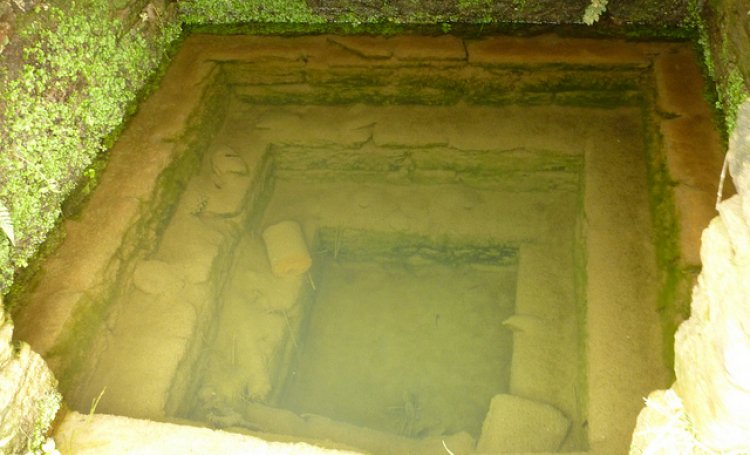
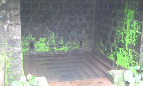
An abandoned naula with sediment and dirt on the bottom (source: India Water Portal)

Despite the key role they play, springs are in crisis. Spring discharge is declining due to groundwater pumping under increased demand, changing land use patterns, ecological degradation and a changing climate. A survey in Sikkim found that water production has declined in half of all springs in the state – a dangerous sign that aquifers are depleting in a state almost entirely dependent on springs for drinking water.

Similar effects are being observed in nearly all mountainous regions of India. In the Western Ghats, once perennial springs are becoming seasonal, leaving communities struggling to meet demand. Temples built on perennial springs are now dry as upstream wells compete for drinking and irrigation water. Exacerbating the problem, water quality is also deteriorating under changing land use and improper sanitation. Springs traditionally used as a village drinking water source are being abandoned due to the close proximity and contamination from latrines.

Any reduction in water supply or water quality will have profound impacts not only on village drinking water, but also on regional livelihoods, health, biodiversity, agriculture, tourism, power generation, and industry.


Managing springs in India

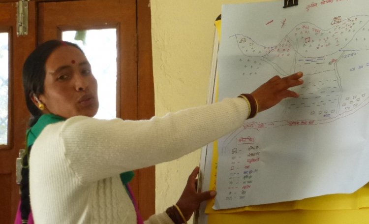
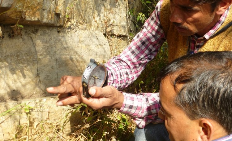
Munni Devi explains the geology of her area (Photo courtesy: India Water Portal)

The Springs Initiative is working to promote awareness of the importance of springs, and to build capacities to protect and develop springsheds across the country. At the community level, most spring protection efforts utilize the similar programmatic approach: 

1. Communities are engaged through hydrogeology to map springsheds

2. These areas are targeted for restoration, protection and/or augmentation of recharge

3. Communities are part of the entire process, including the field hydrogeology, in attempt to demystify the science and make it open source

4. Local institutions then take up the monitoring and management of springs after significant training and engagement. 

5. Many community members become groundwater literate and share knowledge with others


Hydrogeology

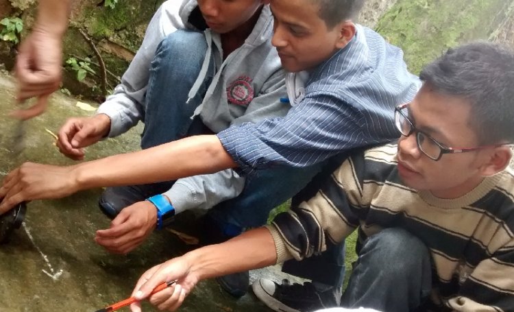
Spring committees learn basic hydrogeology to better understand and manage their springs (photo courtesy: Government of Meghalaya)

Springs owe their existence to the nature and structure of the rocks surrounding them. The science of this interaction of geology and water is called hydrogeology. An understanding of this science is crucial to understanding springs, their behaviour, and the means of their conservation.

We seek to demystify the science of hydrogeology. This puts the ability to map geology, aquifers and recharge areas directly into the hands of community members. So far, this approach of training 'parahydrogeologists' has empowered field-based development organisations and village spring communities to efficiently manage their springs.


Springshed restoration

Contour trenches are an important measure to prevent soil erosion and promote recharge (photo courtesy: GRAMPARI)

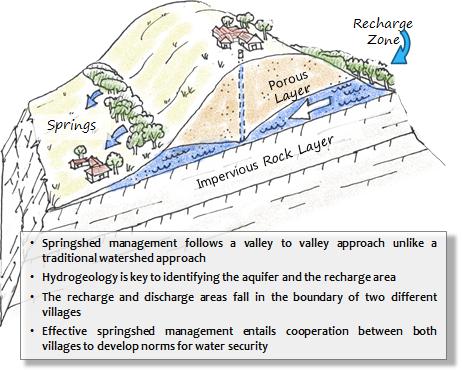
'Springshed' is a portmanteau word that describes the catchment area of a spring, or the land from where it obtains its water. Springsheds differ from watersheds in that they are not necessarily the same as the valley inhabited by the spring. It is common in fold mountains like the Himalayas to have a spring and its springshed in two different valleys. This necessiates a knowledge of hydrogeology and meticulous mapping. Once the springshed is identified, the goals of springshed restoration are akin to those of watershed management:

1. Reduce soil erosion, increase vegetation cover and soil organic matter

2. Increase natural infiltration of water into the soil and recharge of the aquifer

3. Protect the area to allow ecological restoration and prevent pollution of the groundwater and surface runoff by maintaining cleanliness in the catchment area.

4. Augment natural infiltration and recharge through best practices

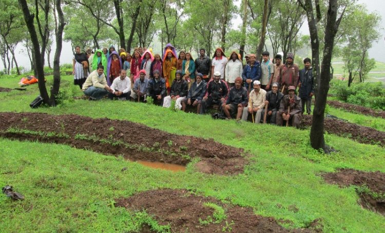
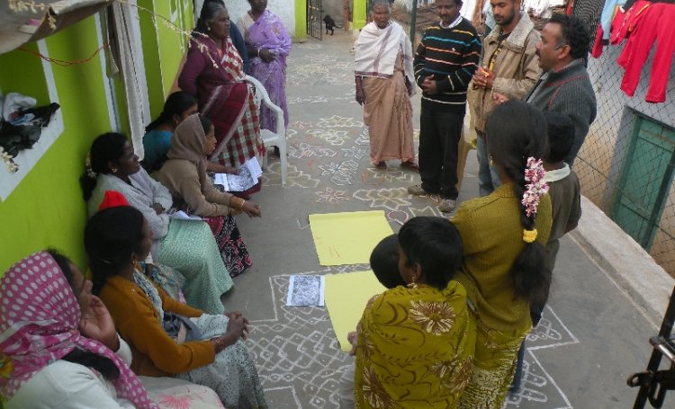
Villagers and development workers conduct a participatory rural appraisal (Photo courtesy: Keystone Foundation)Participation

The success of spring restoration, and of the Springs Initiative hinges on the enthusiastic participation of all the entities concerned. Firstly, these are the communities that use springs. It is important that they are convinced of the need to conserve their springs, that they understand how  it is done, and that they be  willing to assume the responsibility of managing their springs. In most cases, therefore, the demand for spring restoration needs to come from the communities. 

Non-govermental organisations, including funders, researchers, and field development organisations all have a role to play in facilitating the exercise and enabling communities to manage their springs.

However, the scale at which these organisations can operate is necessarily limited. The crises surrounding water make it necessary that springs management be taken up at the regiional scale. This is where governments come in. Sikkim and Meghalaya have demonstrated that state governments  can take the lead in participatory, science-based management of springs. 

Paraprofessionals

Many community members have gone on to become parahydrogeologists with some training (photo courtesy: CHIRAG)


Many community members have an inherent understanding of hydrogeology and, after some exposure and informal training, they go on to become para-hydrogeologists. There are self help groups (SHGs) in Uttarakhand who can explain rock types and formations as well as many geology graduates. There are farmers in Maharashtra who are now mapping geologic contacts to help other villages identify their springsheds. 


Springs are important, and so it is important to get the nature of springs clear at the outset. A spring-simply put- is that  point or area at which water emerges from an aquifer located underneath the ground onto the surface. 

Types of springs:This emergence can be due to several reasons like, change in slope, change or nature of local geology or geologic structure.  Springs are classified into different types by the nature of their origin. Thus  springs can be classified as per the following:

  • Depression: Formed when water table reaches the surface due to topographic undulations.
  • Contact: Formed at places where relatively permeable rocks overlie rocks of low permeability.
  • Fracture: Occur due to existence of jointed or permeable fracture zones in low permeability rocks.
  • Fault: An impermeable rock unit may be brought in contact with an unconfined aquifer due to faulting. Groundwater (at depth) under hydrostatic pressure (such as in confined aquifers) can move up along such faults.
  • Karst: Large quantities of water move through the cavities, channels, conduits and other openings developed in limestones.

 Geographical extent: It is usual to associate springs with the mountains. It is true that mountain topography is more conducive to the emergence of springs. The Himalayas, the Eastern, and Western Ghats have a rich treasure trove of springs which give birth to several rivers. The great Krishna and Godavari rivers, along with all the other perennial rivers of the Indian Peninsula owe their origin to springs. However, springs are to be found across all of India to varying extents, including in the vast flatness of the Gangetic plains. Naimis Aranya, in the watershed of the Gomti, owes its existence to thousands of bubbling springs that have given rise to a mythology of their own. Villages in the peninsular state of Andhra Pradesh also depend on springs.

Extent of use: While it is true that with more than a million pumps India is a vast pumping machine, this does not even begin to tell us of the extent of the groundwater use of the country. People in all mountain areas almost entirely dependent on springs. The reason for this is the topography. Mountain areas cannot boast of the extensive aquifers that are found in the Gangetic plains or in other relatively flat areas. Instead, they depend on local or what are ofter called as 'perched' aquifers-small and isolated pockets of water found where the geology forms a convenient receptacle for water.  These are often fed by fissures and faults in the rocks that bring water from far away. The small size and the nature of these aquifers rules of the fact of making wells for extracting groundwater - not only that, blasting and drilling may well close the fissures that bring in water and possibly the spring itself. And so, mountain peoples have learnt to content themselves with the water that is issued naturally from the springs. This is used for drinking, washing and irrigation- infact, for every conceivable use.

Traditional knowledge/lore: With the importance of springs, it is not surprising that there is a substantial body of traditional knowledge around their use and management. Springs are often demarcated by temples and small stone sculptures such as the 'gomukh' to be found in the western ghats. These are stone spouts shaped like the head of a cow or some other animal and placed so that the water issues from the mouth of the sculpture. This is mainly found at the springs that form the source of a river. In the Himalayas, a structure like a miniature step-well (called a naula) is constructed which allows seepage while also providing a certain amount of storage and protection.

These structures and the many others like them are governed by strict rules to protect agains pollution. This includes a ban on washing and bathing at the naula, a ban on entering while wearing footwear etc. The flip side of course, is that these codes of conduct often also foster caste distinctions. In the Central Himalayas atleast, naulas are – besides marriage- the last bastions of casteism.

In Sikkim, traditional knowledge and beliefs provide a strong force towards the preservation of the springs. Springs are believed to come out where Goddess (Devithan) dwells and are important places of worship. These cultural beliefs also prevent polluting these sources and are instrumental in keeping biological contaminants away to a large extent.

Current status: While individual organizations are beginning to maintain a database of springs in the areas they are based, there is still no exhaustive census of the total number of springs in the country. However, there is some recurring anecdotal evidence across the country that dependence on springs as either the primary or the secondary source of water for domestic use is increasing while simultaneously, the yields of these springs are decreasing. Springs continue to be extensively used for domestic water supply. In most cases, the springs are untapped and nearby households collect water directly from the spring. Springs with a large discharge are harvested to supply piped water. Most villages, such as Indwalgaon, boast a hybrid system which uses a centralised water supply for the village in conjunction with smaller springs used by hamlets.

Crises: There is a decrease in both the quantity and quality of the water available from springs. This, coupled with increasing population- both resident and tourist- translates into water scarcity and much hardship for rural families.

Sinking of multiple borewells  and extensive pumping is the single biggest threat to springs in the Eastern and Western Ghats, as well as elsewhere where springs are prevalent. Both drilling and pumping change the nature of the aquifers as well as the level of water in them.  This causes a decrease in the time for which springs flow, the amount of water flowing in them, and also whether the springs continue to flow at all.

Catchment areas of the springs are being threatened by changes in land use, pollution and activities such as the construction of roads and dams. A spring is fed by the water that percolates down into the aquifer that it emerges from. The amount of water that percolates into a given area and for a certain amount of rainfall depends on the nature of the land.  Land covered by broad leaved forest will always arrests rainfall runoff and help water to percolate than if the land was paved over with concrete. Deforestation and construction are severely impacting the amount of water that percolates into the ground.

It is also essential that the conduits through which the springs are fed -most notably in the case of fracture and fault springs- be kept open. These can be closed or shifted by movement in the rocks which may occur due to an earthquake or due to blasting. The blasting of rocks for construction of dams and roads has led to several springs drying up in the mountain areas of Uttarakhand, Himachal Pradesh and Sikkim.

Climate change has its own role to play in the decline of spring discharge. At present, anthropogenic changes predominantly impact groundwater . However, erratic rainfall directly impacts the recharge that is available to springs. Other indirect impacts are due to changes in cropping patterns and increase in extreme events.

Springs being extensively used for drinking, water quality concerns need to be taken seriously. Studies carried out in the Himalayas indicate that all springs in the vicinity of villages- those that are most used for drinking- are contaminated with faecal coliforms. This needs to be treated at source, by protecting the spring recharge areas and a program of awareness generation 

Work being done: The discrete nature of these springs means that they are intensely local. It follows that conservation and management of these springs also needs to be local. Recognising this, there is now a new movement to enable village communities to understand, protect and manage their own springs. Trials in this direction are being made in the Central Himalayas , the North Eastern Himalayas , and the Western Ghats  among other regions. These pilots indicate the interest in learning about the invisible workings behind springs and the potential to develop a cadre of people who are conversant with their local geology and can develop informed strategies to manage their springs. The willingness of communities to set aside their differences and cooperate over the management of their water has also been demonstrated. The experiences so far have also contributed to the creation of a protocol for the management of springs at the local level .

It remains now to further the work already begun by empowering communities to manage their springs using both science and negotiation.

Content developed with the support of:
 
Dr. Jared Buono, a hydrogeologist working on springs,and
Kaustubh Mahamuni, a hydrogeologist working with ACWADAM on springs
 
Term Path Alias

/topics/springs

Featured Articles
June 21, 2022 While springs in Kashmir have still retained their good quality and have a great potential to be used for drinking water, threats to them are growing. Their protection and sustainable management is crucial.
Verinag spring in Anantanag district of Kashmir (Image Source: Wikimedia Commons)
March 21, 2022 Recognizing women's accumulated knowledge and adaptive capacities in springshed management
Van Panchayat Samiti discussing the matters related to forest (Image: Varun Raja)
February 3, 2022 Shailendra Patel, a passionate water warrior from Pune, is on a mission to save a live spring in the city. It is important that he is heard and action taken!
Shailendra Patel, near the Bavdhan spring, Pune (Image Source: Tushar Sarode)
May 21, 2021 The water woes of Darjeeling continue to grow with unreliable public water supply and highly elastic private water markets. Is there a way out?
Darjeeling, in the grip of a water crisis (Image Source: Bernard Gagnon via Wikimedia Commons)
January 18, 2021 Multilateral action needed for a green post-COVID-19 recovery.
A living root bridge, a type of simple suspension bridge formed of living plant roots by tree shaping in village Nongriat, Meghalaya (Image: Wikimedia Commons)
October 1, 2019 Deconstructing the traditional narrow engineering based policy discourses around floods and droughts and connecting them to social and cultural realities is the need of the hour in India.
Water talk Series at Mumbai (Image Source:Tata Insitute of Social Sciences)
Dynamic groundwater resources of Maharashtra – A report by CGWB and GSDA (2004)
The report gives the groundwater potential of different districts of the State on watershed basis and also information about the semi-critical, critical and over-exploited watersheds. Posted on 08 Aug, 2011 04:35 PM

This report on “Dynamic Ground Water Resources of Maharashtra (2004)” presents the groundwater estimates for the State of Maharashtra as computed by the Central Ground Water Board (CGWB) and Groundwater Survey and Development Agency (GSDA) based on the guidelines given by the Groundwater Estimation Committee (GEC-1997) constituted by Ministry of Water Resources (Government of India). 

Maps generated from the integration of water level data of Central Ground Water Board and State Ground Water Board
This report of the Central Ground Water Board (CGWB) presents maps generated from the integration of data of CGWB (CGWB) and State Ground Water Board (SGWB). Posted on 17 Jul, 2011 03:49 PM

The CGWB under the Ministry of Water Resources, Government of India, is the national apex agency entrusted with the responsibilities of providing scientific inputs for management, exploration, monitoring, assessment, augmentation and regulation of ground water resources of the country.

Gravity based spring water supply systems in Vishakhapatnam: A sustainable solution to an age-old problem
The tribal inhabitants in water-rich Eastern Ghats mostly rely on the water reserves of natural springs and hill streams for their drinking water and other daily domestic needs. Posted on 23 Jun, 2011 05:42 PM

Gravity based spring water supply systems – A sustainable solution to an age-old problem With an annual rainfall of more than 1200 mm, this region has truly pristine and under-developed ground water resources. The water related issues are more complex in the hilly areas. Some of the most concerning issues that affect the current water scenario in the Eastern Ghats are pollution of water sources (springs & streams) leading to poor health, illiteracy and ignorance resulting in improper hygiene and sanitation practices. The burden on women and children is also high since they have to walk a long distance to the springs/streams for fetching water.

Down the drain – Exploring traditional water systems - A film by Tarun Jayaram
Where does our water come from? Where does it go? Can the Yamuna ever be a river again? Posted on 21 Jun, 2011 10:41 AM


These are some of the questions which led Tarun Jayaram, the film-maker to explore traditional water systems in the country. From the documentary’s opening moments, the director engages us with a beautifully shot array of footages ranging from pilgrims taking a holy dip of Ganges to beautiful baolis and tankas of Rajasthan to the ancient town of Hampi in Karnataka, while establishing how rivers have been an integral part of Indian culture and how its rich tradition of harvesting rainwater needs to be re-established to deal with the present day water crisis. Over the refreshing images and soothing audio, it advocates the need for community participation in rejuvenating the traditional methods of rainwater harvesting. 

Jalyatra: Exploring India's traditional water management systems
Jalyatra places water resources in the local environmental and social context. Posted on 14 May, 2011 07:34 PM

Cover PageJalyatra - Exploring India's traditional water management systems, by Nitya Jacob is an ecological travelogue that looks at links between water, society and places It describes in detail what existed, how it fitted into the socio-cultural milieu and was appropriate for the local climate and geography. It then examines reasons for their decline, as indeed most have, in recent decades.

While recording the dismal state of traditional systems, the author stumbles upon small initiatives that have brought about significant transformation across regions. It refers to noisy hidrums and gharaats, the river-run flour mills of Uttaranchal, the technologies whose potential has yet to be fully realised. It looks at water harvesting structures of southern India—the eris and ooranis. However, it admits that the average person is singularly uninterested in protecting the environment.

Jalyatra captures the efforts of NGOs and enlightened individuals striving to revive these systems. It makes the case for a mass movement to revive traditional water management systems, especially village ponds, across the country as the way to ensure water security in India. In Chambal, the author meets Brij Mohan Gujjar, dacoit turned water conservationist, who is doing valuable work on the check dams designed to control the flow of water in the ravines; and in Shillong, Lan Potham shows him the uses of the easily available bamboo to construct the shyngiar which irrigates his areca nut plantation.

Geo-hydrological studies for augmentation of spring discharge in the Western Himalaya – Final technical report by the MOWR
This study examines the geomorphological and anthropogenic influence in the spring recharge zones on spring water quality and discharge Posted on 23 Jan, 2011 04:39 PM

 It is an attempt to understand the effect of rainfall, physiography, lithology, slope and aspect, land use practices, vegetation, altitude, soil type and anthropogenic interference (e.g., road construction and settlement etc.) and other characteristics in the spring recharge zone on the water yield and water quality of the selected springs in the mid-altitudinal belt (lesser Himalaya) in western Himalaya (Uttaranchal).

Sustainable water management initiatives in Konkan under threat - A report
an intricate system of tanks, channels and falls which supplies water to the Panderi village and goes down as a free flowing stream, to irrigate a plantation of arecanut, pepper and mangoes- this intricate system is now beginning to fall apart. Posted on 21 Jan, 2011 02:09 PM

Guest Post by: Parineeta Dandekar

At the first sight, Daarche Paani (‘water at the doors’) appears unreal.. on a small flat plateau called ‘Sadaa’ in konkan, an elegant cobbled walkway leads a puzzled visitor to stairs carved in stone, which go down to an ancient grove, and here is an intricate system of tanks, channels and falls which supplies water to the Panderi village and goes down as a free flowing stream, to irrigate a plantation of arecanut, pepper and mangoes in a village called Gudaghe. When I visited the place, I could see three eminent visitors, a silent lady washing her load of clothes, a fairy bluebird splashing at a tank and a huge moonmoth in one of the trees.

Stone walkway and ancient mango trees leading to Daarche PaaniStone walkway and ancient mango trees leading to Daarche Paani.
Photo: Parineeta Dandekar

Understanding groundwater - A course by ACWADAM
How does the groundwater form? How does it move, flow and store? A six module course designed to detail these and more questions on groundwater Posted on 20 Dec, 2010 01:01 AM

The  Advanced Centre for Water Resources Development and Management (ACWADAM) has created a power-point course to explain the formation of groundwater and its management.

The course consists of 6 modules; it includes the basics of understanding groundwater, study of geology, groundwater level and movement, planning and management of groundwater, storage and flow of groundwater and water quality. The modules have been made into succinct power-point presentations that include charts, diagrams and photographs besides the written word.

An illustrated collection of groundwater problems: A guide to a beginner in groundwater hydrology by CAREWATER
Understanding groundwater hydrology. Posted on 18 Oct, 2010 07:53 PM

This report by CAREWATER has been prepared as part of a component on Groundwater Governance in Asia: Theory and Practice under the CGIAR Challenge Programme on Water and Food. The purpose of this collection is to guide a beginner to groundwater hydrology through the basic concepts in this subject. The problems begin with fundamentals of the subject and are followed by those which test the comprehensiveness of understanding. Most problems are illustrated and a real-world situation is related with the problem.

Training modules on planning, development and management of groundwater with special reference to watershed management programmes by ACWADAM
A comprehensive training module on basic hydro-geology and groundwater science Posted on 06 Oct, 2010 08:12 PM

Acwadam

Advanced Center for Water Resources Development and Management (ACWADAM) is a premier education and research institution and facilitates work on groundwater management through action research programmes and trainings. ACWADAM’s main thrust has been on the process of capacity building and facilitation, both founded strongly on its research base.

ACWADAM, with support from the Ford Foundation, has embarked on strengthening civil society capabilities in groundwater management, using the watershed management platform. A comprehensive training module on basic hydrogeology and groundwater science, has been developed, and can be sourced by writing to ACWADAM at acwadam@vsnl.net.

These trainings enable the trainees particularly from Civil Society Organisations to improve the planning, implementation and monitoring of their watershed development and allied projects.