Sangeeta Deogawanka
Sangeeta Deogawanka
Geospatial technology for groundwater management – An article in Geospatial World
Posted on 13 Jul, 2011 03:05 PM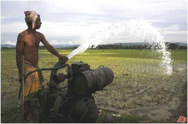
2010: The year of climate records
Posted on 18 Jan, 2011 11:35 PMArticle Courtesy: Cognizant Reflections
Author: Sangeeta Deogawanka
The year 2010 has witnessed a few climate records that has mounted evidence of climate change the world over.
- It marked the end of the warmest decade since climate records were kept.
- It has been one of the three warmest years recorded, since 1850.
Cancun: Is it a climate meet with a difference?
Posted on 25 Dec, 2010 07:58 PMDespite the pre-Cancun Wikileaks revelation of U.S. strong-arm tactics at the Copenhagen summit, and U.S. climate envoy Todd Stern's remarks about "climate bribery", wherein he said countries asking for aid were in no position to accuse the U.S. of bribery; it is largely perceived that the Cancun Climate Meet has picked up the lost momentum of Copenhagen.
193 nations met at Cancun to debate on how to move forward on the climate change adaptation process and drafted the Cancun Agreement.
Relevance of Meltwater in River Basin Hydrology
Posted on 23 Jul, 2010 10:53 PMA peer paper in Science Magazine focuses on the core of a riverine system, the upstream basin, and its impact on the entire river basin.
Project Boond - V, a comprehensive mitigation initiative in the drought prone regions of Bharatpur
Posted on 21 Jul, 2010 01:47 PMWith the failure of monsoons in Rajasthan and dry-up of the Bilaspur dam, the water situation assumes graver proportions in most parts of Rajasthan, besides Jaipur, Tonk and adjacent districts. These areas, now in the news for acute water shortage problems, have always depended upon monsoons for their traditional rainwater-harvesting systems and the riverine sources.
While the Government has taken remedial measures with construction of tube-wells across the rural and drought-prone areas, they have been sporadic and insufficient at their best. Merely announcing relief measures and planning of schemes on paper as an immediate disaster management strategy are not solutions to mitigation of water problems in this State.
Climate policy watch
Posted on 16 Jun, 2010 11:57 PMClimate change has been denied, labelled as a myth and a political manoeuvre or synergised with individual weather events.
Channel network delineation and catchment area demarcation of ponds: A GIS-based application
Posted on 25 May, 2010 03:06 PMContent Courtesy: GIS Development
Forwarded to the portal by: Sangeeta Deogawanka
Ponds are important sources of fresh water in the world as they store surface runoff produced by the storms. In this research paper, demarcation of the portion of land contributing runoff to ponds in village Nandgaon (Uttar Pradesh) has been done using topographical information of the surrounding area of the ponds, in a GIS interface.
Wetland mapping and conservation: Use of GIS
Posted on 01 Mar, 2010 04:35 PMGuest post by Sangeeta Deogawanka
February 2nd, designated as World Wetlands Day, has quietly slipped by with isolated events that speak of the lackadaisical attitude towards this rich ecosystem.
With 67,429 wetlands covering an area of about 5.5 million hectares, [Ministry of Environment and Forests (MoEF), 1990], the wetland systems in India are diverse, found in high altitude cold zones, the hot and humid coastal areas or occurring as scattered inland wetland systems.
Using GIS mapping for Urban Flood Management in Chennai
Posted on 05 Nov, 2009 04:30 PMFor a GIS zealot like me, this is breaking news on the Indian mapping front. Finally a GIS application for risk-mapping and management of floods in India!
The Flood Risk Mapping Study, funded by the Water Resources wing of the Public Works Department to a tune of Rs 2,17 crores, is an initiative of the Tamil Nadu State Government. It is supported by the Centre's Department of Science and Technology and Survey of India in the research component of the project. This one-year project is being handled by Anna University’s Institute of Remote Sensing (IRS), Chennai.
Why India needs to link rainfall to climate change
Posted on 23 Oct, 2009 07:24 AMClimate Change has already arrived in India. The recent flooding in Andhra Pradesh and Karnataka is portentuous of the times to come. As climate change accelerates, so will the unpredictability and intensity of the rainfall, giving rise to s