Term Path Alias
/topics/glaciers-and-polar-ice-caps
/topics/glaciers-and-polar-ice-caps
Recent scientific studies show that global warming is already causing environmental changes that will have significant global economic and social impacts. As the world's 4th largest emitter of greenhouse gases, India has to juggle the imperative demand for economic development with pressures for greater efficiency in the use of energy.
Climate change is a change in the statistical properties of the climate system when considered over long periods of time, regardless of cause. Climate change reflects a change in the energy balance of the climate system, i.e. changes the relative balance between incoming solar radiation and outgoing infrared radiation from Earth. The threat emanates from accumulated green house gas emissions in the atmosphere, generated through long term and intensive industrial growth and high consumption life styles of developed countries.
It explores the understanding of the local controls on the retreat of glaciers of the Baspa valley in Himachal Pradesh. The geomorphic records mapped are accumulation zone, exposed ablation zone, moraine-covered ablation zone, snout, deglaciated valley, lateral moraine, medial moraine, terminal moraine and hanging glacier.
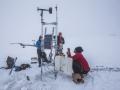
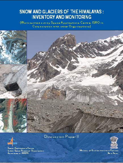 The study on “Snow and Glacier Studies” was taken up by the Space Applications Centre, Indian Space Research Organisation (ISRO) and executed in collaboration with fourteen research organizations and academic institutions of the country, at the behest of the Ministry of Environment and Forests.
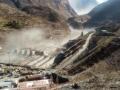
Himalayan mountains contain important natural resources of frozen fresh water in the form of snow and glaciers. These glaciers are unique as they are located in tropics, high altitude regions, predominantly valley type and many are covered with debris.
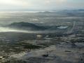
The great northern plains of India sustain on the perennial melt of snow and glaciers meeting the water requirements of agriculture, industries, domestic sector even in the months of summer when large tracts of the country go dry. Therefore, it is important to monitor and assess the state of snow and glaciers and to know the sustainability of glaciers in view of changing global scenarios of climate and water security of the nation. Any information pertaining to Himalayan glaciers is normally difficult to be obtained by conventional means due to its harsh weather and rugged terrains.
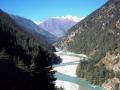
Himalaya is one of the youngest mountain systems on Earth, and has a direct influence on the climate, hydrology and environment of the Indian subcontinent. It is the abode of one of the world’s largest and mostly inaccessible area of glaciers outside the polar region and provides glacier-stored water to the major Indian river basins. Many of the Himalayan rivers are fed by snow and ice melt run-off from snow fields and glaciers.
Guest Post by Shashank Srinivasan
High altitude wetlands in the Indian Himalayas are crucial to the water security of downstream communities. They buffer the flow of glacial meltwater to sustain river flow in the dry season, ensuring that human settlements have access to water when they need it most.
High altitude wetlands are also reservoirs of biodiversity and contribute local livelihood opportunities. Identifying these wetlands and demarcating areas for their protection is thus crucial to any wetland management plan.
In this poster, a method of using topographic data obtained by remote sensing techniques, to identify the catchment areas of these wetlands has been described.
The author suggests that the protection of these catchment areas will ensure the survival of these wetlands, as well as of the communities that depend on them.
 This report by ICIMOD contains an assessment of the threat facing the Hindu Kush-Himalayan region from the recent (post-1950s) and rapid formation of meltwater lakes on the surface or at the end of a large number of the region’s glaciers owing to current climate warming. Individual case studies of the catastrophic outburst (glacial lake outburst floods or GLOFs) from such glacial lakes are introduced.
A peer paper in Science Magazine focuses on the core of a riverine system, the upstream basin, and its impact on the entire river basin.
The report presents an inventory of water bodies in the State of Jammu & Kashmir in the Western Himalayan region prepared using satellite data of IRS-1A (standard FCC, scale 1:250000) for 1988/ 99 and digital data of IRS-1C for 1998. Also, presented is a database developed with the help of Survey of India (SoI) topographic maps, which includes name and type of the water body, nearest place, district, river basin, geographical coordinates and elevation.
The report presents the status of the sediment studies carried out in the lower as well as higher altitude region of the Garhwal Himalayas. The processes associated with sediment production in the mountainous region have been described with an emphasis on the glaciarized region. Suspended sediment concentration and load observed in the Dokraini glacier melt stream near its snout has been computed.
The study attempts to develop a relationship between glacier melt runoff and meteorological parameters for the Dokriani glacier in Garhwal Himalayas. The discharge auto-correlation, correlation between discharge & temperature and between discharge & rainfall has been computed for each month of the summer season and for the melt season as a whole for different years.