Finding Groundwater

Term Path Alias

/topics/finding-groundwater

Featured Articles
December 4, 2019 The 2015­-2018 drought, the longest, but less severe of droughts experienced by India raises alarm on the negative effects of future droughts on water security in the country.
India will see more droughts in the future. (Image Source: Wikimedia Commons)
October 25, 2019 Groundwater use has doubled in Pune. Comprehensive mapping of groundwater resources and better management and governance is the need of the hour.
Groundwater, an exploited resource (Image Source: India Water Portal)
October 1, 2019 Deconstructing the traditional narrow engineering based policy discourses around floods and droughts and connecting them to social and cultural realities is the need of the hour in India.
Water talk Series at Mumbai (Image Source:Tata Insitute of Social Sciences)
September 30, 2019 The recently concluded 4 day conference in Bangalore looked at the current state of global water resource challenges & future pathways to achieve the SDGs, while ensuring equity in access to all.
Charles Vorosmarty, Chair, COMPASS Initiative, Water Future at the opening plenary on advanced water system assessments to address water security challenges of the 21st century.
September 28, 2019 Groundwater, drawn at rapid rates from peri-urban areas of Hyderabad is now turning into a commodity, controlled and distributed by a few, to meet the needs of the urban elite.
Groundwater in Hyderabad, in peril (Image Source: India Water Portal)
September 25, 2019 Making false doomsday claims of a water crisis could support problematic mega solutions, which could lead to more problems.
India's demand for water will exceed supply by a factor of two by 2030, as per a NITI Aayog report (Image: Vinoth Chandar, Flickr Commons (CC BY 2.0))
Groundwater prospects analysis through hydrogeophysical parameters and hydrogeomorphic zonation - a case study in parts of Kewta watershed - upper Barakar basin - Bihar
The study integrates hydrogeomorphic and hydrogeophysical approach for groundwater exploration for Kewta watershed, upper Barakar basin, Bihar Posted on 19 May, 2009 01:43 PM

 In this paper from the GIS Development site present study, hydrogeomorphic zonation has been carried out through remote sensing technique.

Hydrogeomorphological mapping of Panchkula district in northern Haryana- a study in GIS development
The study attempts to delineate groundwater potential zones in Panchkula district, Haryana, using satellite imageries and remote sensing Posted on 19 May, 2009 12:11 PM

This study from the GIS Development site is an attempt to use remote sensing techniques to prepare hydrogeomorphological maps of the Panchkula district in the northernmost part of Haryana to delineate the

An integrated approach of remote sensing, geophysics and GIS to evaluation of groundwater potentiality of Ojhala subwatershed, Mirzapur district, U.P.
The study shows that integrated remote sensing and GIS has proved to be an efficient tool in groundwater studies and can give more realistic picture of groundwater potentiality of an area Posted on 19 May, 2009 11:51 AM

This paper uses an integrated approach of Remote Sensing, Geophysics and GIS to evaluate groundwater potentiality of Ojhala subwatershed in Mirzapur district of Uttar Pradesh.

Groundwater potential modelling in Chandraprabha subwatershed, Uttar Pradesh- a case study in GIS development
The study aims to find suitable sites for groundwater exploration in Chandraprabha subwatershed in Uttar Pradesh using remote sensing, geoelectrical and GIS approach Posted on 19 May, 2009 11:36 AM

This study on the GIS Development site attempts to select suitable locations for groundwater exploration in hard rock areas using an integrated approach of remote sensing, geoelect

Case study of Pondhe watershed area in Maharashtra based on rapid hydrogeological mapping by advanced center for water resources development and management (ACWADAM)
Demand’ management of water resources in a region often holds the key to a complete and sustainable water resources management strategy Posted on 15 May, 2009 11:13 AM

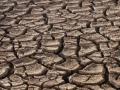
This document deals with a study by ACWADAM of Pondhe watershed area in Maharashtra based on rapid hydrogeological mapping through field studies. Large areas of India are covered by what are called “hard rocks” that are mostly of igneous and metamorphic origin. Many arid and semi-arid regions of India obtain water supplies from groundwater stored in these rocks.

The living wisdom: using local well driller knowledge to construct digital groundwater data bases
The study analyses knowledge of well drillers about groundwater aquifers and verify it with scientific data Posted on 14 May, 2009 12:39 PM

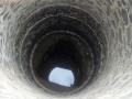
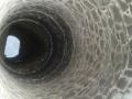
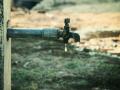
In the absence of groundwater instrumentation networks in India, the knowledge of local well drillers about the location, quality, etc of groundwater aquifers is invaluable. 

Read more

×