Term Path Alias
/topics/ecology-and-environment
/topics/ecology-and-environment

This presentation by ACWADAM on aquifers states that a systematic approach to groundwater studies is required to understand how water exists in each type of rock or sediment for which hydrogeological mapping of aquifers becomes significant in every watershed programme. The necessity of studying the scientific aspects of groundwater such as its properties and distribution below the earth’s surface is highlighted.
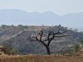
This presentation by ACWADAM deals with the Himalayan mountain system, the planet's highest, and home to the world's highest peaks. It specifically deals with the various divisions, the kind of structures present and the presence of groundwater in the massive mountain system.
The presentation deals with weathering, erosion and deposition of rocks -
This presentation by ACWADAM deals with hydrogeology and sanitation guidelines. Safe water supply and sanitation choices are an important public health measure and source quality improvement is critical to this. The impact of different aspects of water and sanitation appears to be largely dependent on the conditions within a particular community and existing access to other components of water and sanitation.
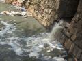
This presentation by ACWADAM deals with the structure of the sub-surface. The lithology and structure of rocks together define the geometric framework for the movement of groundwater. To some extent, these factors also govern the movement of surface water too. In other words, the physical environment of rocks and rock material hosts water, and hence, controls its accumulation and flow in the watershed.
This presentation by ACWADAM deals with the importance of groundwater. It is well-known fact that groundwater forms a very crucial source of water supply in the national scenario on water resources today. And yet, it continues to remain a resource that is both abused and misused. Often, watershed projects suffer from insufficient inputs, especially hydrogeological to address the problem(s) of groundwater within the watersheds.
The Eleventh Plan (2007-08 to 2011-12) sought to build on the gains achieved in the Tenth Plan and shift the economy to a path of faster and more inclusive growth. The Mid Term Appraisal (MTA) report for the Eleventh Five Year Plan 2007-2012 by the Planning Commission reviews the experience in the first three years of the Plan and seeks to identify areas where corrective steps may be needed.
The Eleventh Plan (2007-08 to 2011-12) sought to build on the gains achieved in the Tenth Plan and shift the economy to a path of faster and more inclusive growth. The Mid Term Appraisal (MTA) report for the Eleventh Five Year Plan 2007-2012 by the Planning Commission reviews the experience in the first three years of the Plan and seeks to identify areas where corrective steps may be needed.
This presentation by ACWADAM deals with integrated data management using Geographic Information Systems. A Geographic Information System (GIS) integrates hardware, software, and data for capturing, managing, analyzing, and displaying all forms of geographically referenced information.
 This presentation by ACWADAM deals with the subject of groundwater balance. It begins by describing the skeleton for the water balance equation viz., ground surface, soil, aquifer and bed rock. It describes the processes subsequent to rainfall such as interception, initial detention, depression storage, infiltration, runoff, streamflow, soil moisture retention and recharge.
The watershed water balance equation is explained in terms of input (rainfall and water transfers) and output (runoff, evapotranspiration and infiltration). It notes that the input to a generalized water balance is rainfall whereas the input to a groundwater balance is infiltration. The difference between infiltration & recharge, natural & artificial recharge and interflow & discharge are explained thereafter. The water balance for an aquifer may vary, depending upon the nature of groundwater system –