Droughts and Floods

Term Path Alias

/topics/droughts-and-floods
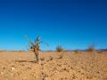
Featured Articles
May 18, 2024 A case study of women-led climate resilient farming by Swayam Shikshan Prayog
Building the resilience of women farmers (Image: ICRISAT, Flcikr Commons)
April 25, 2024 Understanding the impact of heat on our world
Rising temperatures, rising risks (Image: Kim Kestler, publicdomainpictures.net)
March 30, 2024 A recent study finds that climate change induced extreme weather events such as droughts can increase the vulnerability of women to Intimate Partner Violence (IPV).
Droughts affect women the most (Image Source: Gaurav Bhosale via Wikimedia Commons)
January 22, 2024 This study finds that baseflows have a stronger triggering effect on river floods in Peninsular India as compared to rainfall and soil moisture.
River floods and groundwater, the connection. Image for representation purposes only. (Image Source: India Water Portal)
July 14, 2023 These states are at the forefront of flood early warning systems
Previously drought-prone areas are now facing floods (Image: Needpix)
July 7, 2023 WOTR study throws important new findings
The study by WOTR and Wageningen University researchers emphasizes the need to prioritize adaptive capacities alongside agricultural productivity (Image: WallpaperFlare)
India's experience with drought management: Changed perspectives and challenges
Drought is a natural disaster. Nearly 200 million ha land in India in 135 districts of 13 states are severely affected by drought four times in every 10 years. Posted on 29 Aug, 2009 02:43 PM

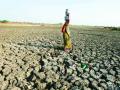
This document describes the drought situation in India over the years, the earlier perspective at drought management and the gradual change in perspective at managing droughts that evolved over the years.

Reference: Impact of climate change on major river basins in India
A short compilation of further reading and references on the impact of climate change on major river basins in India Posted on 28 Aug, 2009 03:45 PM

Climate and water resources of India, R. Ramesh* and M. G. Yadava; Current Science, VOL. 89, NO. 5, 10 SEPTEMBER 2005 - http://www.ias.ac.in/currsci/sep102005/818.pdf

Effect of climate change on river Kosi and its basin
Considering the vulnerability of the Kosi's basin, the melting glaciers will acerbate the problem a hundredfold. The melting glaciers will release much more water than normal in a short time thus creating a flood situation. Posted on 28 Aug, 2009 02:46 PM

Kosi is one of Ganga's largest tributaries and in turn is fed by 7 tributaries - Sun Koshi, Dudh Koshi, Indravati, Tama Kosi, Likhu, Arun, and Tamar. These tributaries encircle Mt Everest from all sides and are fed by world's highest glaciers. The river drains a total area of 69,300 sqkm upto its confluence with Ganga. The river basin stretches 54,000 sq.kms.

Effect of climate change on the Ganga-Brahmaputra delta regions
The Ganga-Brahmaputra-Meghana delta belt comprises of 105,000 sq. kms of which 2/3rds is in Bangladesh. The Ganga-Brahmaputra-Meghana system has the largest catchment area of 1,100,000 km². The delta region is particularly vulnerable to seasonal floods, heavy run-offs from melting snows, and tropical cyclones in the Bay of Bengal. Inspite of this, it is one of the most thickly populated regions on Earth. Posted on 28 Aug, 2009 02:28 PM

The delta belt is home to approximately 125-140 million people. And over 300 million people are supported by the delta. The density of population in the Delta region is 200 people / sq.km. making it one of the densest regions in the world.

The delta region is a high-rainfall region and receives 60-80 inches of rainfall every year.

Migration and displacement due to sea-level rise: Mega-cities like Mumbai, Kolkata and Chennai could be hit hard
A one-meter sea level rise will inundate 6000 square kilometers in India, of which Mumbai, Kolkata and Chennai will be the major cities being affected. This would mean losses of billions of dollars in infrastructural, social, physical assets and capital. Posted on 26 Aug, 2009 05:34 PM

125 million people are likely to migrate in the coming century of which 75 million will be from Bangladesh. The people from Bangladesh will most likely migrate to India in addition to our own 50 to 60 million people who will be displaced due to sea-level rise, shrinking water sources due to CC in the densely populated coastal regions of India.

References of the impact of climate change on river deltas and other coastal areas
A short compilation of articles and reports on the impact of climate change on river deltas and other coastal areas Posted on 26 Aug, 2009 04:48 PM

Mumbai Marooned: An Enquiry into Mumbai Floods 2005 - Final Report ,
By Conservation Action Trust - Click here

Enquiry-mumbai-floods-2005-final-report

Glacier lake outburst floods: Wrecking havoc to life and property in the Himalayan region
A glacier lake outburst flood (GLOF) is caused when the glacial lakes burst their banks and cause widespread floods. In the past two decades there have been a number of glacier lake outburst floods. The increase in the melting of glaciers have led to this phenomenon. Posted on 26 Aug, 2009 03:47 PM

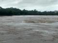
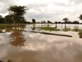
These floods cause havoc with human life, flora and fauna of the area and the infrastructure in the region.

The Dig Tosho Glacier lake outburst in August 1985, destroyed the nearly completed Namche hydropower plant and all the rails, roads, and other infrastructure in its course.

How climate change has affected Ladakh: The region has seen unusual floods in July 2005 and August 2006
Ladakh is known as the cold-desert and has severe conditions and is barren and arid. The region has seen unusual floods in July 2005 and August 2006. Posted on 26 Aug, 2009 03:36 PM

It is in Jammu Kashmir and is bordered by the Himalayas and the Karakoram mountain chains. Ladakh and its water sources are almost entirely dependent on the glaciers and snow-melts and changes in water systems can be directly attributed to changes in the glaciers and thus climate change.

Impact of climate change on the Himalayan glaciers
40% reduction has occurred in the Himalayan glaciers in the last 40 years. 67% of the glaciers have retreated in the last decade. Gangotri is retreating at the rate of 28 m per year. Global warming and its consequent melting of glaciers would result in floods, fast and furious run-offs, erosion of the topsoil and sedimentation of the rivers. This could also lead to changes in the course of the rivers in the region. Posted on 26 Aug, 2009 03:30 PM

The Himalayas' permanent ice cover is around 97,000 sq.km. with 12,930 sq.km. volume of ice and snow: 10-20 % are covered by glaciers and 30-40% are seasonal snowfalls. The Himalayan streams and rivers are fed by the melting of snow and ice of approximately 500 sq.km / year.

Impact of climate change on water resources
Sea-level rise and coastal delta flooding will result in large-scale migration, affecting traditional fishing communities, agriculture, tourism as well as industries and urban agglomerations along the coast. The stress on water resources will impact agriculture, especially rain-fed agriculture; as well as health; changing temperatures and moisture levels will affect insects and plants; and also our forests and pasture lands. Livelihoods will be at stake for the millions.
Can we do something about these impacts? Is something already happening? Yes, on both counts.
Posted on 26 Aug, 2009 02:30 PM

India has contributed immensely to the body of scientific research and analysis that underpins the understanding of the global impacts of climate change. There is, to a slightly lesser degree, an understanding of specific regional impacts. More needs to be done here, especially understinding micro-level impacts.

×