/sub-categories/photos-illustrations-and-other-images
Photos, Illustrations and other Images
People’s Science Institute Calendar 2010- Pictures of the Gori Ganga
Posted on 29 Dec, 2009 12:30 PMGuest Post by: Ravi Chopra (People’s Science Institute)
I have before me PSI’s new calendar for 2010. Even at the risk of sounding immodest, I think it is stunning. I thought that our 2009 calendar on river Ganga could not be topped. But I think that aesthetically this one is better! A pdf version is attached.
I would like to urge you to order your copies before they are sold out. The pricing structure is
In India (includingpostage) | Abroad (including postage) |
| 1 to 49 calendars @ 150 each | 1 to 9 @ US $ 15 each |
| 50 to 99 calendars @ 125 each | 10 to 49 @ US $ 12 each |
| 100 or more calendars @ 100 each | 50 or more @ US $ 10 each |
The 2010 calendar features Gori Ganga, one of Uttarakhand’s remote and pristine rivers. The photographs capture the sun-bathed beauty of the lower valley, the wilderness of the upper catchment and the quietude that comes with the remoteness. Our dynamic photographers, Devraj Agrawal and Salil Das trekked on foot and pony for four days from Munsiyari to Milam glacier, the source of the river, to bring you some rare and breath-taking photos.
Photo essay on water loss due to leaks in Mulbagal, Karnataka
Posted on 25 Oct, 2009 07:58 PMAs I had been waking up to the leaky tap in my new house for quite some time; I thought it would be interesting to look at the different ways water gets wasted. In this post I attempt to do a photo blog from my past photo collections on this subject from different parts of the country.
Tamil Nadu agriculture department - Policy note 2009- 2010
Posted on 02 Sep, 2009 12:07 PMThis policy note 2009-2010 includes the following chapters:
Pictures from the Bagmati embankment breach in Bihar in 2009
Posted on 03 Aug, 2009 10:10 AMThe google map at this URL shows Runi Sayedpur and Sitamarhi, along national highway 77: http://tinyurl.com/lxwfmj
Cyclone Aila 2009
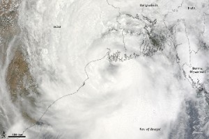
Posted on 01 Jun, 2009 11:27 AMTropical Storm Aila struck southern Bangladesh and eastern India on May 27, 2009. The New York Times reported that floods and mudslides killed at least 191 people and left hundreds of thousands more homeless. As of May 27, the death toll was expected to rise. Images from The Nasa Earth Observatory.
The Moderate Resolution Imaging Spectroradiometer (MODIS) on NASA's Terra satellite captured this true-color image of Aila on May 25, 2009, the same day that the storm temporarily strengthened to a Category 1 cyclone. Aila almost completely fills this scene, stretching from the Bay of Bengal deep into India, Bangladesh, and Burma (Myanmar). On May 25, Aila's wind speeds ranged from 74 kilometers per hour (46 miles per hour or 40 knots) to 120 kilometers per hour (75 miles per hour or 65 knots). More information and detailed images can be accessed here:Cyclone Aila
NASA Earth Observatory: Cyclone Bijli
Posted on 07 May, 2009 12:03 PMImage & Content Courtesy: NASA Earth Observatory
 A ragged-looking Tropical Storm Bijli draped the east coast of India in this image from the Moderate Resolution Imaging Spectroradiometer (MODIS) on NASA's Terra satellite on April 16, 2009. Bijli became a tropical storm in the northwest Bay of Bengal on April 15, and initially headed north, toward the west coast of India. By April 16, it had begun a northeastward turn, however, and the storm was being projected to make landfall in eastern Bangladesh on April 17, according to Unisys. Access higher resolution image here:Cyclone Bijli
Northern Antarctica's Wilkins ice bridge collapse - Images
Posted on 14 Apr, 2009 04:10 AMA narrow ice bridge connecting Charcot Island and Latady Island ”the last remnant of the northern part of Antarctica's Wilkins Ice Shelf broke apart in early April 2009. These photo-like images, from the Moderate Resolution Imaging Spectroradiometer (MODIS), show the break-up of the ice bridge.


