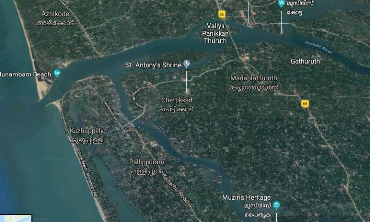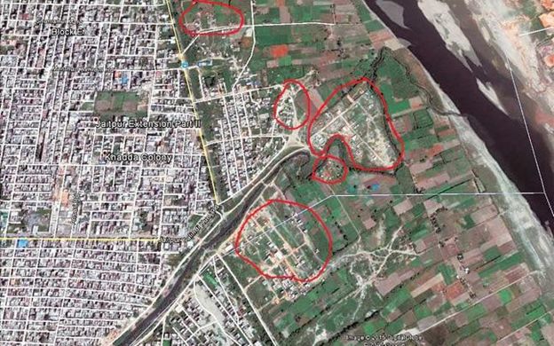
The Kerala flood of 2018 was 30 percent less intense than that of 1924 deluge, the biggest in Kerala’s history. Yet it caused a huge loss of lives, property and infrastructure. Swollen rivers ruptured their banks and floodwaters gushed through houses built on the floodplains. One reason for the unprecedented flood of such magnitude is unplanned construction and encroachment on riverbeds that have reduced the capacity of rivers to carry flood waters.
The lack of regulation and enforcement of land use in the floodplains added to the severity of the damage. “Yet the recent report by the Central Water Commission on Kerala floods does not say a word about rampant riverbed and floodplain encroachments,” says Himanshu Thakkar, coordinator of South Asia Network on Dams River and People (SANDRP), New Delhi.
Basing his argument on an analysis of the Central Water Commission data, Rahul Banerjee, an Indore-based social activist and development researcher, says, “It confirms my hypothesis that much greater damage has been done by deforestation and quarrying in the Western Ghats and construction on the floodplains of the rivers and in paddy fields and wetlands than by the mismanagement of dams. Given that the dams in Kerala are in the upper reaches of the basin, their capacity for flood control is limited. Going forward, increasing artificial recharge through soil and water conservation works and afforestation in the hilly catchment areas and the freeing up of the river channels and floodplains should be the strategy (to avoid floods).”
Preservation of floodplains is crucial for protection from floods
What is a floodplain? Floodplain is a flat area along the river which normally overflows seasonally. Floodplains can be small, large, and at times huge. They often create good agricultural land as they get sediment carrying floodwaters that enrich the soil. In fact, floodplains are lands built up from soil left by floods.
Floodplains provide the space for rivers to spread their waters. When this space is missing due to encroachments, the river surges up and creates destruction.
“The lack of protection of river floodplains from damaging impacts like encroachment and diversion for ‘developmental projects’ is a tragedy that affects both the river as well as those who encroach it adversely. The river suffers as it is unable to occupy and transport flood waters downstream during high rainfall events (monsoon in particular). It is unable to recharge aquifers, wet the lands along its banks or provide life-sustaining conditions to plant and animal habitats along the river margins and banks. It cannot also cut and deposit soil on its banks in a natural fashion or maintain its oxbow and floodplain wetlands,” says Manoj Misra, forestry and river expert and head of Yamuna Jiye Abhiyaan.
Damage to floodplains harms the riverine ecosystem, lessens groundwater recharge capacity and poses threats of flash floods. “People too suffer an immense loss of life and property, including loss of public infrastructure like bridges, roads, schools etc., during high floods,” says Misra.
Lack of floodplain regulation in India
“It is indeed a shame that despite a series of disastrous floods in recent times such as in Mumbai (2005), Kedarnath (2013), Srinagar (2014), Chennai (2015) and Kerala (2018) resulting from human occupation of river floodplains, the nation is still without a legally mandated prohibition on such ingress into and violation of river's integrity,” says Misra.
The Kerala floods are a tragic reminder of the cost that the nation is paying for its inability to enact a river regulation zone (RRZ).
“Since the constitution lists 'land' as a state preserve and states see river floodplains as "developable lands", states are reluctant to admit the overriding need for its legal protection against occupation and conversion. Also, once a disastrous event has diminished in the public memory, the Ministry of Environment, Forests and Climate Change (MOEFCC) also forgets its obligation towards protecting nation's natural resources (including rivers) and the relevant file goes back to a state of hibernation,” says Misra.
Why is a policy on river regulation/ floodplain zone important?
“In India, there is a lack of a clear definition of space for the river or for the floodplain,” says Thakkar. This leaves a lot of ambiguity. In urban India in particular, the floodplains have been encroached due to rapid urbanisation.
Since 1975, when the union water resources ministry had circulated a model Bill on the subject to the states, there have been talks of regulating construction activities on floodplains, yet it is far from a “no-go” zone. The model Bill was ignored by states. States also ignored all talks of demarcating floodplains or the area adjacent to a river which stretches from the banks of its channel to the base of the enclosing valley walls which experiences flooding during periods of high discharge.
Cities get ravaged by floods or face drainage congestion time and again, yet the MoEFCC has failed to implement the RRZ policy draft (2002) authored by civil society representatives headed by Prof. Brij Gopal, a leading river ecologist. This policy draft looks at dividing the area of the river floodplain into zones, the one closest to the river channel to be called "no-development zone".
Rivers which have undamaged floodplain are considered to be in good health. The RRZ policy draft defines the area for protection from further encroachments as the “active flood plain”, which will be marked by the high flood line. This, in entrenched stretches shall be the available space in the valley. In embanked stretches, this would be the area between two embankments or roads along a river acting as an embankment. In other stretches of the river, the active flood plain shall be the 100-year flood line, the land which gets flooded during a 100-year storm. The idea is to establish a no-development zone not less (in area) than the active floodplain, the draft states.
The draft remained a work in progress even though Prof. Brij Gopal had looked at the option of defining the high flood levels at shorter return periods of once in 50 years, to make the notification implementable.
“The closest that we came to a notification was in 2016 when the MoEFCC draft RRZ was circulated for comments to the states and Prakash Javadekar, the then minister of MoEFCC committed in response to a specific query on the floor of the house in Parliament that such a regulation was in the offing. Nothing has materialised till date though,” says Misra.
The MoEFCC continues to sit over the RRZ policy as it is worried that water as well as land along the riverbank are a state subject. Existing constructions on riverbanks may get destabilised should there be a regulation. Thakkar finds the “lack of sincerity of the central and state governments and their agencies, the judiciary, the media and the larger civil society on the issue of protecting floodplains disturbing.”

He says that the Centre’s stand on floodplain violations is evident in the case of Delhi, where even central government controlled bodies like MoEFCC and Delhi Development Authority have taken stands that are clearly permissive and encouraging rather than being restrictive, regulatory or protective of the river or its floodplains. “The value of the land and the lack of value for rivers is the major force working against river zone and floodplain protection. Even the Ministry of Water Resources is least sincere about this,” he adds.
The MoEFCC formed committees and quite a few states, including Tamil Nadu, Himachal Pradesh, Rajasthan, Andhra Pradesh and Karnataka, took part in consultations. Manoj Misra was a part of a committee on RRZ. “Nothing actually came of the MOEFCC committee on RRZ that I was a member of as with the change of guard at the ministry, officials lost their sense of urgency and interest in the matter,” says Misra.
The National Disaster Management Authority’s (NDMA) guideline on ‘management of floods’ has a section on enforcement and regulation related to floodplain zoning. But it is just a guideline and has not been enforced. The NDMA guideline admits that “zoning cannot remedy existing situations, although, it will definitely help in minimising flood damage in new developments.” The NDMA’s guidelines are a good start and provide for categorisation and prioritisation of structures in floodplains zoning.
What is the way forward?
The situation may change as the Centre is now considering a new Bill on creating floodplain zones that could alter the way we contend with annual floods. The Bill is expected to talk about flood zoning authorities, surveys and delineation of floodplain area, notification of limits of floodplains, prohibition or restriction of the use of the floodplains, compensation and power to remove obstructions. Lack of surveillance by authorities and even connivance with the construction lobby are common. Not just regulation, enforcement is very important, too which needs to be encouraged through incentives.
/articles/why-floodplains-need-be-protected