North Bihar has a long history of flooding.Through a series of posts here, we will attempt to explain the background of flooding in Bihar and what are the root causes.
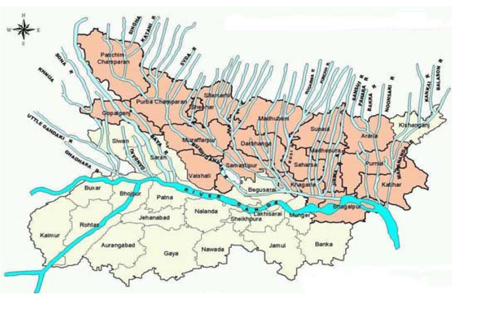
 For those not familiar with the area the map above gives a startling glimpse into how strongly Ganga tributaries are interwoven into the fabric of the land of North Bihar. North Bihar is the portion of Bihar above the Ganga.
In the above map, the Ganga is the thick blue line roughly through the middle of the state. North Bihar is a playfield of eight major rivers – Ghaghra, Gandak, Burhi Gandak, Bagmati, Kamala, Bhutahi Balan, Kosi and Mahananda. All these rivers end up in Ganga. It is estimated that 16.5 per cent of the total flood affected area of the country is located in Bihar while 22.1 per cent of the flood affected population in India lives in the alluvial plains of the state.
According to the 2001 census, Bihar has a total population of 82.88 million which is 8.06 percent of the population of the country. The population density is very high, 880 per square kilometer on average, against the country average of 324. Floods in North Bihar are a recurring disaster which on an annual basis destroys thousands of human lives apart from livestock and assets worth millions. Map and text courtesy of Megh Pyne Abhiyan
What are embankments ?
On the 18th of August 2008, the eastern embankment of Kosi near Kusaha in Nepal’s Sunsari district breached and this was the cause of the flooding. So what are embankments ?
An embankment is an earthen wall built alongside a river. The purpose is to prevent river water spilling into the countryside and thereby reducing its impact on human, livestock and agriculture. So its major purpose is flood control.
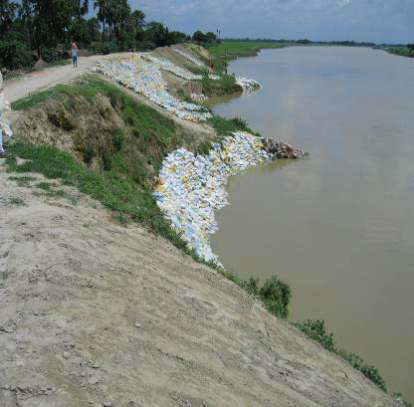
Some pictures of embankments:

(Above) An embankment in Bihar - Image Courtesy: Megh Pyne Abhiyan
But there are several consequences of embankments: They prevent the entry of floodwater from the countryside into the river. This leads to a major problem of waterlogging as the natural function of the river of draining out stormwater is obstructed. The situation is aggravated by seepage of river water out from beneath the embankment. Embankment breaches: Badly constructed/maintained embankments will breach when the pressure of flowing water is too high. When it does so, the flood water enters the surrounding countryside with huge intensity and causes severe flooding. This has been an annual phenomenon in Bihar with different embankments breaching at various points every year and causing huge loss of life, livelihood and suffering. In 1952 Bihar state had 160 kilometers of embankments, in 2002 the embankment length is 3430 km, showing the extent of work that has gone into building (and repairing) embankments.

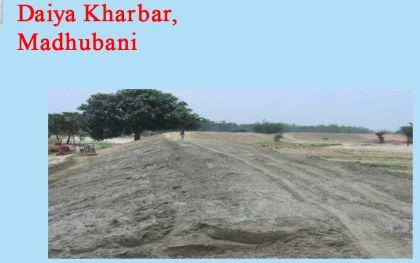
This embankment in N. Bihar had breached in a previous year
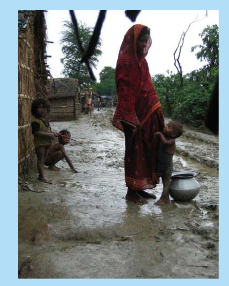
A disturbing feature of the flooding in Bihar is that when people are affected by the breach of an embankment they cannot stay in their houses any more so they often end up living for long periods of time in makeshift dwellings on the embankment itself. Its a miserable existence.

(Above) File photo of people living on an embankment in Bihar, during a flood in previous years. Photo Courtesy: Megh Pyne Abhiyan
The breach of the embankment this year had completely unexpected consequences, different from past years. Instead of localized flooding, the breach kept widening and the river started flowing out of the breach and taking an entirely different course to meet with the Ganga. It was following a previous course that it had followed a 100 years ago.
/articles/understanding-floods-north-bihar-background-and-causes