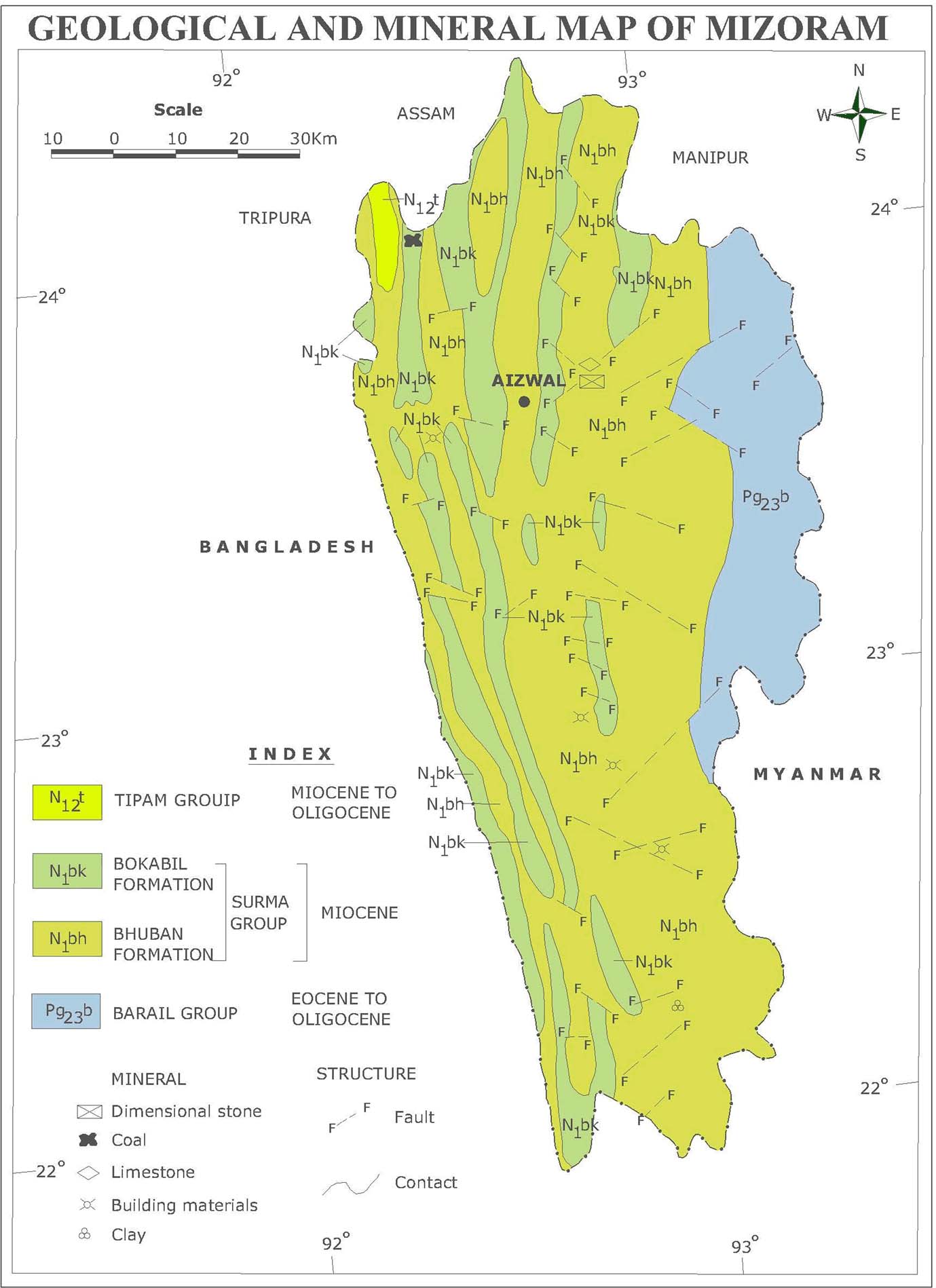
The Geological Survey of India (GSI) has been preparing state geology and mineral maps as a part of its Miscellaneous Publications series from time to time. During the span of three and a half decades since the first edition was published, enormous knowledge has been added in the sphere of geology of the areas necessitating revisions. The entire modified and updated series published at various points of time is available here.
Though this series essentially deals with geology, geomorphology and mineralogy, GSI has generated huge baseline data on geo-hydrology as well. It has been involved in characterisation of water bodies in different physical environments incorporating geological, geomorphological and hydrological criteria.

Mizoram - State geology and mineral map: Geological Survey of India
GSI has delineated favourable groundwater recharge zones and potential groundwater resources (palaeochannels) and has undertaken morphometric analysis of drainage network in the upper and middle catchment areas of river basins as part of watershed management studies. The evaluation of water resources and proper utilization of surface run off towards mitigation of the drought hazard has also been done by GSI.
The maps are also accompanied by reports for the states of Tamil Nadu, Assam, Arunachal Pradesh, Karnataka, Kerala and a report for the four north eastern states of Manipur, Nagaland, Mizoram and Tripura. Divided into five sections the reports provide a comprehensive overview of geology and minerology of the states.
Beginning with a general description of the area, the major hydrologic features, such as climate (precipitation, temperature, radiation, etc.), streamflow, groundwater, soil, physiography etc., are discussed. A detailed treatment of the geology and stratigraphy is provided. The report also briefly covers a brief account of ground water surveys.
The detailed hydrogeological studies conducted are discussed to field establish the feasibility of controlling the artesian aquifer for safe and economic mining of certain minerals. Some of the reports also provide an account based on systematic geohydrological studies taken up in all districts and a permanent network of observation wells installed for collection of data on seasonal water level fluctuations.
This is followed by a discussion on structure and tectonics and an account of the various minerals. The reports and maps should be useful to natural resource management professionals, particularly graduate students, researchers, teachers, planners and policy makers.
Download the state geology and mineral maps and reports from the Miscellaneous Publication series below -
/articles/state-geology-and-mineral-maps-geological-survey-india-miscellaneous-publication-series