Watersheds are natural hydrological entities that cover a specific aerial expanse of land surface from which the rainfall runoff flows to a defined drain, channel, stream or river at any particular point. The terms region, basin, catchment, watershed etc are widely used to denote hydrological units.
Size of a watershed is governed by the size of the stream occupied by it. Size of the watershed is of practical importance in development programmes. For example, size of irrigation cum hydel projects have a watershed size of several thousands of square kilometers but for a farm pond, the size may be few hectares only.
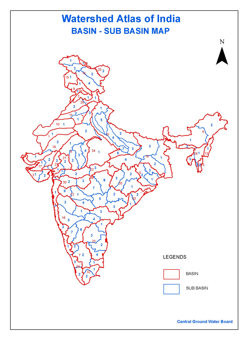
This map gives a high-level picture of the main river basins of the country, and a river-basin wise breakdown of the sub-basins/watersheds.
Here's the link to the basin-wise watershed atlas of India - CGWB
/articles/river-basin-and-sub-basin-map-india-central-ground-water-board