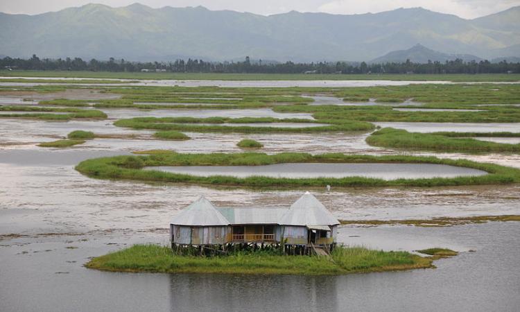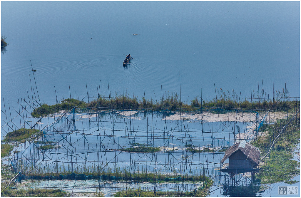
Loktak, the largest freshwater lake in North East India is also known as the ‘floating lake’ for the numerous phumdis or masses of vegetation it supports. The phumdis float around on the lake’s surface due to decay from the bottom. Some are so large that the indigenous fishing folk Meiteis have constructed makeshift floating huts locally known as phumsangs on them.
Owing to its rich biodiversity, the 287 square kilometre lake in the Indo-Burma biodiversity region had been recognised as a wetland of international importance in 1990 under the Ramsar Convention. Back in 2011, the Loktak Development Authority had burnt down more than 200 phumsangs and evicted the occupants, citing the Manipur Loktak Lake (Protection) Act, 2006. The Act prohibits dwellings on the phumdis and the dwellers were termed occupiers. This caused tremendous hardship to the Meiteis, who to this day are resisting eviction from phumdis in a bid to uphold their age-old way of living and fishing.
Around 12 towns and 52 settlements with over 9% of the total population of Manipur as per Census 2011, are located in and around Loktak. All these people, directly or indirectly, in one way or another, depend on the lake for their livelihoods.
The lake is divided into three zones: the northern zone, central zone and southern zone. The central zone is the main open water area and does not have too many floating islands. The Keibul Lamjao National Park (KLNP) covering an area of 40?square kilometres located in the southern zone is the world’s only floating National Park. It is the last natural habitat of the highly endangered Manipur brow antlered deer (Rucervus eldii eldii), locally known as Sangai.

Change in land-use profile around Loktak
A paper published in the Egyptian Journal of Remote Sensing and Space Science tries to assess the changes in land use patterns in and around Loktak lake over the last 38?years. It does so by analyzing digital change using multi-temporal satellite data followed by remote sensing techniques to assess the land cover changes.
The land use of the lake was classified into five types - open water area, agricultural area, phumdis with thick vegetation (tall dense plant area), phumdis with thin vegetation (short plant area) and settlement. These five land use types were delineated using image interpretation techniques in ERDAS 11 and ArcGIS 10 software. The change in land use class was obtained from Landsat TM and IRS LISS III images in 1977 and 2015 respectively.
|
Land Use Classes |
1977 |
2015 |
Change (1977 to 2015) |
|||
|
km2 |
% |
km2 |
% |
km2 |
% |
|
|
Open water bodies |
74.76 |
30.30 |
101.65 |
41.20 |
?26.89 |
?10.94 |
|
Agricultural area |
10.33 |
4.18 |
35.66 |
14.45 |
?25.33 |
?10.27 |
|
Phumdis with thick vegetation |
24.23 |
9.82 |
15.64 |
6.33 |
8.59 |
3.49 |
|
Phumdis with thin vegetation |
132.24 |
53.59 |
82.86 |
33.58 |
49.38 |
20.01 |
|
Settlement |
5.16 |
2.09 |
10.91 |
4.42 |
?5.75 |
?2.33 |
|
Total |
246.72 |
100 |
246.72 |
100 |
0.00 |
0.00 |
Table: Change in Land Use/Land Cover categories during 1977–2015
The findings indicates overall increase in open water bodies, agricultural area and settlement by 10.94%, 10.26% and 2.23% respectively while phumdis with thick and phumdis with thin vegetation have decreased by 3.48% and 28.89%.
These changes in land use pattern have affected the fragile ecosystem of Loktak lake, and pose a serious threat to the aquatic ecosystem.
Agricultural area in the lake increased by 25.33?square kilometres due to construction of the Ithai barrage, which made Loktak a reservoir for a hydroelectric project. This led to the inundation of low lying areas and destroyed agricultural fields. Settlement inside the lake also increased by 5.75?square kilometres as lack of employment opportunities led locals to take up agricultural and aquaculture activities in the lake. Local people were thus engaging in agriculture in the phumdis.
The lake’s open water area also increased by 26.89?square kilometres in 2015 because the government removed phumdis from the central zone. This area was mostly covered by phumdis after the construction of Ithai barrage and the rise in aquaculture. The phumdis used to flow out of Loktak during the rainy season naturally, but this movement was blocked after the Ithai Barrage was constructed, leading to an increase in phumdi population.
Thanga, Ithing and Karang villages located inside the lake showed substantial growth in population. Phumdis with thick (8.59?square kilometres) and phumdis with thin vegetation (49.38?square kilometres) recorded the maximum loss of areaduring the study period. This loss has been converted to agricultural area, open water bodies and human settlement. The decrease in phumdis is a major concern as Keibul Lamjao is the only floating national park in the world.
The population inside the lake including Ithing, Thanga and Thanga Karang also increased compared to 2001. According to the 2011 Census, the households inside the lake numbered 3,054 with a population of 18,007. Further, it was found that 80% of the respondent collected natural resources from the lake every day for their domestic needs.
The study found that the water quality of the lake had also deteriorated. It further identified the need for proper management and consistent monitoring of Loktak lake using spatial technology, which is cost effective and highly accurate. Proper land use planning and efficient implementation of the Manipur Loktak Lake Act 2006 is needed for sustainable management of the lake.
The paper can be viewed here
/articles/manipurs-floating-lake-risk