La Niña conditions increased atmospheric moisture and an unusual pattern in the jet stream trapped rainy weather over the country. According to the Pakistan Meteorological Department, nationwide rain totals were 70 percent above normal in July, and 102 percent above normal in August.
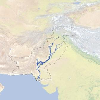
 Due to the unusual weather, flood waters over ran many parts of Pakistan. Flood waters covered at least 37,280 square kilometers (14,390 square miles) of the country at some time or another between July 28 and September 16, 2010. (Not all areas were inundated at the same time or for the whole time). This map - made from data assembled by the United Nations Operational Satellite Applications Program - shows the sum of all flooded areas in blue. The country border used in this image indicates areas administered by Pakistan.
/articles/flood-extent-pakistan-updates-nasa-earth-observatory