Rainfall and other forms of Precipitation

Term Path Alias

/topics/rainfall-and-other-forms-precipitation
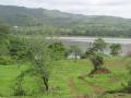
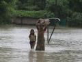
Featured Articles
May 8, 2024 What is the ecosystem based approach to water management? How can it help in solving the water woes of states in the Deccan Plateau?
An ecosystem based approach to water management (Image Source: India Water Portal)
January 25, 2024 This report by CEEW discusses the findings of a study on India’s first sub-district -level monsoon variability assessment to decode changing rainfall patterns across India during the southwest and northeast monsoon.
The moody monsoon (Image Source: Mayank Makhija via IWP Flickr photos)
August 16, 2023 India Water Portal is hosting a photo competition on World Photography Day. Hurry, send us your photos before 31st August!
May 8, 2023 Warming will not only lead to a decline, but also trigger monsoon extremes in the Indo Gangetic Plains.
A woman wades through knee-deep water with her belongings. (Picture courtesy - 101Reporters) (Source: IWP Flickr photos)
May 4, 2023 Climate change is expected to have significant impacts on the Indian monsoon
As per the India Meteorological Department (IMD), instances of heavy rainfall have increased by almost 85% in the country since 2012 (Image: Marina, 2009,Wikimedia Commons)
April 4, 2023 Forests greatly help in maintaining the water balance of nature by storing water during monsoons and making this water available during dry seasons. India urgently needs to save its forests to prevent droughts and the adverse effects of climate induced global warming.
Forests and soil moisture can act as buffers to store water during dry spells (Image Source: India Water Portal)
Map showing the site where river Bagmati breached its embankments in Sitamarhi, Bihar in 2009
Mpa showing the spot near Tajpur in Sitamarhi where the Bagmati breached its embankments Posted on 04 Aug, 2009 09:50 AM

The following map from South Asia Network on Dams Rivers & People gives a schematic sketch of the Bagmati Breach site near Tajpur in Bihar’s Sitamarhi district.   

Rapid assessment of the flood situation at Tilak Tajpur Panchayat in Sitamarhi, Bihar
The Rapid Assessment Report of Tilak Tajpur Panchayat prepared by GPSVS is attached herewith Posted on 04 Aug, 2009 09:30 AM

Queries, request for information & additional clarifications can be sought via the comments section.

Download here: Rapid assessment report - Tilak Tajpur Panchayat

Pictures from the Bagmati embankment breach in Bihar in 2009
These photos were taken by NGO Ghoghardiha Prakhand Swarajya Vikas Sangh, Madhubani Posted on 03 Aug, 2009 10:10 AM

The google map at this URL shows Runi Sayedpur and Sitamarhi, along national highway 77: http://tinyurl.com/lxwfmj

Background documents on the Bagmati embankment breach: Article and presentation
Article and presentations on the Bagmati and its embankments from the Central Water Commission and well known scholar Dinesh Kumar Mishra Posted on 03 Aug, 2009 09:46 AM

1) A presentation from the Central Water Commission of the Government of India studying the flood problem on the Bagmati and making some recommendations:

flood-management-in-bagmati-basin

Meteorological datasets: Download entire datasets for various meteorological indicators from 1901 to 2002
Resource rich app that allows you to download datasets for various meteorological indicators from 1901 to 2002 Posted on 27 Jul, 2009 10:52 AM

Meteorological data is essential for water resource planning and research. In India, this data is difficult to obtain for the average citizen. In this application, entire datasets for various meteorological indicators from 1901 to 2002, for any part of India, is made available for users, in a simple format.

Monsoon clouds at Nagercoil, Tamil Nadu (Source: Wikimedia Commons)
Rain Shocked-Climate change and the rainfall pattern
Rain Shocked: A research study by Down to Earth, on how climate change is leading to a rising trend of short but intense spells of rainfall, which is making usable water scarce in India. Posted on 11 Jun, 2009 02:40 PM

The research study was published in Down to Earth in March 2009 issue. The study describes how climate change is leading to a rising trend of short but intense spells of rainfall, which is making usable water scarce in India.

IMD Data on website: Monthly, district wise rainfall data for five years!
IMD Data on website: Monthly, district wise rainfall data for five years! Posted on 05 Jun, 2009 11:13 PM

Guest Post by: Himanshu Thakkar, SANDRP


You may recall that following an appeal by SANDRP before the Central Information Commission, CIC had in January 2009 asked India Met Dept to review their policy and put up district wise monthly rainfall data for at least five years on its website. The relevant order of CIC can be seen here: CIC to IMD Review Info Policy and relevant Press Release from SANDRP can be seen at: CIC Directs IMD to Review Information Policy Now, IMD has put up the requested data on its website, see: http://imd.gov.in/section/hydro/distrainfall/districtrain.html IMD tells us that they are still in the process of collecting, collating the data and data of more districts would be uploaded as they are ready. We have also suggested to IMD to also provide annual figures (total of the monthly data) so that people get quick picture about the same. We also notice that links for some of the districts (e.g. Nalgonda in AP) are not working. Let us know if you have other feedback. We would like to thank all those who have also submitted their comments on the India Water Portal, supporting our position, the comments were submitted to IMD and CIC.

Press Release : Water Initiatives Orissa
World Bank report confirms what WIO had said 3 years ago!! Posted on 05 Jun, 2009 12:15 AM

Guest Post by: Ranjan Panda

Sambalpur 27.5.2009

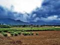
What 'Water Initiatives Orissa (WIO)' had found out three years ago have been substantiated now by a World Bank report, titled 'Climate Change Impacts in Drought and Flood Affected Areas: Case Studies in India'. The World Bank report , which took Orissa as a case study of flooding in a climate change scenarios - has referred to projections that 'temperatures, precipitation, and flooding are likely to increase, with adverse impacts on crop yields and farm incomes. Among the more substantial effects is a spatial shift in the pattern of rainfall towards the already flood-prone coastal areas'. Three years ago the WIO had found out significant increase in average annual rainfall in coastal districts like Baleswar and Puri. Now the World Bank report has projected 23 per cent increase in annual mean rainfall in that region.

Rainfall data sources for Karnataka
Reliable, fine grained rainfall data sources for Karnataka Posted on 02 Jun, 2009 10:25 AM

India water portal has a meteorological data application that has climate parameters on a .5 by .5 latitude/longitude grid throughout the country, for a 100 years. The data is derived from a research data set from the Tyndall Center for Climate Change Research in the UK.

Regional meeting - "Mazhapolima", Thrissur
Regional meeting to discuss the effects of the Mazhapolima program. Posted on 02 Jun, 2009 09:22 AM

Forwarded to the Portal by: Nitya Jacob, UN

Dr Kurien Baby, District Collector of Trissur, Kerala, and Solution Exchange Water Community are organizing a regional meeting to discuss the effects of the Mazhapolima program. The dates are 16-17 June 2009, and it will be held in Trissur.

Background

Kerala has among the highest well densities in India, and 71% of the population depends on them for drinking water. The aggregate household investment in the state on wells is pegged at Rs 1800 crore and they have a combined yield potential of 6.6 million cu m per day. That works out to a water availability of 197 litres of water per capita per day (lpcd), well above the government's prescribed norm of 140 lpcd. These wells are threatened. Despite an annual rainfall of 3,000 mm, 70% go dry in summer. The surface runoff is heavy, and therefore groundwater levels in several blocks have fallen sharply, and coupled with saline intrusion at an accelerated pace, have led to water quality problems.

×