Term Path Alias
/sub-categories/information-graphics-and-visualisations
/sub-categories/information-graphics-and-visualisations
For the last 2 decades Samaj Pragati Sahayog (SPS) has implemented watershed management projects in an attempt to integrate regeneration of natural resources with livelihood security of the poor
SPS has recently completed production of two films, which are now available for purchase.
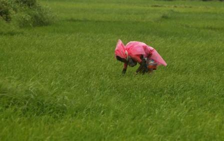
Since the start of the 11th Five Year Plan, the growth rate in agriculture has virtually remained stagnant. A scene at a paddy field in the outskirts of Hyderabad.
Guest Post: Text by Amitangshu Acharya, Photographs by Ayan Ghosh
Kachchh – a brilliant halfway between a turmeric yellow Rajasthan and the emerald green Sahyadris – offers an upside down version of life. It tells you that seeds of life and civilisation are often hidden beneath the sands of time in inhospitable terrains.
Ecological Sanitation is a new approaching sanitation where there is minimal water use and where human waste can be used as fertilizer. It is a truly sustainable approach.
Video Courtesy: EarthReport
Source: 5min Media
It has been proved that it's a direct result of drinking ground water that's contaminated with high levels of fluoride. This video suggests that rainwater is the best source of water for communities living in these regions.
 This report presents the latest Wastelands Atlas, put together by the Ministry of Rural Development (MoRD) and National Remote Sensing Centre (NRSC) developed as a part of the “National Wasteland Monitoring Project”. The mapping efforts have generated valuable datasets on unutilized/vacant lands and their use in watershed and wastelands management.
The three sets of Wastelands Atlas of India by NRSC comprise -

I was going through weather data exposed by India Water Portal and I was thinking about an interesting application which would show my love to Bangalore. The best part of Bangalore is its temperature, rains and clouds. So I wrote this small app which uses the data provided by India Water Portal (which in turn is by CRU). IWP has data for all the districts in India, for every month and for multiple parameters. They have data for 100 years. It quite an amount of data to play with if you are interested. They have an easy way of filtering and downloading.
Flood forecast alerts are provided by Central Water Commission. They have boring maps and tables. Also they don’t provide data in program accessible format. Members of ICTD for asia are working on parsing and storing that data. In the meantime I wanted something to play. I found ScraperWiki (hacker news discussion) which can be used to scrape data from any page and schedule it for running. It allows php, python and ruby languages. Its easy and gives lot more flexibility than Y! pipes to scrape that data. Here is my scraper to get the flood data. You will have to register to get an API to use the data. Data is available in JSON, XML, PHP etc.
After watching “developing world” video on TED, I was eager to try out Google visualization API. When I found the rain fall information, I thought its the best suited data to play around. Go check out the Visualization of Rain Fall in Karnataka.
This presentation by ACWADAM deals with the importance of groundwater. It is well-known fact that groundwater forms a very crucial source of water supply in the national scenario on water resources today. And yet, it continues to remain a resource that is both abused and misused. Often, watershed projects suffer from insufficient inputs, especially hydrogeological to address the problem(s) of groundwater within the watersheds.