Data

Term Path Alias

/sub-categories/data

Background on the meteorological datasets
This data can be useful in various research areas Posted on 01 Oct, 2021 10:04 AM

Data source

Creating a repository for India’s water resources data
WRIS provides a comprehensive, authoritative and consistent data on India’s water resources in a standardised national GIS framework. Posted on 29 Oct, 2020 11:08 AM

Water, a scarce natural resource fundamental to life, livelihood, food security and sustainable development is required in every sector i.e. domestic, agricultural, industrial and environmental. Its source is precipitation, the usual forms being rainfall, snowfall etc. These in turn build surface and groundwater resources in the form of rivers, lakes, ponds, glaciers, groundwater etc.

Remoteness of the observation sites poses a challenge in setting up the data collection instrument (Image: Pxfuel)
Architecture of community program organisations and their data systems
A simple explanation is all you need to get your head around issues related to software technology and its use in community programs. Posted on 17 Oct, 2020 12:48 PM

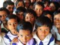
Samanvay Foundation has developed a knowledgebase for leaders working in nonprofit organisations, on issues related to software technology and its use in community programs. It covers strategy, management, economics, and appropriateness of software technology.

Image courtesy: Pete Linforth from Pixabay
Data, data everywhere, but where?
Involving the community in a data framework with the right incentives will have the second-order benefit of the community becoming decision makers with respect to water use. Posted on 16 Oct, 2020 09:21 AM

A few of us did an exercise where we closed our eyes and thought of the first four words that came to our minds when we thought of water data in India. Here is what we came up with:

The seamless flow of data from one program to another can be enabled if a few principles are kept in mind (Image: José Manuel Suárez, Wikimedia Commons)
Data-driven ‘water and agriculture’ planning: The big picture
If data was better organized and available for download in more ‘user-friendly’ formats, its utilization would improve manifold. Posted on 15 Oct, 2020 06:57 PM

India is fortunate to have a rich tradition of public data collection and compilation.

The quality of our public data is highly variable, yet if analyses and interpretation are done keeping in mind some of the limitations, the datasets can be a precious resource at the meso and macro level. (Image: Pixabay)
Democratization of data through use of GIS technology
How technology enables monitoring and evaluation, or comparative analysis of developmental data from village to state level. Posted on 26 Mar, 2020 11:55 AM

Developments in geographical information systems (GIS) in India, both in policy and law, have thus far empowered to a greater extent government and business at national and regional level. The real challenge in this sector is to extend this technology to local communities for self-governance and to enable them to participate on an equal footing in regional and national development.

A view of a village in Almora district of Uttarakhand (Image: Raja Harjai, Flickr Commons)
Can ruin of quality forests be made up by plantations?
There is a gain in forest cover outside forest land as per the 'State of forest report 2019'. But, can reforestation replace natural forests and its essential ecosystem? Posted on 18 Jan, 2020 04:49 PM

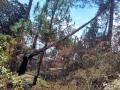
The recently released biennial State of India’s Forest Report 2019 (SFR) indicates an improvement in forest cover since 2017 but dense forests continue to turn into non-forests.

Chir pine trees felled by forest fires in Uttarakhand, 2016 (Image: Ramwik, Wikimedia Commons, CC BY-SA 3.0)
Training course on Data Analysis, Visualization and Interpretation
The four day training programme organised by Water and Livelihood Foundation is a basic skills course for NGOs in the water and related sectors.
Posted on 21 Oct, 2019 05:50 PM

Objectives of the course:

To equip the participants with essential techniques of data analysis using simple graphical, deterministic and statistical tools.

Course content:

Techniques and methods of handling following types of data encountered frequently by NGO workers:

GIS and Remote Sensing Workshop on Natural Resource Management
Udaipur, 10th to 14th October 2019
Posted on 18 Sep, 2019 12:49 PM

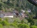
Spatial and temporal information of agriculture, forest, topography, land use change, climate and socio-economic factors are very useful in the planning and implementation of Natural Resource Management (NRM) programs.

What’s shit got to do with child health?
Open defecation plays a key role in solving the puzzle of persistent childhood malnutrition in India, says study Posted on 02 Sep, 2019 06:35 PM

A pig snorts after emerging from the open drain that passes through a slum in the Digha area of south Patna. Small children crawl on the road nearby with slime dribbling from their nose.

Studies indicate that more children stunted in India than in sub-Saharan Africa (Image: MOSPI)
×