/sub-categories/courses-toolkits-manuals-guides-and-handbooks
Courses, Toolkits, Manuals, Guides and Handbooks
Relevance of Meltwater in River Basin Hydrology
Posted on 23 Jul, 2010 10:53 PMA peer paper in Science Magazine focuses on the core of a riverine system, the upstream basin, and its impact on the entire river basin.
Learning package for hydrology – A report by National Institute of Hydrology
Posted on 18 Jul, 2010 10:14 PMThe report emphasizes the necessity of Computer Aided Learning and presents a Learning Package on Hydrology covering various important elements of hydrology including the definitions and figures in a simple and straight forward language.
Fundamentals of Environmental Pollution and Control - NPTEL Mining Engineering Course
Posted on 30 Jun, 2010 11:26 PMFundamentals of Environmental Pollution and Control is a course offered by NPTEL under Mining Engineering, and is structured into 28 video lectures along the following topics:
- State of the Environment
- Environmental Movement
- Definitions of Environmental Terms
Water Footprint Manual: State of the art - A method of water footprint assessment by the Water Footprint Network (November 2009)
Posted on 11 Apr, 2010 07:37 PM The Water Footprint Manual (2009) by the Water Footprint Network (WFN) is a comprehensive and up-to-date outline of the method of water footprint assessment. It introduces how water footprints can be calculated for individual processes and products, as well as for consumers, nations and businesses.
The concept is introduced as a comprehensive indicator of freshwater resources appropriation, as against the traditional and restricted measure of water withdrawal. The hidden water use behind products are measured over the full supply chain and water consumption volumes are measured by source and polluted volumes by type of pollution. All components of a total water footprint are specified geographically and temporally. Blue water (surface and groundwater), green water (rainwater stored in the soil as soil moisture) and grey water (polluted water) footprints are defined and are included along with the indirect water use in measuring the overall water footprints.
Young Climate Savers programme:Teacher's manual on climate change and energy
Posted on 14 Oct, 2009 01:52 PMIn realizing this vision, WWF-India has partnered with Tetra Pak in designing the Young Climate Savers programme, aimed at imparting education on climate change in 200 schools across 10 cities in India through teacher training workshops and mainstreaming climate issues in the academic curriculum.
How to conduct survey of water and sanitation: A reference toolkit by Arghyam
Posted on 08 Oct, 2009 02:03 PMIn 2008-2009 Arghyam conducted an extensive household survey of water and sanitation in rural Karnataka, covering 17,200 households and 172 Gram Panchayats.
How to measure water percolation rate
Posted on 15 Sep, 2009 04:53 PMTo measure how fast water percolates into the soil, you need to measure the time it takes for a specific amount of water to soak into a specific area of soil. The easiest way to do this is to get a length of cylindrical pipe that is sharp enough to push (or hammer) into the soil at one end. Mark it with two lines – one is the line to which you insert it into the soil, and the other is the line to which you fill the water.
How to measure slope and mark contours
Posted on 15 Sep, 2009 04:43 PMYou can measure slope by making use of gravity. Find a protractor for measuring angles. Attach a straw across the straight edge of the protractor.
Agronomic measures in dryland agriculture: An overview
Posted on 15 Sep, 2009 10:39 AM
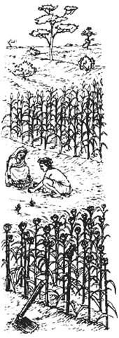
Soil and water conservation measures consist of agronomical and mechanical methods. Agronomic methods are supported with mechanical measures where land slope exceeds permissible limits and runoff gains erosive velocities.
The following boxes explain the nature of agronomic measures which are essential in inter-bunded or terraced areas. These practices enhance the utility value of all kinds of mechanical structures.
Global Water Tool- For organisations to map their water use
Posted on 04 Sep, 2009 11:34 AMThe World Business Council For Sustainable Development has developed a Global Water Tool which organizations can use to map their water use, and get a perspective on its use in their work.