Term Path Alias
/regions/lakes-and-wetlands
/regions/lakes-and-wetlands
The report presents a sedimentation study of the Mansar lake in Udhampur district situated about 55 kms east of Jammu at an elevation of 666 m above mean sea level in the Siwalik terrain. The lake surface area is 0.59 sqkm whereas the lake basin area is 1.67 sqkm. The maximum depth of lake is 38.25 m. The lake has been developed as a tourist spot of the region owing to its natural beauty. The water is also being used for drinking and irrigation purposes.
The Ministry of Environment and Forests released a draft of the regulatory framework for wetland conservation - Wetlands Conservation and Management Rules (2009) for feedback from all stakeholders. The draft framework was prepared by a multi-disciplinary expert group, and final round of comments were invited till June 21st 2010.
The Wetland Conservation Team of Ashoka Trust for Research in Ecology and the Environment (ATREE) did a detailed analysis of the draft regulation and submitted several pertinent concerns to the Ministry. The most significant observation is that the new framework (as do much of India's policies and laws) continues to propose unjustifiable State control and interventions over the country's wetlands and livelihoods of people dependent on them. The regulation does not make any constructive suggestions or recommendations for the conservation that the country's wetlands demand, and instead brings all wetlands into complete official control by installing Central, State and District-level wetland regulatory authorities, wherein the majority of the members will be senior government officials.
Desilting is becoming a major component of any Lake Conservation Project now a days. The basic reasons given for necessity of desilting are - increasing the storage capacity and checking eutrophic conditions.
As it is not practicable to reverse the slow process of silting in the bed of lakes through which only silt can be removed, there is no word like 'desilting' in any standard English dictionary. What we are doing in the name of 'desilting' is practically 'digging' or 'excavation' of lake bed. By so called desilting, the original lake bed is disturbed which has far reaching adverse effects on the performance of the lake. Most visible effect is the increase in percolation rate resulting in heavy seepage losses through the lake bed as observed after massive desilting at Pushkar lake in 2009.
The report provides an account of the findings of water quality studies of Lake Nainital and surroundings. Even though quite a few water quality investigations have been conducted by other researchers, they were more focused on biological aspects and overlooked the hydrological aspects. Further, not all of the earlier studies on Nainital incorporated the groundwater quality aspects, which are essential to establish the background values that can be ascribed to the geology of the region. Only after establishing these, the pollution levels can be assessed.
The study attempts water quality monitoring of Mansar lake to detect the various water quality parameters. The lake water conditions were monitored by collecting water samples from different depths to determine the spatial and temporal variations.
The report deals with the findings of a water quality study of Mansar lake in Udhampur district of Jammu and Kashmir. The water samples from different locations at the surface and from three zones (viz, epilimnion, metalimnion and hypolimnion) were collected and physico-analysis carried out.
The study undertakes hydrological investigations to develop a conceptual model for the water balance of Lake Nainital in Kumaon Himalayas. All the components of lake water balance, except the sub-surface ones, have been measured or estimated using standard methods like isotope mass balance method in conjunction with the conventional water balance method. The sub surface outflow from the lake was assessed by studying the hydraulic interconnection of the lake and downstream springs using environmental tracers.
The study undertakes an exhaustive survey of the morphometric features of the Mansar lake, Udhampur district to prepare a bathymetric map of the lake. The map is useful in understanding the lake hydrological behavior through a study of volume, sedimentation rate and identification of the high siltation zone. The study is significant as the lake water can be utilized for drinking and irrigation purposes for the water scarce Kandi belt of Jammu.
The hydrological study develops a water balance of the Lake Nainital to facilitate the utilization of its water in a planned and systematic manner. The lack of knowledge of input and output parameters such as subsurface inflow, use of lake water for domestic and industrial purposes, evaporation loss and leakage from lake including the outflow through sluice gates had created uncertainty in determining the availability of water in the lake. The study attempts to understand the behavior of the input and output parameters in detail by using both conventional and isotopic techniques.
The lake meets the local drinking and domestic water needs and is for the most part fed by rainfall during monsoon and by inflow from perennial springs and subsurface inflow during the non-monsoon season.
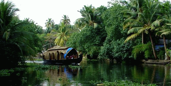 The Vembanad estuarine system, the largest of its kind on the west coast of India is known to be abundantly enriched with diverse fishery resources, providing feeding, spawning and rearing areas for a very large proportion of commercial (fin) fish and shellfish. However, ecosystem health of the Vembanad wetlands is alarmingly declining due to a variety of reasons - obstruction of river courses, sand mining & habitat destruction, loss of riparian canopy cover, encroachment, pollution and unethical fishing practices. Reduced summer flow due to drying up of rivers and pollution hazards from agro-chemicals and sewage also lead to mass mortality of fishes. Depletion of fishery resources has changed this ‘inland fish basket’ to an ‘inland wastebasket’, driving the fisherfolk, the primary stakeholders of the lake into a livelihood crisis.