Term Path Alias
/regions/bihar
/regions/bihar
A very large number of people are emotionally traumatized, constantly crying non-stop and in a state of utter shock. At least definite reports of suicide by a woman has also been received by me. I will appeal to you that a psycho-social help intervention should be higher in the order of priority.
More than 17 million people have been affected in India, Bangladesh and Nepal by the recent floods in South Asia. Around 3 million people have been rendered homeless and more than one million are now living in relief camps.
Forwarded to the Portal by: Pratibha Singh
Guest Post by: Dinesh Kumar Mishra
The foundation stone of the Kosi Project was laid on January 14, 1955 amidst fanfare, jubilation and victory. Dr. Shrikrishna Sinha, thgen Chief Minister of Bihar, laid the foundation stone near Bhutaha village close to Nirmali, in Saharsa (now Supaul) district with the chanting of mantras by Pt. Mahabir Jha of Jhitki village and shouting of slogans like 'Aadhi Roti Khayengein, Kosi Bandh Banaayengein.' (We will eat only half a chapati but we will surely build the Kosi embankments). A majority of people lost the other half of the bread too on the 18th August 2008 when the Kosi embankment breached on that day.
Col. Townsend of the US Army while deliberating in a seminar organized by the American Society of Civil Engineers to discuss the Mississippi floods of 1927 had said that even the best designed and carefully constructed embankments remain at the mercy of burrowing animals like rats, foxes, muskrats who can create a hole in the finest levee that has been devised, which if not closed within a few moments will ensure its destruction. The Mississippi River of the United States broke loose in 1927 inundating an area of 51,200 sq. kilometer and damaging property to an estimated extent of two hundred million to a billion dollars. The breaches drove nearly three quarters of a million people from their homes and six hundred thousand of them were dependant on Red Cross. The wealth and power of the United States enabled much to be done for the sufferers, still they suffered. He further added a 'careless supervisor and dark nights' to the list destroyers of embankments. His observations remain valid till date as the Kosi comes out of its shackles in Kusaha in Nepal some 13 kilometers upstream of the Kosi Barrage. All the eight breaches that have occurred so far can be brought under these categories.
Col. Townsend gave benefit of doubt to the planners and engineers when he prefixed 'best designed and carefully constructed' adjectives to the embankments. The Kosi has breached its embankment eighth time and it is for the first time that the 'disaster' has generated so much of interest. These embankments are spaced at an average distance of 9 to 10 kilometers below the barrage with a maximum width of 16 kilometres between Kisunipatti and Bhaptiahi and minimum width of nearly 3 kilometres at the barrage itself. The spacing of the embankments is only 8 kilometres at the tail end, between Baluaha Ghat and Ghonghepur. In Nepal portion the spacing between them is restricted to between 3 to 6 kilometers. Common sense suggests that the spacing between the embankments should increase as the river advances further as more and more streams join the river from western side. This simple common sense was kicked around when these embankments were constructed in late 1950s. There were 304 villages with a population of 192,000 (1951 census) going to be trapped between the embankments and each one of them was trying to be located outside the embankments. Later the embankments were extended and 380 villages of Bihar and 34 villages of Nepal came within them. Their current population is nearly 1.2 million. The village locations were fixed and it was the embankment on either side of the river that could be moved. So did it happen. Now the embankment alignment is a caricature of what it was designed, if there was any design.
 Since its foundation in 1968, the IRC International Water and Sanitation Centre (IRC) has facilitated the sharing, promotion and use of knowledge so that governments, professionals and organisations can better suppo
Forwarded to the Portal by: Avijit Dey, Plan International The following is a report on Plan International's current intervention in the Bihar Flood Situation. The report was received on 12th September 2008.
Name of Organisation: Plan India
Address: E-12 Kailash Colony, New Delhi
Phone No. 46558484 Fax: 46558443
Head of Organisation: Bhagyashri Dengle
Email: Bhagyashri.dengle@plan-international.org
Mobile-9810307476
Website:http://www.planindia.org/ Online campaign page: http://www.helpbihar.in
Plan’s India’s Response:
Plan India has started a limited and focused response operation to the Bihar flood situation in Supaul district ,Triveniganj Block Dafarka Canal an isolated and cutoff population of around 40000 people who are living in an embankment and are yet unreached by either government or civil society. Plan has already dispatched 10 lakh halazone tablets, 650 kilograms of carbolic acid [to prevent snake and insect bites], 2.5 tons of bleaching powder and 20 life jackets. Plan has raised 25000 soaps through corporate donations and the consignment will be sent early next week. Plan India staff have contributed one day of their wage to the response operations. A lot of effort is also being put in to raise funds through local sources.
On the ground, the interventions are planned through 3-5 Camps sites in three districts with local NGO partnership:
At the Camp Sites
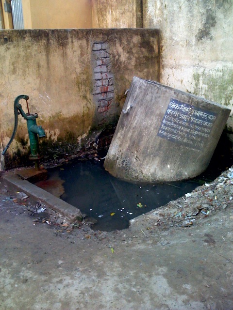
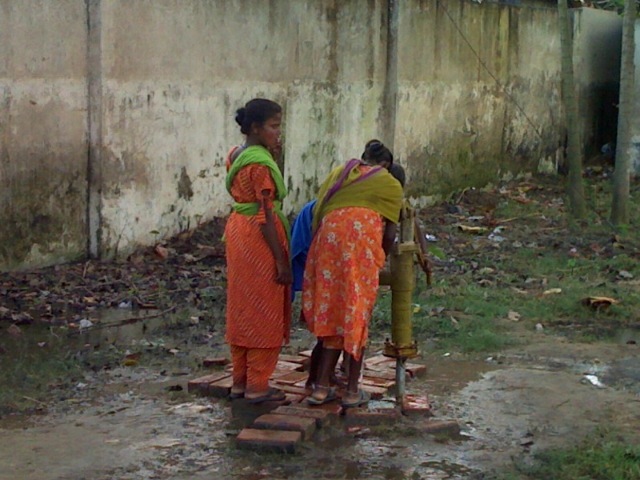
Parineeta Dandekar spent some time to find resources on the web for people involved in relief efforts in flood situations.The following provides a concise look at precautions, useful resources and general tips regarding drinking water, sanitation, relief measures in the flood affected regions. Water and Sanitation during floods: Some resources for relief workers and flood affected population With more than 300,000 people in relief camps and two mega relief camps planned in Bihar, consideration of issues related to water and sanitation is urgent. Epidemics and water borne diseases can spread rapidly and easily in the present situation.The information below is collected from various sources and aims to help of flood affected population, people in relief camps, volunteers, relief workers working in Bihar. Relief and aid workers should take the necessary precautions to assure their health and safety while working on rescue and clean up procedures. While conducting rescue and clean up operations, it should be assumed that the all surfaces have been contaminated with disease-causing organisms. This important assumption must be considered in decisions involving personal safety of rescue and cleanup personnel . ( for more information, please see here) Personal Protection Measures ( For more information, please see here)
Download the resource document as a doc file: Water & Sanitation for the Flood Affected
Two documents giving the details of the mega camps and other relief camps that are being run by the Government. Thanks to Eklavya Prasad of Megh Pyne Abhiyan for forwarding these documents.