/regions/bay-bengal
Bay of Bengal
Paleochannel and paleohydrology of Middle Siwalik (Pliocene) fluvial system in Northern India – A paper in Journal of Earth System Science
Posted on 09 Aug, 2011 11:41 AMThis paper in Journal of Earth System Science deals with paleochannel and paleohydrology of the Middle Siwalik (Pliocene) fluvial system in Northern India. In recent years, fluvial sedimentologists have carried out numerous studies to estimate quantitative hydrodynamics of ancient fluvial systems, particularly, their morphology and hydrology. The methods for reconstructing the morphology and hydrology employ either several groups of empirical relationships derived from modern fluvial environments or dynamic models of fluvial flow and sediment transports in alluvial reaches.
Uncertainties in downscaled relative humidity for a semi-arid region in India – A paper in Journal of Earth Systems Science
Posted on 05 Aug, 2011 05:42 PMThis paper in Journal of Earth Systems Science deals with uncertainties in downscaled relative humidity for a semi-arid region - Malaprabha basin in India. Researchers and decision-makers who assess the impact of climate change in river basin development, agriculture, hydrology, irrigation management, etc., require future scenarios of relative humidity.
Water quality status of rivers in India – Report of Central Water Commission
Posted on 15 Jul, 2011 06:19 PMThe Level-I Laboratories are located at 258 field water quality monitoring stations on various rivers of India where physical parameters such as temperature, colour, odour, specific conductivity, total dissolved solids, pH and dissolved oxygen of river water are observed.
Analysing the role of geomorphic features in Kosi flood – An article in Geospatial World
Posted on 12 Jul, 2011 10:45 AMKosi is known as the sorrow of Bihar due to its frequent and often disastrous floods. The major geomorphic units of flood-inundated area in Kosi fan (terrain of Kosi river in India) are sand bars in the form of inter-connected drainage networks, an ox-bow lake and its meandering cut-off and imprint.
Impacts of climate change on growth and yield of rice and wheat in the Upper Ganga Basin – A study by Indian Agricultural Research Institute
Posted on 26 Jun, 2011 01:51 PM This report presents the results based on climate change scenarios and identifies potential adaptation strategies. The study is part of the ‘Climate Change Impacts on Freshwater Ecosystems in the Himalayas’ (CCIFEH) project, a joint initiative of WWF-India and WWF-Nepal, supported by WWF-Netherlands and aims to study and understand climate change impacts on freshwater ecosystems, livelihoods and the economy.
Change in climate conditions and the frequency of natural disasters in recent times has made it imperative to find lasting adaptation solutions for the agriculture sector. Given that almost 60 per cent of the country’s population relies on this sector for its livelihood and that it contributes approximately 15.7 per cent of India’s GDP, an analysis of changes which could impact crop yields and subsequently lead to an instable food security scenario is necessary.
Where our rivers begin - Water literacy for urban India
Posted on 20 Jun, 2011 12:37 PM
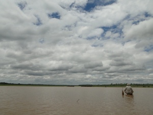
 Fisherman on Hessarghatta Lake on the Arkavathy River
It is here in a small pond that the Arkavathy river is famously said to originate. It moves down the hill in the form of a spring and enters the first of the man-made reservoirs, called ‘tanks’, the Chikkarayyappanhalli Kere. From thence begins the journey of this tributary to the Cauvery. Passing through a series of tanks built to hold its water for irrigation it comes to the large ‘Nagarakere’ at Dodballapur. The entire drinking water for the town of population 100,000 used to come from this large tank. Moving further on the river comes to the almost 7 sq.km. Large Hessarghatta tank. In 1894 this tank was enlarged and became the first external source of water supply to the city of Bangalore.
MoEF signs three agreements with World Bank for cleaning Ganga and conservation of biodiversity in June 2011
Posted on 16 Jun, 2011 04:55 PMThe River cleaning project is to the tune of US $ 1 billion (approximately Rs 4,600 crore) loan and credit that will form part of the Bank’s long-term support for cleaning the Ganga River. Two Biodiversity Conservation agreements are for a credit of US$15.6 million and US$8.14 million grant.
On this occasion, Sh Jairam Ramesh , Minister of State for Environment and Forest Minister said, “Two protected areas, one each in Uttarakhand and Gujarat, will put in place a complete new model of managing the protected areas while safeguarding the livelihoods of local communities. So far local community was looked as enemies of protected areas, but this has to be changed. We have to make local communities full partners in the protection and regeneration of these protected areas. These new models will be applied in other areas of the country.” Giving details of cleaning operations of last few years, the Minister said, “The objective of Ganga project is ‘by 2020 no municipal sewage and industrial effluent will be let into the river Ganga without treatment’. With the help from the World bank, we are taking a big step forward in achieving the Mission Clean Ganga”.
Villages in north Bihar sinking in Bagmati's sand - Entire flood control planning needs thorough review - Article by Dinesh Kumar Mishra in d-sector.org
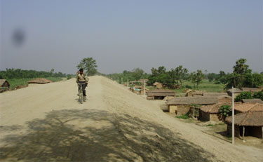
Posted on 16 Jun, 2011 03:56 PM The Bagmati Embankment separating riverside on the left and countryside of the right near Ibrahimpur – Electric poles suggest the height of the embankment
One often hears about the civilizations buried under earth and attributes various reasons for such disappearance of life from a particular place. Excavations reveal the way of life the people might have had before they chose to leave their villages and towns and allowed the nature to take its own course. These accounts are available in books and we all believe the process told to us by historians and archaeologists. These are all conjectures that are revealed by scientific investigations but how many of us have seen, not read, how the civilizations get buried under the debris created by nature? There are places in Bihar where one can see the process of disappearance of civilization and the villages getting buried under the sediments brought by rivers.
Godavari river water sharing accord - A paper by N. Sasidhar
Posted on 13 Jun, 2011 03:37 PMThe water availability in these projects has diminished to 33% dependability from the designed dependability of 75% in last nine years. Due to meager inflows, the river water quality is becoming unsafe for human and cattle consumption. It also suggests the remedial action to overcome the problem in future.