Rajasthan, Gujarat, Maharashtra and Goa, all located in the west of India, have rivers belonging to several different basins. With the exception of rivers in Rajasthan that drain into the Yamuna basin, the other rivers in these states either drain into the Bay of Bengal via the peninsular basins or run from the Western Ghats and into the Arabian sea.
Encroachment: In Rajasthan, rivers are mostly seasonal. The riverbed and the floodplains in this desert state are vast grazing grounds supporting millions of livestock. However, the mostly-dried riverbeds invite encroachers, restricting even the seasonal flows.
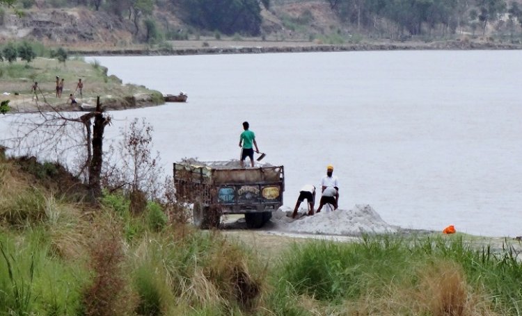
Rampant sand mining in Rajasthan has affected the water retention and seepage into subsurface channels. Banganga river, which flows near Jaipur, is the biggest casualty to encroachments and sand mining. In Banganga basin, Jamwa Ramgarh reservoir, which hosted the rowing events of 1982 Asian Games, has been dry for the last 10 years. In Goa too the unregulated mining of alluvial sand has damaged the river ecosystem impacting traditional fishermen. Many of the small rivers of Goa are on the verge of extinction.
Chambal, one of the two perennial rivers of Rajasthan, has been reduced to a stagnant, shrunken sliver beyond the Kota barrage as it is channelised to meet the needs of Madhya Pradesh and Rajasthan. Lift irrigation schemes at Dholpur and Pinahat have furthered the decimation. The river recovers with the Kali Sindh and the Parbati river flowing in.
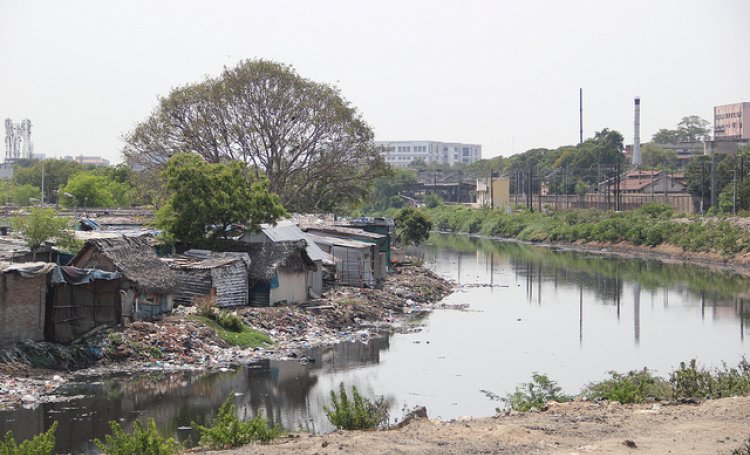
Water pollution: It is estimated that 469 MLD of industrial waste is generated in Rajasthan. Rivers such as Banas, Luni and Bandi are polluted at different stretches due to the industrial, domestic and agricultural pollution. On Luni river basin, the textile units of Balotra and Pali towns and the industrial waste of Jodhpur exert tremendous pressure. Pali is the fifth most polluted industrial area as found in the Comprehensive Environmental Pollution Index of the country and its wastewater has contaminated several wells along the stretch, turning the farmland around 50 villages redundant. Banas basin, which feeds the Chambal river, suffers from pollution due to the dumping of the slurry by the marble industry, extensive sand mining and sewage pollution from major towns of Udaipur, Chittorgarh and Bhilwara.
In Gujarat, most of the rivers, including the Sabarmati, are dumping grounds for industrial waste. Mahi river is on the verge of extinction due to pollution and salinity. Mahi estuary is badly affected by industrial effluents. The 32-km long journey of Tapi river through Surat city is mired with illegal drainage lines that dump domestic sewage and toxic waste from industries. The industrial patch along the southern bank of the Narmada river uses its water and releases waste in its tributaries. The west-flowing rivers of Saurastra and Kutch region are no better. The tubewells in the Jetpur town of Rajkot district spew red-coloured water containing harmful chemicals due to contamination of the Bhadra river.
Twenty-three percent of the rivers of Goa are critically polluted. The Baga river that emerges from the forested areas of Assagao of Bardez is heavily polluted today, thanks to the increase in tourism resulting in the intense garbage and sewage dumping. Some of the private resorts have started boating and cruising facilities for the tourists, affecting the natural drainage of the river.
The Kalpasar project which will have a large dam is bound to harm the ecology of Narmada, Sabarmati, Dhadhar, Mahi and some of the Saurashtra rivers.
Mining and rivers: In Goa, the ecosystem is sustained by 11 major and several small rivers. Mining and tourism contribute the most to the degradation of state’s rivers. Many of the 800 mines operating in the state are located near the river banks. Heavy monsoon runoff carries huge quantum of mining rejects into the rivers. These mining rejects ultimately get settled in the channel resulting in overflowing of banks and inundation of low-lying areas.
Salaulim dam, built on the Salaulim river, which supplies drinking water to 55 percent of Goa’s population, has more than 15 mining leases in the catchment of its reservoir. River Khandepar, which is the source of drinking water to 30 percent of Goa’s population, has 21 mines within its catchment. The silt often chokes the filter beds of the water treatment plant. The Bicholim river, once navigable, has lost its navigability on account of siltation. The main rivers of Goa, the Mandovi and the Zuari are also heavily polluted due to mining. The Zuari has 10 operating mines in its catchment and the Mandovi has 27 mines depositing 70,000 cubic tonnes of iron particulates every year in the river.
Increased abstraction: The increasing number of dams, growing sugarcane cultivation, urban and industrial water demand have altered the face of the river basins in Maharashtra. Intrastate water conflicts are becoming a routine though Maharashtra has been trying to address the recurrent conflicts through some of its institutional mechanisms like the Maharashtra Water Resources Regulatory Authority (MWRRA).
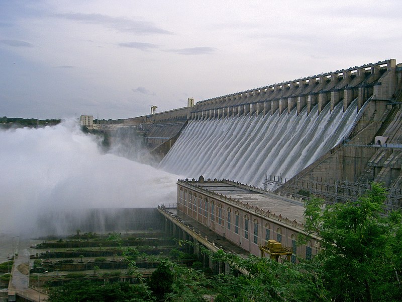
Krishna, one of the important east-flowing peninsular rivers, has undergone extensive dam construction. Water parched stretches of the Krishna river downstream of the dams are further being polluted by untreated sewage, effluents from sugar distilleries and other industries. Maharashtra has also been experiencing floods in Upper Krishna basin caused by the backwater effect of the Alamatti dam built in the Bijapur district of Karnataka.
Studies show that the flow of the Bhima river which makes a significant contribution to the Krishna has reduced substantially in the period between 2001 and 2011 from dam construction and allocation of water. There is no allocation for environmental flows for the river downstream of any of the dams.Thus, the rivers below the dams are almost entirely dry and are unable to sustain life.
Tata hydropower dams at the origin of the Mula-Mutha sub basin have been diverting water of the Bhima basin to water surplus Konkan for power generation, even in severe drought seasons. Various citizens groups staged jal satyagraha in May 2016 demanding nationalisation of six dams so that their water can be used by the general public. The high court also passed a strong order recommending the release of water stored in the “private dams” and sources for drinking water purposes of the drought-hit region. Unfortunately, no water has been released yet.
Godavari is also fettered in many dams all along its length and across its basin which have been responsible for human sufferings, ecological impacts, livelihood struggles and conflicts. Domestic sewage of urban centres is one of the principal pollutants of Godavari. In the Wardha basin however, the river is also critically polluted due to coal mining and thermal power plants.
The southern slip
The region of south India, comprising Kerala, Karnataka, Andhra Pradesh and Tamil Nadu has been in the grip of controversies related to interstate water sharing and dams.
Water pollution: Tamil Nadu is famous for having a cluster of industrial towns known for their industries like textiles, tanneries, chemicals and metals. With over 40 percent of population in urban centres, the domestic sewage generation is also high. Both these aspects add to the groundwater and surface pollution. The Cauvery river is the biggest carrier of sewage while its delta, a major source of food and livelihood, is sinking due to the lack of sediment flow. In Kerala, the Eloor–Edayar stretch of the Periyar has been consistently reporting high toxicity.

The rivers of Karnataka with pollution at three to 10 times the norm for clean water bodies are cesspools of stink. As per the Monitoring of Indian National Aquatic Resources System, a part of the Central Pollution Control Board (CPCB), over 655-km length of 15 rivers in 38 spots is highly polluted. The report by CPCB also adds that “poor environment management systems in industries, such as chemicals, metal and minerals, leather processing and sugar mills, have led to the discharge of highly toxic and organic waste water”.
Seawater intrusion: Tamil Nadu faces the additional problem of seawater intrusion through backwater canals and underground. The Nagappattinam district is 100 percent saline and is facing the threat of going under the sea. Groundwater salinity is on the rise in all 14 coastal districts due to the reduction in fresh water river flows.
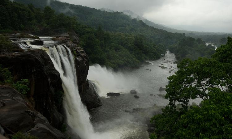
Dams and diversions: Dams in Kerala have submerged vast stretches of indigenous domains and forests. The river flows of the Periyar, Chalakudy, Bharatapuzha, Siruvani and Neyyar have been subjected to interstate and interbasin diversions. The hydroelectricity projects at Athirappilly, Pooyamkutty, Pathrakkadavu and Pandiyar-Punnampuzha, besides the 205-km long West Coast Canal are bound to further impact the river ecology. Except for the Vamanapuram river, the flow in all the southern Kerala rivers is affected by dams.
To read the first part of this series on the north and east rivers, click here.
The detailed state reports can be accessed at India Rivers’ Week blog
/articles/river-health-goes-south
