The Kosi-Gandak interfan region of the East Ganga Plains (EGP) is densely populated by wetlands, most of which are monsoonal (or seasonal), and remain dry in the non-monsoonal season.
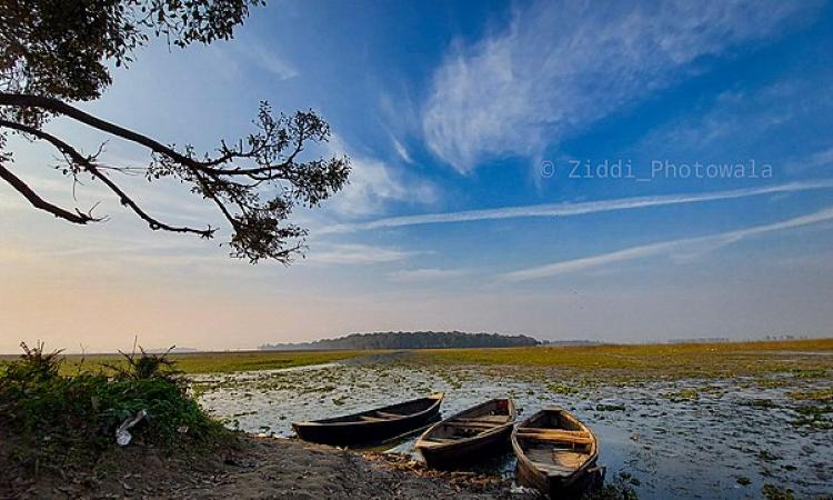
Kaabar Tal, Bihar's first Ramsar site
The Kaabar Tal (also known as Kanwar lake, Kabar Taal or Kabartal), is the largest wetland in the Kosi-Gandak interfan situated in the state of Bihar. It has recently been designated as India’s 39th and Bihar’s first Ramsar site inform the papers titled 'Kaabar Tal, Bihar’s first Ramsar site: status, challenges and recommendation' published in Current Science and 'Hydrogeomorphic indicators of wetland health inferred from multi-temporal remote sensing data for a new Ramsar site (Kaabar Tal), India' published in Ecological Indicators by Manudeo Singh and Rajiv Sinha .
Two streams flow near the wetland, one being the Burhi Gandak and a small seasonal stream called the Chanha river in the east. The Burhi Gandak used to feed the Tal during the monsoons, but has now stopped doing so after the Burhi Gandak river was embanked on both sides to prevent floods. No streams flow into the Tal now and water from the catchment reaches via sheet-flow and subsurface flow into the Tal.
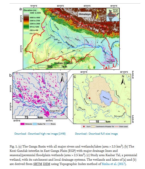
The total catchment of the Kaabar Tal (including the wetland) is 250 km2, and almost 70 percent of the wetland area is under agricultural land-use. A canal was constructed to drain the wetland for agriculture and is now choked with sediments.
Rainfall is the primary source of water for the Kaabar Tal now, and the water-spread area of the wetland depends on the amount of monsoon rainfall, which is not sufficient to sustain the hydrological functions of the wetland.
The wetland plays an important role in the hydrography of the region and harbours significant biodiversity. It has recorded 165 plant species and 394 animal species with 291 bird species. It is an important stopover for the Central Asian Flyway and 58 migratory waterbirds use it to rest and feed. It has also recorded 50 species of fish indicating high biodiversity. Three endangered species of vultures reside in the wetland along with two endangered waterbirds, the sociable lapwing and the Baer’s pochard.
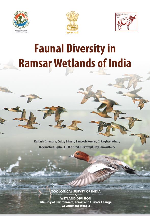
Ramsar wetlands in India harbour rich diversity, Know more from the above report 'Faunal diversity in Ramsar Wetlands of India' published by Zoological Survey of India and Wetland Division, Ministry of Environment, Forest and Climate Change, Government of India in the year 2021.
Threats to the Tal are increasing
The Tal is facing increasing threats due to urbanisation and land use changes leading to drying and fragmentation of the wetland. Encroachment due to taking over of land for agricultural use is also leading to deterioration in the water quality of the Tal as run-off from agricultural fields brings in nutrients, pesticides and sediments into the wetland.
The two papers describe studies that shed light on the condition of the wetland. They find that the vegetation cover and density over the Tal has been increasing, and the wet areas have been decreasing and getting transformed into vegetated marshes.
The Tal is experiencing water stress
Connectivity is very important for the survival of a wetland and involves the regular inflow and outflow of water, sediments, and plants and animals residing in the wetland. Seasonal assessment reveals that the wetland has a better connectivity during the water-stressed pre-monsoon season as compared to the water-surplus post-monsoon season. Higher vegetation density during the post-monsoon has been found to affect the connectivity of the Tal. This is not ideal for a wetland, which is dependent on monsoon rainfall as the prime water source.
Regions with high connectivity potential of the Tal are decreasing while those with low connectivity are increasing. This is leading to decreasing hydrological connectivity due to reduction in the inlet of monsoon run-off thus increasing hydrological stress.
Agricultural intensification is triggering eutrophication
The catchment of the Kaabar Tal has also undergone changes due to intensive agricultural practices that have modified the hydrogeomorphic dynamics of the wetland. Catchment processes strongly control the wetland chemistry and highly connected systems tend to have similar water chemistry.
The wetness of the wetland is decreasing with increase in vegetation density. Wetness seems to be increasing in the marginal portions of the wetland showing that it is not natural, but due to increasing groundwater and surface water abstraction for irrigation. In the core regions of the wetland, vegetation growth trend is increasing, implying increasing eutrophication of the open water areas due to nutrient-loading.
The Tal is experiencing fragmentation
Agricultural practices are leading to transfer of fertilisers, pesticides, nutrients in the highly connected proximal parts of the wetland triggering eutrophication of the wetland. They are also generating high volumes of sediments and the well connected proximal catchments with high input of loose sediments have been found to increase fragmentation within the wetland through siltation.
Drying is leading to fragmentation of the wetland. When a waterbody starts drying from the outside, it can lead to shoreline shrinkage; but when it dries from the inside, it starts fragmenting. Analysis of data over the last forty years shows that the shorelines of the tal are shrinking both from inside and outside. As a result, the wetland is getting more fragmented and losing connectivity.
Rather than implementing a routine approach, a holistic approach considering the geomorphic diversity is required to restore this fragmenting wetland, argue the studies. While the western parts of the wetland are under extreme stress and show high levels of drying, shoreline shrinkage, and fragmentation and need immediate attention, a multidisciplinary approach is needed while designing strategies for sustainable restoration and management of the Tal, argue the papers. Thus wetland management approach for Kaabar Tal needs to:
- Focus on restoration of hydrological connectivity by reconnecting the wetland with the Burhi Gandak
- Undertake steps to reduce sediment and nutrient connectivity from the catchment areas and from within the wetland
- Keep the natural drainage network intact by construction of culverts across roads within the catchment
- Close the drain canal
- Monitor groundwater abstraction within the catchment and encourage canal irrigation fed by the Burhi Gandak
- Restrict agricultural practices and encourage pisciculture within and in the proximity of the wetland
- Discourage use of inorganic fertilisers and pesticides in the catchment
- Minimise siltation of the wetland through vegetative buffers around its margins.
/articles/kaabar-tal-gasps-breath