Why a training on managing groundwater ?
A watershed is an area that drains to a common waterway (line or area), such as a stream, lake, estuary, wetland, aquifer , or even the ocean — and our individual actions can directly affect it. What is generally ignored is the fact that the physical characteristics of rocks below the soil, including their mineralogical and chemical composition, grain size, their sorting and packing and the primary structures have hydrogeological significance in the watershed area.
Unconsolidated granular materials like gravel, pebbles and sand deposits are potential aquifers and geological structures like folds, faults, joints and stratified rocks are potential zones for the movement and storage of ground water. Thus it is imperative to take into account, the intrinsic characteristics of the rocks and soil, surface hydrology, and other depositional and structural features in order to delineate the groundwater potential of an area.
Mainstream watershed management does not include the study of the hydrogeology of the region in planning. The workshop's aim thus is to create hydrogeologists from the local region to manage groundwater resources in India’s Himalayan region in an equitable and sustainable manner.
The training was conducted with technical support from ACWADAM, Pune and ACT, Bhuj and financial support from Arghyam, Bengaluru.

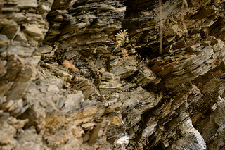
Rock strata below the ground influences the storage and transmission of water
The workshop had 31 participants mainly from the Himalayan states comprising of representatives from voluntary development organisations, land and water user groups, SHG members, junior engineers, research scholars and students. For those with a background in science, engineering or in particular, geology, the training helped sharpen theoretical knowledge while for the beginners to science and engineering, it was an unique experience, where an attempt was made to simplify the science of groundwater.
Understanding groundwater in the Himalayan context
A recent World Bank report says that by 2025, an estimated 60 per cent of India's groundwater blocks will be in a critical condition. How climate change could further aggravate the situation and its repercussions on the groundwater dependent-irrigated agriculture, as well as on rural and urban water supply, can well be imagined.
In the Himalayan region, groundwater essentially occurs in disconnected localized bodies in jointed fractured zones owing to steep slopes and a typical geology. Though groundwater is relatively less tapped in the Himalayan states, it is becoming a major source of water in the form of springs and base flows in the mountain streams.
But rapid developmental activities in the Himalayan region, including the construction of dams, tunnels and roads, changes in land use patterns and deforestation are leading to a decline in water quality and quantity. In many areas springs are drying up or their discharge is declining. Such complexities and ever-decreasing groundwater resources, entail the need for conservation and management.

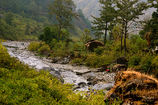
Springs are a major source of water in the Himalayas
Course content
The course design was crafted for better understanding of fundamental concepts of hydrogeology of the Himalayan region, and focussed on groundwater management, geological and hydrogeological mapping, designing watershed development plans, and monitoring groundwater quality with the help of rigorous theoretical and practical sessions, as well as outdoor work.
The theoretical sessions covered a range of topics and were as much about discarding old concepts about watershed management, as much as it was about forming new ideas. These sessions gave an overview of the environment and hydrological (water) cycle, its importance, how it works, the processes involved, how human activities alter the hydrological cycle.
Geology lessons on understanding the lithosphere, formation of the earth, types of rocks, rocks cycle, evolution of the Himalayas and hydrological characteristics of its rocks helped the participants see water in relation to its surrounding geological complexities.
A number of sessions were dedicated to develop among the participants a clear understanding of groundwater, its use and importance, groundwater in the Himalayas, linkages, its situation in India and scarcity and contamination impinging upon food and water security in a changing climate.
Having the basics now in place, the workshop moved into showing the role of hydrogeology in watershed management and possibilities of different types of storage and harvesting structures under different situations in the Himalayas, and the role vegetation can play in springshed and watershed management.
Considering the importance of conservation of springs in the Himalayas, several sessions were focused on explaining the hydrogeology of springs and its relation to groundwater and sanitation. Not only this, there were also presentations about how to treat a catchment area (catch water where it falls) and how to manage a springshed effectively.
The training also touched upon social protocols of groundwater management, preparation of tools for social survey, water quality and its monitoring, sampling and data analysis. Reporting and calculation found a special place in the theory sessions, with each parameter discussed in utmost detail.
Practical sessions on unit of measurements, reading topographical maps, mapping, drainage analysis, measuring and understanding spring discharge and water quality sample analysis with the help of water quality testing kit were also taken, so that participants can independently understand the ground situation back home, plan and implement tasks accordingly.
Outdoor visits to learn concepts first hand
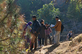
The course gave equal stress, if not more on applying the classroom lessons on the ground. Visits were made to Maldevta and Bandawali in Dehradun region, to help the participants identify rock types, fractures, faults etc for themselves. They were divided in groups to measure the dip and angle of fractures of rocks and the strike trend of a stream using instruments such as Brunton and clinometers at several different spots. At Bandhawali, the participants learnt how to measure the discharge of a stream.

Exercise on geological mapping of a bawdi (step-well) at Sirmour, Himachal Pradesh
On another outdoor visit to Sirmour district, Himachal Pradesh, the participants in groups tried out geological and hydrogeological mapping of a bawdi and chashma, and identifying their recharge areas.
A social survey was also done in the nearby villages in groups to learn about the situation of groundwater, land use pattern, water quality and the interest and commitment of local people towards managing the watershed in their area.
Successful examples of springshed management
To complete the picture, successful examples of springshed management were presented before the rest of the group. Dhara Vikas Initiative is a unique endeavour where this alchemical knowledge of watershed and groundwater management has transformed the fate of dying springs and lakes in Sikkim. Participants from Sikkim presented their case explaining the nuances of practical application of the learning in the field and their journey towards reviving over 50 springs in the state.
Dr. Ravi Chopra, Director, People's Science Institute, also shared his experiences underlining how the knowledge of intelligent water harvesting practices has always existed within local communities who depend on land, water and other natural resources. He shared the experiences of community organisations such as the Dudhatoli Lok Vikas Sansthan in managing land and water in the Pauri-Garhwal region of Uttarakhand, and his own work in the Kosi basin, helping the participants take back not just knowledge but also inspiration.
It is expected that the participants initiate work on watershed and groundwater management in their own areas, and apply the learning from the workshop in designing strategies for the same.
While the training explained hardcore concepts of hydrogeology and planning work on water harvesting and storage within a watershed, the knowledge was conveyed in a language and manner intelligible to a layperson. It helped the participants realize that groundwater is a community resource that requires planning, development and management, to consider and evolve ways to bring about conservation, sustainability and equitable use of groundwater with participation of the local communities dependent on land and water in each region.
Notes:
Aquifers: An underground layer of permeable rock, sediment (usually sand or gravel), or soil that yields water. The pore spaces in aquifers are filled with water and are interconnected, which makes water flow through them. They can range from a few square kilometres to thousands of square kilometres in size.
Brunton and clinometer: Specialized instruments used widely by those who need to make accurate degree and angle measurements in the field.
Bawdi: A well in which the water may be reached by descending a set of steps.
Chashma: A pond
Dip and strike: These are terms to describe the orientation of a plane in 3-dimensional space. It is usually applied to the orientation of tilted layers of rock. Dip is the angle of tilt, measured from the horizontal. The angle of dip is measured in degrees. Strike is the direction of a level line on that tilted surface. It is always perpendicular to the direction of dip.
Geology: The scientific study of the origin, history, structure, and composition of the earth.
Hydrogeology: The branch of geology that deals with the occurrence, distribution, and effect of groundwater.
Hydrology: The scientific study of the properties, distribution, and effects of water on the earth's surface, in the soil and underlying rocks, and in the atmosphere.
Toposheet: This is a shortened name for 'Topographic sheet'. They essentially contain information about an area like roads, railways, settlements, canals, rivers, electric poles, post offices etc. According to their usage, they may be available at different scales (e.g. 1:25000, 1: 50000 etc., where the former is a larger scale as compared to the latter). They are made on a suitable projection for that area and contain latitude-longitude information at the corners. Thus any point on it can be identified with its corresponding latitude-longitude, depending upon the scale (i.e. if the scale is large, then it would have more accurate latitude-longitude).
Watershed: The region draining into a river or river system, or any other body of water such as a lake.
Recharge area: An area in which water is absorbed that eventually reaches the zone of saturation in one or more aquifers.
View photos from the training workshop held in June 2012 here
/articles/integrate-understanding-hydro-geology-planning-watershed-management-programmes-report