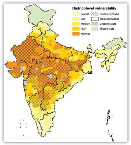
On a scale of 5, from lowest to highest, this map shows the vulnerability of various districts of the country to climate change. The map shows many of these regions are doubly exposed to the risk of climate change.
Source: IPCC
Path Alias
/articles/district-level-vulnerability-climate-change-ipcc-assessment
Post By: arun
Sub Categories