Highlights
- The frequency, magnitude and duration of flooding in the northern Kosi river catchment is showing an increasing trend over the last few years.
- Flood protection structures such as embankments are making it worse by jacketing the heavy sediment load of the river and raising the riverbeds.
- This worsens the intensity and duration of flood events not just for communities living inside the embankments, but also for those living outside and adjacent to the embankments when a breach occurs.
- Marginalised communities continue to be worse affected, and more vulnerable to flood risks and loss of livelihoods.
Kosi, the shifting river of Bihar
While the annual and seasonal rainfall trends in the state of Bihar are showing a decrease over the last century, the frequency, magnitude and duration of flooding in the northern Kosi river catchment is increasing over the years.
The Kosi, a major tributary of the river Ganga, forms one of the largest inland deltas in the Gangetic river basin in India as it constantly keeps shifting river channels. The flood plains of Kosi are permanently flooded and continue to support socio-economically marginalised populations in a highly hazard-prone and flood-vulnerable region of Bihar. And the region is expected to receive even more rainfall in the coming decades as compared to the middle and upper Himalayan part of the sub-basin, which can prove to be disastrous for the region already under strain.
This paper titled 'Flood frequency and flood intensity changes in the post embankment period in the Kosi sub-basin India: Impact of location, caste, and class on the flood vulnerability of the marginal communities' published in Frontiers in Water explores the underlying causes for increasing flood events and their impact on the livelihoods of communities residing in villages located in two highly vulnerable districts of North Bihar.
Kosi is highly susceptible to flooding due to its geomorphology
The geomorphology of the Kosi makes it very susceptible to flooding and the river carries heavy sediment load from the Himalayan mountains, which impedes flow in the river channels of Kosi and leads to a decrease in the carrying capacity of the channels of river resulting in frequent overbank flooding and flash floods .
The river channels and the adjoining areas are at the same elevation and the low gradient of the river and the filling up of the river channels with sediments makes it susceptible to flooding in the lower sub basin area even under normal rainfall events, submerging areas occupied by millions of people, in a matter of hours, without any prior warning systems in place.
Also, the geographical peculiarity and the location of the lower Kosi sub-basin in the foothills of Nepal Himalayas, where plains meet the hills, makes it very susceptible to extreme rainfall events. The increasing precipitation trend in the headwaters of Nepal Himalaya is another concern for the downstream region of North Bihar because it faces the brunt of flash floods and overbank floods during the monsoon.
Embankments on the Kosi
Most of the rivers of Bihar always had some form of private and public embankments, either built by the Zamindars or the Sarkar (the government of India). The Kosi was embanked the last but became the most flood prone. A 153 km long embankment on the eastern side from Birpur to Kopadia and another 126 km on the western side from Bhardah in Nepal to Ghonghepur in Saharsa to protect 214,000 hectares (ha) of land from flooding was completed on the Kosi by 1959. A barrage at the Indo-Nepal border at Birpur was also constructed in 1963 to irrigate 712,000 ha of land through the eastern Kosi main canal and another 325,000 ha through the western Kosi canal.
Thus, three different kinds of landscapes were created: the area between the embankments, the area adjacent to but outside of the embankments and the area protected from floods. Thus, the impacts of floods are experienced by people differently in the region.
The paper describes the findings of a study that looks at the impacts that flooding has on communities residing in villages spread across four community development blocks (CDB) - two blocks each from the Darbhanga and Saharsa districts, which are located in the southeastern part of Kosi.
The study findings:
- Embankments exacerbate intensity and duration of floods
While the role of embankments is to minimise or prevent communities from getting affected by the flood, the household surveys show that embankments exacerbate the intensity and duration of the flood events not just for communities living inside the embankments, but also of those outside and adjacent to the embankments when a breach occurs.
- Marginalised communities are the most affected
While communities have accepted embankments as the new normal, floods have unleashed untold suffering on the marginalised communities in the area. The cost of living has increased, and communities have to look for local adaptation measures to deal with impacts.
Community perception of embankments as good or bad is mostly influenced by their location with respect to the embankments and their caste and socio-economic status in the Kosi villages. Thus some communities continue to face a disproportionate flood risk while embankments continue to protect others from floods.
Socio-economic factors such as landholding, livelihood opportunities, connectivity, main or satellite village, caste, economic class, and gender interact affecting different communities differently, with the marginal communities being the most vulnerable and facing climate-driven displacement.
- Communities living at the highest and lowest elevation in the river basin are the most affected.
Those living at the highest elevation suffer due to lack of potable water because of institutional control of water distribution and disparities based on the socio-economic conditions of the community members while those living at the lowest suffer because of excess of water. Much of the runoff generated from rainfall in the upper catchments flows downstream, and starts overbank flooding in the flatter flood plains.
- Marginalised communities have limited access to relief and rahabilitation
Marginalised communities have to depend heavily on the state and central governments for help, which is inequitable and the lower castes continue to be excluded from relief and rehabilitation funds pushing them further into poverty and increases their flood risk.
- Communities have devised their own strategies to cope with floods
While prior preparation for floods is difficult taking into consideration their suddenness, communities have devised strategies to deal with their situation like the use of manejara plants to control the weeds, sending children to study outside and accepting the fact that they have to live with the floods. Households located inside and adjacent to embankments raise their lands twice a year, while the households located inside the embankments have to raise them at least four times.
Type of houses built in the Kosi villages depends on where the houses are located with respect to the embankments. The houses built inside and adjacent to the embankments are mostly Kutcha (semipermanent) that can be quickly and easily assembled and dismantled. They use portable cement pillars, detachable rooftops, and sidewalls made up of locally available tall grasses and Manejara.
- Marginalisation has trickled into the everyday fabric of communities living at the fringes of the Kosi
Cultural practices have also been affected because of the embankments. The communities living outside seek alliance from families from outside embankment villages and not with villages located inside the Kosi embankments due to the constant threat of floods. The Kosi region lacks public infrastructure and utilities due to a lack of investments because of the constant threat of floods indicating marginalisation not only by the state, but also the market.
- Rich landowners gain from agriculture during short duration floods
Agricultural production is good during short duration floods and farmers can earn enough income for an entire year. However, since most of the land is owned by rich landowners, they stand to gain from the rich produce while only some of the benefits trickle down to the marginal classes such as the Musahar and Mallah communities in the flood prone villages.
The study thus puts the spotlight on environmental inequality in Bihar’s Kosi region, by demonstrating how flood risks are disproportionately distributed between communities on the basis of caste, class, region, gender etc and it is he marginalised communities who suffer the most.
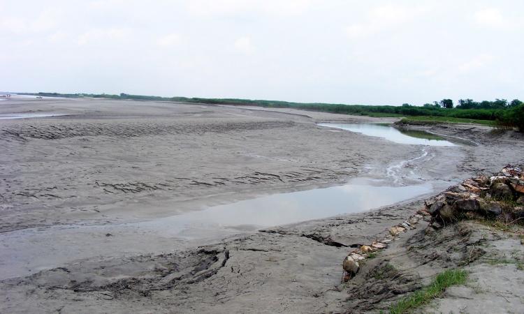
Lead Image Source: Silt deposition at Kosi embankment at Navbhata near SaharsaBihar, India, in the Kosi River Basin (Image Source: CC BY 3.0 via Wikipedia). Accessed from this link
This is an open access article distributed under the terms of the Creative Commons Attribution License (CC BY).
/articles/angry-river-and-succumbing-population