South Central Highlands

Term Path Alias

/regions/south-central-highlands

Water treated royally in Mandu's Jahaz Mahal (Ship Palace)
It was not enough for the Mughals to just harvest rainwater but the structure needed to form a lilting backdrop to life in their palaces as exemplified by the Jahaz Mahal. What can we learn from it? Posted on 12 Aug, 2015 07:56 PM

Ghiyas-ud-din-khilji is a man about whom history is confused. Contemporary records speak of 'a lover of peace, particular in his daily prayers'.

An intricate set of curlicues set in the floor leads rainwater from the roofs to a tank in Jahaz Mahal, Mandu
Why did Urmila have to suffer?
Although fluoride contamination was identified in Dhar, Madhya Pradesh a decade ago. children of some villages still continue to fall victim to skeletal and dental fluorosis causing bone deformities. Posted on 27 Jul, 2015 08:11 PM

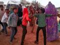
Urmila can neither walk upright, nor run about, nor do her chores easily. She is loved in her parents' house and they do not grudge her the extra care she requires. In rural India, this state of affairs does not last long for a girl, especially since she's only six years old. 

Children dance during the inaugration of the safe water supply system in Kalapani, Madhya Pradesh
Farm like the rishis!
Raju and Shalini Titus have been engaged in no-till farming for over 23 years. Contrary to pop wisdom, their net income has gone up because of increased yields and a reduction in input costs. Posted on 09 Feb, 2014 08:20 PM

It all started in the eighties when Friends Rural Centre, a group of Gandhian Quakers in Rasuliya village, near Hoshanagabad, Madhya Pradesh came in contact with Masanobu Fukuoka.

Results of no till farming; Image: Titus
Small MP village inspires neighbours
Once water-deficient, Didakhedi in Madhya Pradesh is now a village with year-round water supply and a sense of community and belonging. Posted on 01 Dec, 2013 08:31 PM

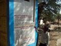
The 200 odd residents of Didakhedi, a sleepy village just 13 kms from Sehore town in Madhya Pradesh, never had adequate water. Two decades ago, most of the farming in the village was done during the monsoons. The village had no electricity and a lone diesel pump operated the shallow dug wells to irrigate some lands during the winter.

Annual climate summary of India during 2010 - Press release by India Meteorological Department
Mean annual temperature for the country as a whole during 2010 was +0.93 0C above the 1961-1990 average. It was slightly higher than that of the year 2009, thus making the year 2010 as the warmest year on record since 1901. Posted on 17 Jan, 2011 12:06 PM

Content courtesy: Indian Meteorological Department

Mean annual temperature for the country as a whole during 2010 was +0.93 0C above the 1961-1990 average. It was slightly higher than that of the year 2009, thus making the year 2010 as the warmest year on record since 1901.

Considering different seasons, Pre-Monsoon season (March-May) in 2010 was the warmest since 1901 with mean temperature being 1.8 0C above normal

The annual total rainfall for the country as a whole was normal during the year 2010 with actual rainfall of 121.5 cm against the long period average (LPA) of 119.7 cm.

"Jungle Trees of Central India" - A preview of the field guide for tree-spotters by Pradip Krishen
Jungle Trees of Central India is a lovingly detailed field guide to every tree you're likely to see in the magnificent dry, deciduous forests of the region. Posted on 23 Dec, 2010 01:26 AM

/sites/default/files/iwp/Jungle Trees of Central India - Pradip Krishen - Cover

Content Courtesy: Flowers of India

Jungle Trees of Central India is a lovingly detailed field guide to every tree you're likely to see in the magnificent dry, deciduous forests of the region. Bigger than France and encompassing 5 of India's most visited Tiger Reserves, Central India is home to the classical types of wilderness that one associates with the term 'Indian Jungle'.

India - Physical Map from the Survey of India (2002)
A definitive physical features map of the country from the Survey of India, showing elevation in metres of different regions and major rivers and land formations. Posted on 18 Aug, 2009 05:35 PM

Download the map from the attachment listed below:

×