Chamarajanagar District

Term Path Alias

/regions/chamarajanagar-district

Access to clean water and sanitation: the rural-urban gap closes
News this week Posted on 27 May, 2014 12:21 PM

The rural-urban divide in access to sanitation reduces: UN

Many rural areas have free toilets
Rare floral diversity in the Western Ghats forests
Many plants are in equal danger of becoming as extinct as some animals. Does anyone care? Posted on 03 May, 2013 02:29 PM

A fluttering butterfly or a dashing cheetah immediately bring vivid images to mind. Does the image of a plant stir us as much? Are we as fascinated watching a flower bloom? Probably not. Maybe that’s why there is such a large focus on endangered animals and birds and not so much on plant species that are dying out.

Video documentary on the work done by Dr. Sudarshan for the upliftment of Soliga tribes in BR Hills, Karnataka- A webisode in Chai with Lakshmi
This webisode gives an insight into Dr.Sudarshan's work with the indigenous forest dwellers, Soliga tribes in Biligiriranga Hills, Southern Karnataka. Posted on 20 Feb, 2013 11:47 AM

Source of video: Chai with Lakshmi

A brief note on bio-sand water filters - An adaptation of the traditional slow sand filter
Biosand filter (BSF) is an adaptation of the traditional slow sand filter, which has been used for community drinking water treatment for 200 years. Posted on 17 Jan, 2013 11:20 PM

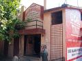
Pragathi was founded in 1987, it is a non-government, non-profit and non-religious organization that works for the welfare and development of the tribal and marginalized sections of society, particularly targeting women and children. Pragathi is working in Mysore and Chamarajngar District, covering more than 100 tribal villages with approximately 9600 families.

Village level maps of population, cultivation, number of wells and water supply Chamrajanagar taluk, Karnataka, used as basic indicators of Godavari basin
Village level maps of total population, number of agriculture families, total cultivable area, number of wells, water supply and overlay maps of these parameters of Chamrajanagar taluk in Karnataka used to assess the cultivation pattern and water availabilty in Godavari Basin. The overlay map of total number of agricultural families vs total cultivable area in ha shows positive correlation in villages having cultivable area above 1219 ha and below 241 ha but in villages with cultivable area ranging between 241 to 1219 a weak correlation is observed. in overlay map of total population and water supply in litres per capita per day (lpcd) water availability is quite low irrespective of the population in the village except for villages with population over 4000. Posted on 15 Jun, 2009 03:27 PM

Chamrajnagar Taluk- Total Population

×