Brahmani

Term Path Alias

/regions/brahmani

Industrial effluents dirty River Brahmani
Setting up industries along rivers may be financially rewarding but when untreated effluents drain into the river, the water quality deteriorates. Posted on 14 Dec, 2015 06:47 PM

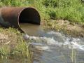
Water is the most fundamental component of any natural resource, and the crisis of fresh water has posed a formidable challenge worldwide. Among the sources of drinking water rivers play an important role, and in the peninsular river system in India, the River Brahmani plays a pivotal role. 

Effluents from industries & factories contaminate the water source (Source: Wikipedia)
NGT orders Singrauli power plants to supply drinking water to residents
Policy matters this week Posted on 21 May, 2014 08:48 AM
NGT orders Singrauli power plants to supply drinking water to residents
Singrauli Coal Mines (Source: UA Satish on Flickr)
Ajit Pawar reinstated as Maharashtra deputy CM, despite being involved in a multi-crore irrigation scam - Roundup of the week's news (December 10 – 16, 2012)
The newsroundup this week informs of reducing water level in the Cauvery basin, pollution of rivers in Odisha, Punjab and Kerala, green signal given by the cabinet to the land aquisition bill and the decision made by the Karnataka government for the need to seek permission from the water board for drilling borewells or dugwells in Bangalore city Posted on 17 Dec, 2012 09:42 PM

Ajit Pawar reinstated as deputy CM of Maharashtra  

Daily rainfall-runoff modeling of Brahmani river at Rengali reservoir, Orissa – A research report by National Institute of Hydrology
The report presents a hydrologic simulation model, HYSIM for modelling the daily flows of the Brahmani river at Rengali reservoir in Orissa. Posted on 24 Jul, 2010 05:50 PM

The report presents a hydrologic simulation model, HYSIM for modeling the daily flows of the Brahmani river at Rengali reservoir in Orissa. Considering the large catchment area of 25,250 sqkm at Rengali reservoir, for modeling purposes the basin has been divided into two sub-basins viz, Upper Sub-basin and Lower Sub-basin. The Upper Sub-basin having a catchment area of 16,900 sqkm up to Bolani gauging site is treated as a nominal sub-basin since the daily flows from this sub-basin as recorded at Bolani gauging site are available.

Map: Location of water resource projects across river basins in India
This map from the National Institute of Hydrology shows the location of the various water resources projects in each river basin in the country. Posted on 20 Aug, 2009 03:23 PM

The map indicates that across the main 19 river basins of the country, water resource projects with a total live storage of 174 BCM (Billion Cubic Metres) have been completed, 75 BCM are ongoing, and 132 BCM are being planned.

River basins and river basin organisations in South Asia
The research study will help in providing the basis for planning for future strategic interventions in the river basins mentioned in the study, and to encourage similar exercises in other regions Posted on 22 Jul, 2009 03:12 PM

As part of the research study, River Basins and River Basin Organisations in South Asia, done by the Society for Participatory Development Hyderabad, CapNet South Asia (Read More) and Gomukh Environmental Trust for Sustainable Development Pune (Click Here), data about individual river basins has been collected for the river basins in South Asia.

×