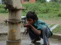
Groundwater

Term Path Alias

/topics/groundwater

Featured Articles
July 2, 2024 Community governance for groundwater management
Jasmine on the fields as part of the groundwater collectivisation agreement at Kummara Vandla Palli village, Sri Satya Sai District. (Images: WASSAN/Swaran)
June 13, 2024 The rising trend of abandoning open wells for borewells in Chikkaballapur and Annamayya districts, and the potential negative consequences of this shift.
Borewell proliferation may dry up open wells (Image: FES)
May 19, 2024 The surprising connection between Wikipedia, beaches, and your water bottle.
A top down image of a lush green forest in a sacred grove in Meghalaya (Image created by: Sreechand Tavva)
May 15, 2024 बेहिसाब भूजल दोहन भूकंप के खतरे को विनाशकारी बना देगा। हाल फिलहाल के दो अध्ययन हमारे लिए खतरे का संकेत दे रहे हैं। एक अध्ययन पूर्वी हिमालयी क्षेत्र में भूकंप के आवृत्ति और तीब्रता बढ़ने की बात कर रहा है। तो दूसरा भूजल का अत्यधिक दोहन से दिल्ली-NCR क्षेत्र के कुछ भाग भविष्य में धंसने की संभावना की बात कर रहा है। दोनों अध्ययनों को जोड़ कर अगर पढ़ा जाए तस्वीर का एक नया पहलू सामने आता है।
भूजल का अत्यधिक दोहन
May 12, 2024 Rethinking community engagement in the Atal Bhujal Yojana
Towards sustainable groundwater management (Image: IWMI)
May 8, 2024 What is the ecosystem based approach to water management? How can it help in solving the water woes of states in the Deccan Plateau?
An ecosystem based approach to water management (Image Source: India Water Portal)
International Groundwater Resources Assessment Centre's trans boundary aquifers of the world
The transboundary aquifers shows the present state of information regarding the occurrence and extent of TBAs world-wide Posted on 18 Aug, 2009 05:53 PM

Trans-boundary aquifers (TBAs) of the world: This map shows the present state of information regarding the occurrence and extent of TBAs world-wide. The intention of the map is to provide a global overview of these important shared water resources and to encourage their further assessment.

In India, TBAs are located on the India-Pakistan, India-Nepal and India-Bangladesh borders.

Rainwater harvesting basics: All you need to know about recharge pits
A recharge pit allows the rainwater to replenish groundwater by recharging the underground aquifers. It can be built to recharge a borewell or just to help the water infiltration in an area. Posted on 18 Aug, 2009 04:09 PM

1) Overview:

Map depicting the salinity affected areas in India
This map indicates the extent of salinity affected areas in the coastal states of the country Posted on 18 Aug, 2009 12:52 PM

The map shows that Tamil Nadu, Kerala, Karnataka, Goa, Maharashtra and Gujarat are high salinity zones, and Andhra Pradesh, Orissa and West Bengal are moderate salinity zones.

Click here to view the map - IRFC

Karnataka's water resources: Excerpts from the Karnataka State of the Environment Report
The chapter on water resources in the report deals with the environmental problems linked to water resources pertaining to availability, distribution, management, utilization and sustenance Posted on 14 Aug, 2009 02:48 PM

It deals with the (a) inequities in sectoral distribution and inadequacy in availability of water (b)  inefficiency in use of water in domestic and agricultural sector (c) depleting ground water resource (d) inadequate treatment of watersheds (e) deteriorating surface and groundwater quality (f) degradation of traditional and community owned tanks and (g) siltation in river basins and command a

Chemical parameters in Karnataka's groundwater: A report by the state government's Mines and Geology department
This report by the Department of Mines and Geology (Government of Karnataka) deals with excess chemical parameters in groundwater in the state Posted on 14 Aug, 2009 02:15 PM

The aim of this report is to highlight the quality problems encountered in the groundwater in the state. The chemical parameters which are present in groundwater in excess of the prescribed norms and which are considered harmful beyond permissible limits are discussed in detail.

Status of groundwater quality in Bangalore: Conducted by the Department of Mines and Geology, Government of Karnataka
This study on the status of groundwater quality in Bangalore by the Department of Mines and Geology presents an analysis based on a systematic collection of groundwater samples from the city Posted on 14 Aug, 2009 01:47 PM

The study collected 918 samples from 735 locations across an area of 400 square kilometers of the city and its environs. The samples were collected in March and April of 2003. Testing was done for 25 parameters. The results indicate that -

CGWB's district groundwater atlas of Rajasthan
Comprehensive groundwater Atlas of Rajasthan published by the Central Groundwater Board Posted on 14 Aug, 2009 01:00 PM

CGWB's groundwater atlas all the basic information regarding Rajasthan's groundwater including the following:

District-wise report of habitations covered in Himachal Pradesh for water supply and irrigation
A complete list of district wise data on irrigation, water supply, hand pumps distribution and progress of Command Area Development programme in the state of Himachal Pradesh Posted on 14 Aug, 2009 12:19 PM

District-wise report of habitations covered for water supply, hand pumps, irrigation, flood control and command area development

Read more

Bacteriological quality of water samples of a tertiary care medical center campus in North Western Himalayan region
Studies conducted in the North Western Himalayan region have found that surface and groundwater samples are highly contaminated with faecal matter in the region Posted on 14 Aug, 2009 11:53 AM

A study published in the The Internet Journal of Third World Medicine of bacteriological quality of water samples of a tertiary care medical center campus in North Western Himalayan region, more specifically in Kangra district of Himachal Prad

Baseline report: Sachetana Drinking Water project of the Government of Karnataka (2006-2011)
The project envisions a set of interventions including household rainwater harvesting for clusters of villages in Karnataka that are particularly severely affected by fluoride Posted on 14 Aug, 2009 11:28 AM

The Sachetana Drinking Water project of the Government of Karnataka covers 15 villages in each of the taluks of Bagepalli (Chikkaballapur), Mundargi (Gadag), Sira (Tumkur) and Pavagada (Tumkur).

The baseline survey covers a representative portion of the villages and families of the above and contains the following information:

×