Term Path Alias
/topics/rivers
/topics/rivers

The study suggests a procedure based on the methodology of Gustard et al (1992) for estimation of baseflow index (BFI) using the mean daily discharge data over a period of 4 to 6 years for three rivers between the Mahanadi and Godavari deltas. The rivers from the Zone 4 (A) are Rushikuliya at Purushottampur in Orissa, Nagavalli at Narayanpuram wier and Sarada at Anakapalli in Andhra Pradesh.
The study applies the methodology developed by United States Department of Agriculture’s (USDA), Soil Conservation Services (SCS) for the nine subwatersheds of the representative Dudhnai basin in Assam & Meghalaya and estimates the runoff volume on a daily basis for the period 1986-1991. The method is widely adopted for the estimation of runoff from rainfall depths and takes into account the important physical aspects of a basin on which runoff depends such as land-use, hydrological soil cover and antecedent moisture condition.
The study attempts to determine the adsorption characteristics of bed sediments of rivers for the control of metal pollution. In particular, it looks at adsorption of zinc ions on bed sediments for the river Ganga at Hardwar. In the natural conditions of river water, suspended loads and sediments have an important function of buffering higher metal concentrations of water, particularly by adsorption or precipitation.
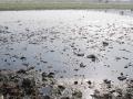
The study attempts to find out the pollution potential in the Hindon river, a polluted river in western Uttar Pradesh. Qualitative and quantitative estimation of pesticides was done using gas chromatography. Among various organic, inorganic and biological water pollutants, pesticides are very dangerous and harmful because of their carcinogenic properties. Pesticides are bio-accumulative and relatively stable and therefore require close monitoring.
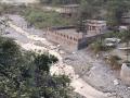
The study attempts to do a field and laboratory determination of soil moisture characteristics such as particle size distribution, hydraulic conductivity and soil moisture retention curve in a part of the Hindon river catchment and studies the variation of these along the river in its upstream reach.
The study attempts to develop a computerized model for Geomorphological Instantaneous Unit Hydrograph (GIUH) for estimation of flood hydrographs resulting from intermittent storms of varying intensity. The model applied to the rainfall-runoff data of the Myntdu-Leska basin of Meghalaya infers that the channel network and geomorphological features are closely related to the retention and discharge characteristics of the basin.
The theory of GIUH assumes that rainfall that occurs over a basin is assumed to be composed of infinite number of non-interacting drops of uniform size. After spending some time in one state in the channel or overland region, the drop makes transitions to another state to reach the basin outlet. Assuming one parameter, exponential time distribution of one drop chosen at random from the basin defines the IUH of the basin.
The study gives a systematic methodology to determine field hydraulic conductivity using Guelph Permeameter (GP), its limitation based on the experiences gained in the field and a comparison of its results with that estimated from the predictive method for the soils in Central Bihar. Predictive methods applying empirical formulae are used to ascertain hydraulic conductivity from easily determined factors like bulk density, porosity and water content.
Physically based hydrological models, soil water balance, groundwater flow and transport models require values of saturated and unsaturated hydraulic conductivity to solve the sub-surface flow and transport equations. Several field, laboratory and predictive methods are available for determination of this parameter. However, these methods have some advantages and some limitations. GP is used as a tool to determine the field hydraulic conductivity even when the water table is low. It is portable, durable and allows rapid field calculation of saturated and unsaturated hydraulic conductivity.
The study estimates the average soil loss using the Geographic Information Systems (GIS) tool of Integrated Land and Water Information Systems (ILWIS) and the Universal Soil Loss Equation (USLE) methodology for the Hire nadi catchment, in Yelbarga taluk, Koppal district of Karnataka, under different conditions.
Scientific planning for soil conservation and water management requires knowledge of the relations among factors that cause and prevent soil and water loss. Controlled studies on field plots and small watersheds have supplied vital information regarding these complex factors and their interrelations.
The study assesses waterlogging in a canal command area in Rohtak and Jhajjhar districts through waterlogging area zonation using multi-spectral and multi-temporal imagery like IRS LISS III data of pre and post monsoon period. Seasonal and permanent waterlogged area and standing water were delineated on the basis of remote sensing data, digital elevation model and groundwater data.
The study assesses the suitability of groundwater for drinking and irrigation use and examines the likely impact of Yamuna river water quality on groundwater. Delhi is faced with severe problems associated with groundwater quality and quantity. The quality varies spatially and seasonally, with depth and is primarily governed by the extent and composition of dissolved solids present in it. Surface water bodies play a role and the hydraulic gradient determines the lateral and vertical migration in the groundwater flow system.
Groundwater samples were collected through extensive field surveys covering entire Delhi area representing various geo-hydrological and land-use conditions. The data has been analysed with respect to BIS and WHO standards to examine its suitability for various uses. The area has a peculiar feature of infiltration of surface water to groundwater from river Yamuna and from various drains.