Term Path Alias
/topics/rivers
/topics/rivers
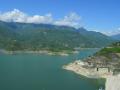

Building the Tehri Dam in India -
Dear all,
IUCN, with Zoo Outreach Organisation, have today published a new report, 'The status and distribution of freshwater biodiversity in the Eastern Himalaya', which is available online here
 KWDT-II freshly assessed the yearly yields in the Krishna and determined the award on the basis of the yearly yield at 65 per cent dependability which was assessed at a total of 2,293 tmcft.
In its order, announced in an open court, the tribunal allocated a total share of 1,001 tmcft to Andhra Pradesh, 911 tmcft to Karnataka and 666 tmcft to Maharashtra with certain restrictions imposed on each State in keeping with the dependable flows of the rivers on which the allocations have been made. The allocation under the first award (KWDT I) was 811 tmcft for Andhra Pradesh, 734 tmcft for Karnataka and 585 tmcft for Maharashtra.
The scarcity value of natural resources has risen due to rising pressure of human population and demands made by modern economics progress. As such managing these resources has become very important.
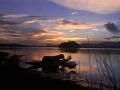
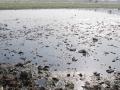
These Articles analyse and detail the issues of rainwater harvesting and river pollution
There are vast areas of fresh water flooded forests in Amazon River, Mekong River and Meghna River (Bangladesh) basins. In these flooded forests, the flora & fauna is richer than tropical ever green forests and many tree species grow more than 20 meters in height. These forests are inundated / submerged by river flood water up to ten meters depth for 5 to 7 months duration at a stretch.
Forwarded to the portal by: Sudhirendar Sharma
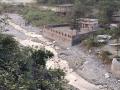
Those activists, practitioners and journalists who have travelled in the Kosi River basin during 2008 (before the Kushaha breach), 2009 and 2010 have helped enhance our collective understanding on a manmade crises of gigantic proportions. Though not pre-planned, a unique fellowship on Kosi has indeed developed over these years. In their respective domains, each of the fellows have/are contributing to taking the key learnings across for better understanding on how our land, rivers and water ought to be managed (or not managed). The task, however, is far from finished.
Guest Post by Shashank Srinivasan
High altitude wetlands in the Indian Himalayas are crucial to the water security of downstream communities. They buffer the flow of glacial meltwater to sustain river flow in the dry season, ensuring that human settlements have access to water when they need it most.
High altitude wetlands are also reservoirs of biodiversity and contribute local livelihood opportunities. Identifying these wetlands and demarcating areas for their protection is thus crucial to any wetland management plan.
In this poster, a method of using topographic data obtained by remote sensing techniques, to identify the catchment areas of these wetlands has been described.
The author suggests that the protection of these catchment areas will ensure the survival of these wetlands, as well as of the communities that depend on them.
This document by the Sulabh International Academy of Environmental Sanitation presents the guidelines for water safety plans for rural water supply systems. The revised National Rural Drinking Water Programme (NRDWP) Guidelines 2009-2012 issued by Rajiv Gandhi National Drinking Water Mission, Department of Drinking Water and Sanitation has shifted the focus from source development and installation of water supply system for providing drinking water supply to rural household to focus on development of village security plan.
This report of the Standing Committee on Water Resources deals with the action taken by the Government on the recommendations and observations contained in their Eleventh Report on “Inter Linking of Rivers” which was presented to Lok Sabha in October 2008.