Climate and Weather

Term Path Alias

/topics/climate-and-weather

Featured Articles
May 31, 2024 From scorching to sustainable: Building resilience against heatwaves
A multifaceted approach to urban heatwaves (Image: Sri Kolari)
April 30, 2024 As temperatures soar, what should India do to adapt to changing conditions to mitigate the adverse impacts of climate change?
Heat waves sweep across India (Image: Maxpixel, CC0 Public Domain)
November 5, 2023 Honeywell’s environmental sustainability index, a quarterly index reveals a growing number of organisations globally are boosting annual sustainability investments by at least 50%, and are optimistic about achieving short- and long-term objectives
Environmental Sustainability Index gauges movement in corporate sentiment and investment on the sustainability front. (Image: Needpix)
May 4, 2023 Climate change is expected to have significant impacts on the Indian monsoon
As per the India Meteorological Department (IMD), instances of heavy rainfall have increased by almost 85% in the country since 2012 (Image: Marina, 2009,Wikimedia Commons)
January 17, 2023 रिस्कन नदी 40 किमी लंबी है। अब तक बने 5000 से अधिक खावों का प्रभाव कहीं-कहीं दिखाई देने लगा है। लेकिन एक नदी को जिंदा होने के लिए पर्याप्त नहीं है। रिस्कन नदी को बचाने हेतु उनके द्वारा माननीय प्रधानमंत्री महोदय, माननीय जल शक्ति मंत्री भारत सरकार व माननीय मुख्यमंत्री उत्तराखंड से भी निवेदन किया गया है।
एक खाव बनती हुई
December 12, 2022 Study looks at behavioral biases in crop insurance adoption
Adoption rate of crop insurance low in India despite government efforts (Image: PxHere, CC0 Public Domain)
Effect of climate change on river Kosi and its basin
Considering the vulnerability of the Kosi's basin, the melting glaciers will acerbate the problem a hundredfold. The melting glaciers will release much more water than normal in a short time thus creating a flood situation. Posted on 28 Aug, 2009 02:46 PM

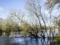
Kosi is one of Ganga's largest tributaries and in turn is fed by 7 tributaries - Sun Koshi, Dudh Koshi, Indravati, Tama Kosi, Likhu, Arun, and Tamar. These tributaries encircle Mt Everest from all sides and are fed by world's highest glaciers. The river drains a total area of 69,300 sqkm upto its confluence with Ganga. The river basin stretches 54,000 sq.kms.

Effect of climate change on the Ganga-Brahmaputra delta regions
The Ganga-Brahmaputra-Meghana delta belt comprises of 105,000 sq. kms of which 2/3rds is in Bangladesh. The Ganga-Brahmaputra-Meghana system has the largest catchment area of 1,100,000 km². The delta region is particularly vulnerable to seasonal floods, heavy run-offs from melting snows, and tropical cyclones in the Bay of Bengal. Inspite of this, it is one of the most thickly populated regions on Earth. Posted on 28 Aug, 2009 02:28 PM

The delta belt is home to approximately 125-140 million people. And over 300 million people are supported by the delta. The density of population in the Delta region is 200 people / sq.km. making it one of the densest regions in the world.

The delta region is a high-rainfall region and receives 60-80 inches of rainfall every year.

Impact of climate change on major river basins in India: The Indo-Gangetic-Plains
The effect of climate change on the Indo-Gangetic-Plain region will primarily be by the glacier melting impacts and heat waves and extreme climates Posted on 28 Aug, 2009 02:14 PM

The Indo-Gangetic Plains, formed by the drainage systems of the rivers Indus and the Ganga, stretch across the countries of Bangladesh, Nepal, India and Pakistan covering approximately 401.72 million hectares of land.

Migration and displacement due to sea-level rise: Mega-cities like Mumbai, Kolkata and Chennai could be hit hard
A one-meter sea level rise will inundate 6000 square kilometers in India, of which Mumbai, Kolkata and Chennai will be the major cities being affected. This would mean losses of billions of dollars in infrastructural, social, physical assets and capital. Posted on 26 Aug, 2009 05:34 PM

125 million people are likely to migrate in the coming century of which 75 million will be from Bangladesh. The people from Bangladesh will most likely migrate to India in addition to our own 50 to 60 million people who will be displaced due to sea-level rise, shrinking water sources due to CC in the densely populated coastal regions of India.

References of the impact of climate change on river deltas and other coastal areas
A short compilation of articles and reports on the impact of climate change on river deltas and other coastal areas Posted on 26 Aug, 2009 04:48 PM

Mumbai Marooned: An Enquiry into Mumbai Floods 2005 - Final Report ,
By Conservation Action Trust - Click here

Enquiry-mumbai-floods-2005-final-report

Impact of climate change on river deltas and other coastal areas in India
While global warming is a matter of worldwide concern, among the most vulnerable areas are the coastlines of less developed tropical countries such as India. The river deltas, in particular, are already facing the brunt of climate change and these adverse impacts can be expected to increase dramatically in the course of this century. Posted on 26 Aug, 2009 04:23 PM

The effects are most visible in the Sunderbans. Literally the 'beautiful forest', these wetlands at the mouths of the Ganga and Brahmaputra river systems are among the largest mangrove forests in the world. About 62% of this area of some10000sq km lies in Bangladesh but there is a significant Indian portion in the state of West Bengal.

Quick reference: Climate change impacts on freshwater ecosystems in the Himalayas (CCIFEH)
Climate change impacts on freshwater ecosystems in the Himalayas (CCIFEH) is a joint initiative of WWF-India and WWF Nepal, funded by WWF-The Netherlands. Posted on 26 Aug, 2009 04:01 PM

The programme entails a panorama of actions working towards understanding future climate change impacts on Himalayan river ecosystems and vulnerable communities for the development of adaptation strategies; implementation of pilot sites; and raising the awareness of climate change impacts on Himalayan river basins, in addition to urging specific adaptation strategie

Glacier lake outburst floods: Wrecking havoc to life and property in the Himalayan region
A glacier lake outburst flood (GLOF) is caused when the glacial lakes burst their banks and cause widespread floods. In the past two decades there have been a number of glacier lake outburst floods. The increase in the melting of glaciers have led to this phenomenon. Posted on 26 Aug, 2009 03:47 PM

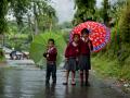
These floods cause havoc with human life, flora and fauna of the area and the infrastructure in the region.

The Dig Tosho Glacier lake outburst in August 1985, destroyed the nearly completed Namche hydropower plant and all the rails, roads, and other infrastructure in its course.

How climate change has affected Ladakh: The region has seen unusual floods in July 2005 and August 2006
Ladakh is known as the cold-desert and has severe conditions and is barren and arid. The region has seen unusual floods in July 2005 and August 2006. Posted on 26 Aug, 2009 03:36 PM

It is in Jammu Kashmir and is bordered by the Himalayas and the Karakoram mountain chains. Ladakh and its water sources are almost entirely dependent on the glaciers and snow-melts and changes in water systems can be directly attributed to changes in the glaciers and thus climate change.

Impact of climate change on the Himalayan glaciers
40% reduction has occurred in the Himalayan glaciers in the last 40 years. 67% of the glaciers have retreated in the last decade. Gangotri is retreating at the rate of 28 m per year. Global warming and its consequent melting of glaciers would result in floods, fast and furious run-offs, erosion of the topsoil and sedimentation of the rivers. This could also lead to changes in the course of the rivers in the region. Posted on 26 Aug, 2009 03:30 PM

The Himalayas' permanent ice cover is around 97,000 sq.km. with 12,930 sq.km. volume of ice and snow: 10-20 % are covered by glaciers and 30-40% are seasonal snowfalls. The Himalayan streams and rivers are fed by the melting of snow and ice of approximately 500 sq.km / year.

×