Term Path Alias
/topics/groundwater
/topics/groundwater
The various initiatives taken up include utilising backwash water for developing Jatropha plantations, recovering waste water, ground water recharging, utilisation of waste steam and reducing steam consumption, increasing cycle of concentration in all cooling towers and more.
This is a detailed introductory presentation about ground water and hydrogeology, and helps to understand the basics of ground water & aquifers. The branch of geology dealing with surface & subsurface water is known as groundwater. The science of hydrogeology is defined as hydrology with emphasis on geology.
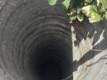
In an earlier post Microfinance for Water - How would it Work? I had put up a picture of a woman drawing water out from a pit.
M.S.P Mandal's Deogiri College,Aurangabad, Maharastra is organising an National Seminar on "Groundwater Recharge, Quality and Auditing in Hard Rock"
This paper describes the findings of a study that was conducted to validate the findings of earlier studies and observations that have been conducted in ancient texts in India that describe termite mounds as useful indicators for groundwater exploration.

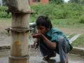
Photograph by Lynsey Addario
As part of its committment to provide safe drinking water to its rural communities, the Karnataka State Government as part of its World Bank-assisted Jal Nirmal Yojana program, implemented through the Karnataka Rural Water Supply and Sanitation Agency, took an initiative to adopt a Geographical Information System (GIS) approach to develop a Spatial Information and K
These two documents, one an introduction document and the other an overview document prepared for the Karnataka Rural Water Supply and Sanitation Agency (KRWSSA) provides information and details on the groundwater quality scenario in Karnataka.
Hydro-fracturing is a new approach to revitalise bore wells to improve its yield, by injecting water at high pressure in the failed bore wells to break up fissures, clean away mud and other impurities, thus bringing it in contact with adjacent water bearing bodies, and thereby yield water.
A concise explaination of the techniques used for groundwater exploration.Electrical well logging is a kind of geophysical logging tool for ground water exploration. It involves the continuous recording of electrical resistance, resistivity and spontaneous potential (SP) of formations of a drilled bore hole. This helps to identify the formations and also delineate freshwater aquifers from saline aquifers.It is also used to delineate the fracture system in hard-rock terrain, for rejuvenation of poor/low-yielding bore wells.