Term Path Alias
/topics/groundwater
/topics/groundwater
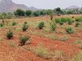
 The state is characterized by varied hydrogeology and vast areas are faced with typical groundwater quality problems like fluoride.
Floods: lessons to be learnt from the massive flooding in Surat city
A report by IIM criticises the way in which dams are managed in the country and calls for the need to apply Management Science / Operations Research techniques and information technology to improve dam management and prevention of floods
The report by Carewater INREM Foundation deals with groundwater and well water quality in the alluvial aquifers of Central Gujarat. Gujarat has a hydrogeology representative of almost all aquifer types and depositional & formation eras. Contamination of aquifers along with scarcity of groundwater resources due to increase in water demand and reduction in recharge of groundwater from changing landuse, is a problem in Central Gujarat.
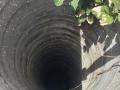
The discussion paper by Carewater INREM Foundation on possibility of revival of dug wells in hard rock India through recharge is based on a field study across ten districts of the country. The study seeks to understand how localized governance of groundwater in hard rock areas is to be pursued through pricing (water, energy), legal regulation and community institutions. Water supply augmentation and demand management are both to be taken care of, directly through regulation or through indirect instruments such as pricing.
This article is written in response to an earlier published article “Chasing a Mirage: Water Harvesting and Artificial Recharge in Naturally Water-Scarce Regions” in the Economic and Political Weekly and argues that the paper makes a number of assertions about small water harvesting systems, that are based on faulty assumptions and inadequate information.
This paper by Centre for Studies in Social Sciences and Jadavpur University, aims at explaining the factors that determine private investment in groundwater irrigation in West Bengal. It also addresses the issues pertaining to institutional arrangements, particularly provision of facilities by the government. The study, largely empirical in nature, is based on data collected from surveys conducted in close to one thousand moujas (villages) spread across the major agro-climatic zones in West Bengal. It begins with a descriptive account of the changes in the agricultural scenario in West Bengal over the last thirty years. The research questions are discussed and the econometric methodology presented.
The report of the Expert Group on Ground Water Management and Ownership (2007) of the Planning Commission takes stock of the availability and use of groundwater and outlines the extent, causes and consequences of groundwater exploitation. It suggests the need for exploiting the untapped ‘static’ water, which if untapped creates stagnant conditions and over time provides the necessary time factor for the deterioration in quality. The rising demand for groundwater from agriculture has been attributed to the legal/regulatory regime governing groundwater and partly to the minimum support price policy and agricultural trade policy currently being followed.
The report presents the groundwater balance for the Southern Channel command area of the Pennar delta canal system as a part of the conjunctive use studies in the area. In a hydrological system, surface water flows, low or high, do not necessarily coincide with the low or high levels in groundwater, because of the sluggishness of the groundwater flow compared to surface water flow.
These guidelines drafted by Department of Rural Development (Andhra Pradesh) are conceptualized in the broad framework of the Hariyali guidelines and the experiences from Andhra Pradesh Rural Livelihoods Programme (APRLP), and are intended to strengthen the processes, and provide clarity and purposefulness in implementation of watershed development projects in Andhra Pradesh. They have been formulated on the basis of several process studies undertaken as well as through wide-ranging consultations with all stakeholders and experts.
The study deals with the analysis of surface and groundwater flow process in Dakshina Kannada district in Western Ghats of Karnataka. The area receives over 4000 mm rainfall annually but is still faced with acute shortage of freshwater during summer months. The study attempts to identify the surface and sub-surface flow process through geohydrological and geomorphological investigations in the Sithanadhi and Netravathi basins.