Term Path Alias
/topics/oceans-and-coasts
/topics/oceans-and-coasts


The Ministry of Environment and Forests (MoEF) has issued the draft CRZ Notification, 2010 under the Environment (Protection) Act, 1986 on 15th September, 2010 inviting suggestions and objections from public within 60 days from date of its issue. The following are the new additions to the original 1991 notification:
The central government has declared the coastal stretches of seas, bays, estuaries, creeks, rivers and back waters which are influenced by tidal action (in the landward side) up to 500 mts. from the High Tide Line (HTL) and the land between the Low Tide Line (LTL) and the HTL as “Coastal Regulation Zone” (CRZ), on 19.2.1991.
This paper published in the journal Conservation and Society reassesses/debates the decision taken by the government to dredge a new sea mouth in the Chilika Lake in Orissa, India, which was based on Geographical Information Systems (GIS) studies.
The paper argues that decisions such as these need to be understood and evaluated by taking into consideration not only the underlying technical aspects, but by also exploring the political and historical contexts in which decisions are taken.
The study by National Institute of Hydrology attempts to model seawater intrusion using FEFLOW, an interactive finite element simulation system in the coastal area of Bardez taluka in North Goa and evaluate the impact of increasing groundwater development on the phenomenon. Coastal tracts of Goa are rapidly being transformed into settlement areas and the poor water supply facilities have encouraged people to develop their own sources of water by digging or boring wells.
![]()
![]()

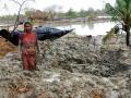
This initiative is an attempt to provide daily updates on Flood Situations and related events/news to water enthusiasts, professionals and citizens concerned about flood in Odisha. News and information collected from Odia news papers, English media (internet editions) and web site of Department of Water Resources, Govt of Odisha are put together at one place to provide an overview of flood in Odisha on a daily basis.
 Salinity in coastal groundwater is a widespread problem and may be caused by individual or combined effects of inherent salinity, tidal effect, irrigation by saltwater and by seawater intrusion due to extensive pumping.
The report deals with the modeling of the Cochin estuary along Kerala coast using two- dimensional finite element model. The basic equations for modeling of any surface water problems are the three dimensional hydrodynamic equations arising from consideration of mass and momentum conservation. In vertically well mixed shallow water bodies, the horizontal components of flow quantities are normally much more significant than vertical components.
The report presents the seasonal mapping of water bodies along the Andhra coast using satellite data to analyze the pre-monsoon and post-monsoon variations in the reservoirs. Water resources development be it construction of reservoir, anicut or irrigation canal, calls for mapping of the various water bodies to throw light on its behavior in different seasons in order to plan a judicious water management scheme.
Remote sensing methods are considered to be more appropriate than conventional methods for collection of such information owing to their capability to provide broad synoptic and repetitive coverage of the area in a multi-spectral mode.
The study focuses attention on the use of inverse modeling technique for estimation of rainfall-recharge in a coastal aquifer. MODINV (Modular Inverse Model), which is software for parameter optimization of 3-D groundwater flow model, MODFLOW is applied to the Central Godavari delta in Andhra Pradesh to estimate the distributed rainfall-recharge during monsoon season.