Term Path Alias
/topics/lakes-ponds-and-wetlands
/topics/lakes-ponds-and-wetlands

The study attempts water quality monitoring of Mansar lake to detect the various water quality parameters. The lake water conditions were monitored by collecting water samples from different depths to determine the spatial and temporal variations.
The report deals with the findings of a water quality study of Mansar lake in Udhampur district of Jammu and Kashmir. The water samples from different locations at the surface and from three zones (viz, epilimnion, metalimnion and hypolimnion) were collected and physico-analysis carried out.
The study undertakes hydrological investigations to develop a conceptual model for the water balance of Lake Nainital in Kumaon Himalayas. All the components of lake water balance, except the sub-surface ones, have been measured or estimated using standard methods like isotope mass balance method in conjunction with the conventional water balance method. The sub surface outflow from the lake was assessed by studying the hydraulic interconnection of the lake and downstream springs using environmental tracers.
The study assesses the quantum of seepage to the aquifers through percolation ponds and establishes their zone of influence, and based on these, correlates the quantum of seepage to the total storage loss in the pond. The assessment of the benefits of the ponds, in terms of artificial recharge to the aquifers is done through an intensive study of two percolation ponds in Tamil Nadu.
A percolation pond is a small water harvesting structure, constructed across a natural stream or water course to harvest and impound the runoff from the catchments for a longer time, to facilitate vertical and lateral percolation of impounded water into the soil substrata, thereby recharging groundwater storage in the zone of influence of the pond.
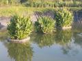
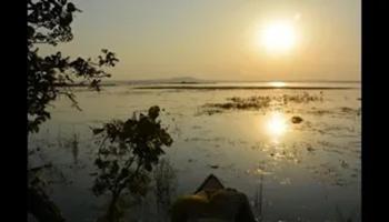
The study presents a preliminary hydrological investigation of the Deepar Beel, a natural freshwater lake near Guwahati, and notes the theoretical aspects of the techniques to be used, methodologies and instruments for conducting a detailed study of the natural processes at hand.
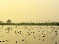
Deepar Beel acts as a natural stormwater reservoir during monsoon period and is greatly influenced by the rapid urbanization and improper land use pattern of Guwahati. It receives a large portion of sewage of the city, but the preliminary investigations reveal that the Beel is largely free from significant levels of pollution. This is due to the dilution effects of large storm water runoff during monsoons as also the release of the Beel water to river Brahmaputra through the Khanajun outlet. Yet, the soil quality is found to have deteriorated to a large extent.
Various parameters of soil and water quality indicate that the process of eutrophication is in progress in this wetland. Although many trace elements are present in the Beel sediments, no known toxic effects are observed on aquatic life. Increasing sedimentation and reduction in lake water capacity and inflow are also observed.
The study undertakes an exhaustive survey of the morphometric features of the Mansar lake, Udhampur district to prepare a bathymetric map of the lake. The map is useful in understanding the lake hydrological behavior through a study of volume, sedimentation rate and identification of the high siltation zone. The study is significant as the lake water can be utilized for drinking and irrigation purposes for the water scarce Kandi belt of Jammu.
The hydrological study develops a water balance of the Lake Nainital to facilitate the utilization of its water in a planned and systematic manner. The lack of knowledge of input and output parameters such as subsurface inflow, use of lake water for domestic and industrial purposes, evaporation loss and leakage from lake including the outflow through sluice gates had created uncertainty in determining the availability of water in the lake. The study attempts to understand the behavior of the input and output parameters in detail by using both conventional and isotopic techniques.
The lake meets the local drinking and domestic water needs and is for the most part fed by rainfall during monsoon and by inflow from perennial springs and subsurface inflow during the non-monsoon season.
The study discusses the hydrological aspects of rainwater harvesting in the Kandi belt in the foothill zone of Siwalik in Jammu region with the help of a case study on water availability in a pond in village Badhori (Samba district, Jammu). It describes the climate, soils, geology, geomorphology and drainage of the Kandi belt. It is marked with small watersheds having low denuded hills and undulating cultivated lands that need to be developed on a watershed basis through engineering and non-engineering measures of rainwater harvesting and soil conservation.
The naturally undulating terrain of Bangalore city, with its hills and valleys, lends itself perfectly to the development of lakes that impound rainwater, store it for future use and ensure ground water recharge. Lakes are thus live ecological systems, and play a crucial role in the supporting life, including human.
Lakes in Bangalore were designed in cascades from higher to lower elevations; as a lake overflowed the excess water would flow into the next lake in the cascade. The flow of water is from North to South-east as well North to South-west along the natural gradient of the land.
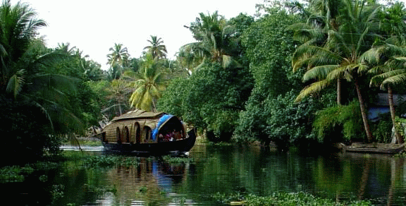 The Vembanad estuarine system, the largest of its kind on the west coast of India is known to be abundantly enriched with diverse fishery resources, providing feeding, spawning and rearing areas for a very large proportion of commercial (fin) fish and shellfish. However, ecosystem health of the Vembanad wetlands is alarmingly declining due to a variety of reasons - obstruction of river courses, sand mining & habitat destruction, loss of riparian canopy cover, encroachment, pollution and unethical fishing practices. Reduced summer flow due to drying up of rivers and pollution hazards from agro-chemicals and sewage also lead to mass mortality of fishes. Depletion of fishery resources has changed this ‘inland fish basket’ to an ‘inland wastebasket’, driving the fisherfolk, the primary stakeholders of the lake into a livelihood crisis.